MyTopo
Classic USGS Kelly Creek Montana 7.5'x7.5' Topo Map
Couldn't load pickup availability
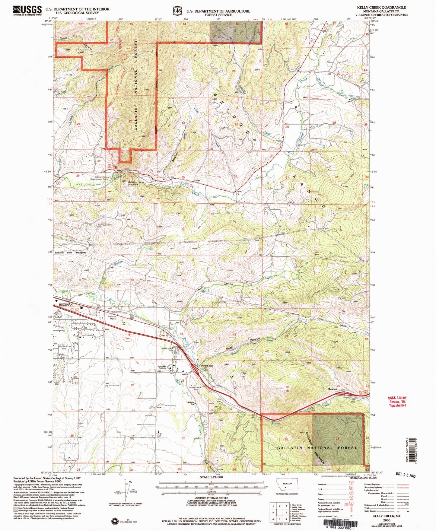
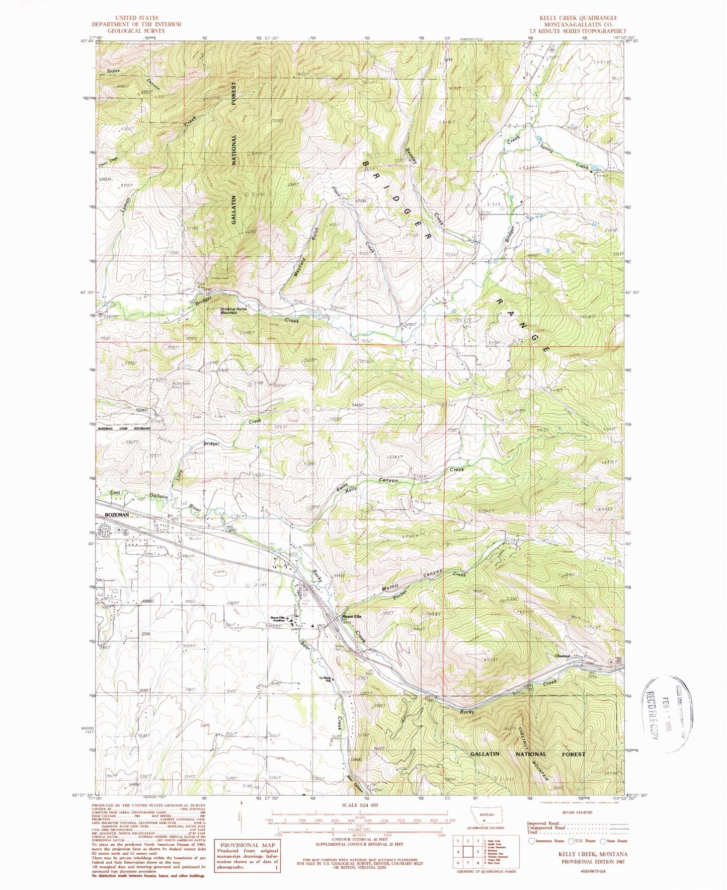
Historical USGS topographic quad map of Kelly Creek in the state of Montana. Map scale may vary for some years, but is generally around 1:24,000. Print size is approximately 24" x 27"
This quadrangle is in the following counties: Gallatin.
The map contains contour lines, roads, rivers, towns, and lakes. Printed on high-quality waterproof paper with UV fade-resistant inks, and shipped rolled.
Contains the following named places: 01S06E34BCDA01 Spring, 01S06E34BD__01 Spring, 01S06E34CA__01 Spring, 02S06E10DC__01 Well, 02S06E21AD__01 Well, 02S06E22AD__01 Well, 02S06E22CB__01 Well, 02S06E23BB__01 Well, 02S06E26CB__01 Well, 02S06E26DDBA01 Well, 02S06E27AA__01 Well, 02S06E28AA__01 Well, 02S06E33BABD01 Well, Bear Canyon, Bear Canyon RV Park and Campground, Bear Creek, Beasley Creek, Bozeman Beacon, Bozeman Division, Bozeman Fish Technology Center, Bridger Canyon Fire Department, Bridger Forest Service Station, Canyon View Trailer Court, Chesnut Post Office, Chestnut, Chestnut School, Drinking Horse Mountain, Fish Hatchery School, Flaming Arrow Rock, Fort Elizabeth Meagher, Fort Ellis, Fort Ellis Farm Bureau Community Building, Fort Ellis Fire Rescue, Fort Ellis Historical Marker, Fort Ellis Post Office, Gordon, KBOZ-FM (Bozeman), Kelly Canyon, Kelly Canyon Bridge, Kelly Creek, KGLT-FM (Bozeman), KGVW-FM (Belgrade), La Motte School, Little Bridger Creek, Lower Bridger, Lower Bridger School, Lyman Creek, M Picnic Area, Mayfield Gulch, Moffit Canyon, Moffit Canyon Bridge, Mount Ellis Academy, Mount Ellis Seventh Day Adventist Church, Pitcher Creek, Place Creek, Reistad Trailer Court, Rocky Creek, Spring Creek, United States Fish and Culture Development Center, Upper Bridger, Upper Bridger School