
MyTopo
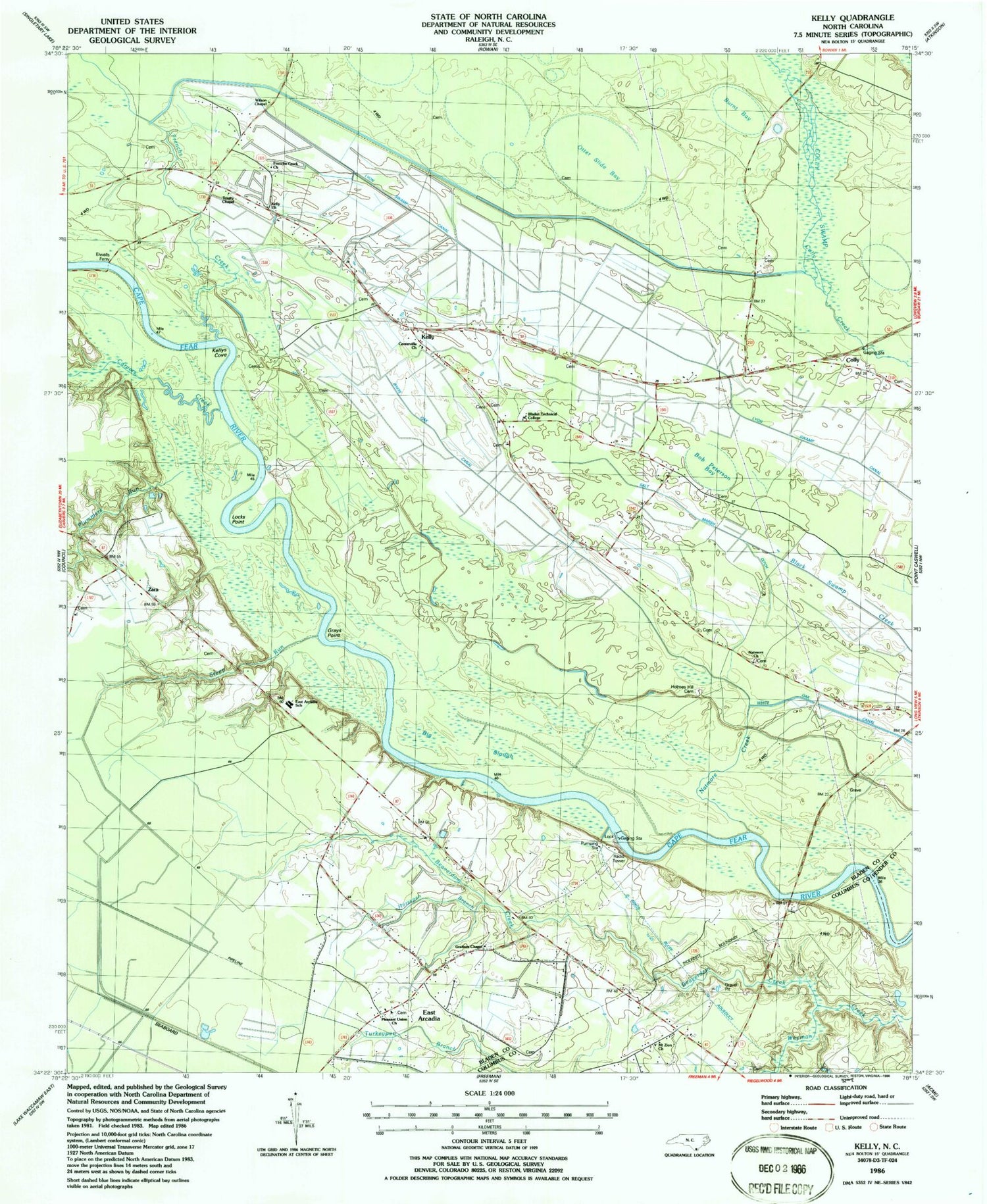
Classic USGS Kelly North Carolina 7.5'x7.5' Topo Map
Couldn't load pickup availability
Historical USGS topographic quad map of Kelly in the state of North Carolina. Map scale may vary for some years, but is generally around 1:24,000. Print size is approximately 24" x 27"
This quadrangle is in the following counties: Bladen, Columbus, Pender.
The map contains contour lines, roads, rivers, towns, and lakes. Printed on high-quality waterproof paper with UV fade-resistant inks, and shipped rolled.
Contains the following named places: Beaverdam Creek, Big Slough, Bladen Technical College, Bob Peterson Bay, Burnt Bay, Carvers Creek, Centerville Church, Colly, East Arcadia, East Arcadia Fire Department, East Arcadia School, Elwells Ferry, Frenchs Creek, Frenchs Creek Church, Gap Bay, Graham Chapel, Graham Chapel Cemetery, Grays Point, Holmes Hill Cemetery, Horsepen Branch, Kelly, Kelly Census Designated Place, Kelly Church, Kelly Post Office, Kelly Volunteer Fire Department, Kellys Cove, Kings Bluff, Lock and Dam Number One, Lock Number 1, Locks Point, Mitchell Field, Mount Zion Church, Natmore Church, Natmore Creek, Natmore Dam, Otter Slide Bay, Pleasant Union Church, Plummers Run, Salt Marsh Dam, Salt Marsh Ditch, Sandyfield, Steep Run, Town of East Arcadia, Township of Frenches Creek, Trinity Chapel, Turkeypen Bay, Weyman Chapel, White Oak Canal, White Oak Dam, Wilson Chapel, Worth Canal, Zara


