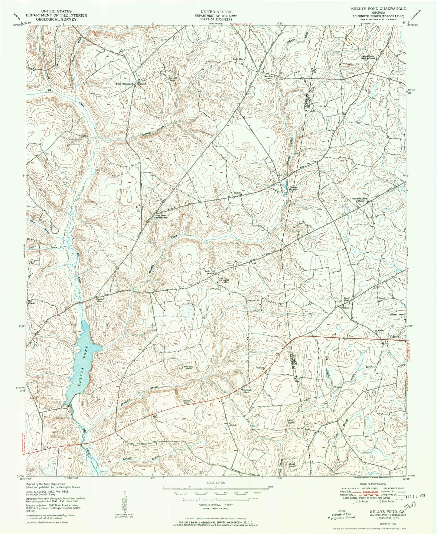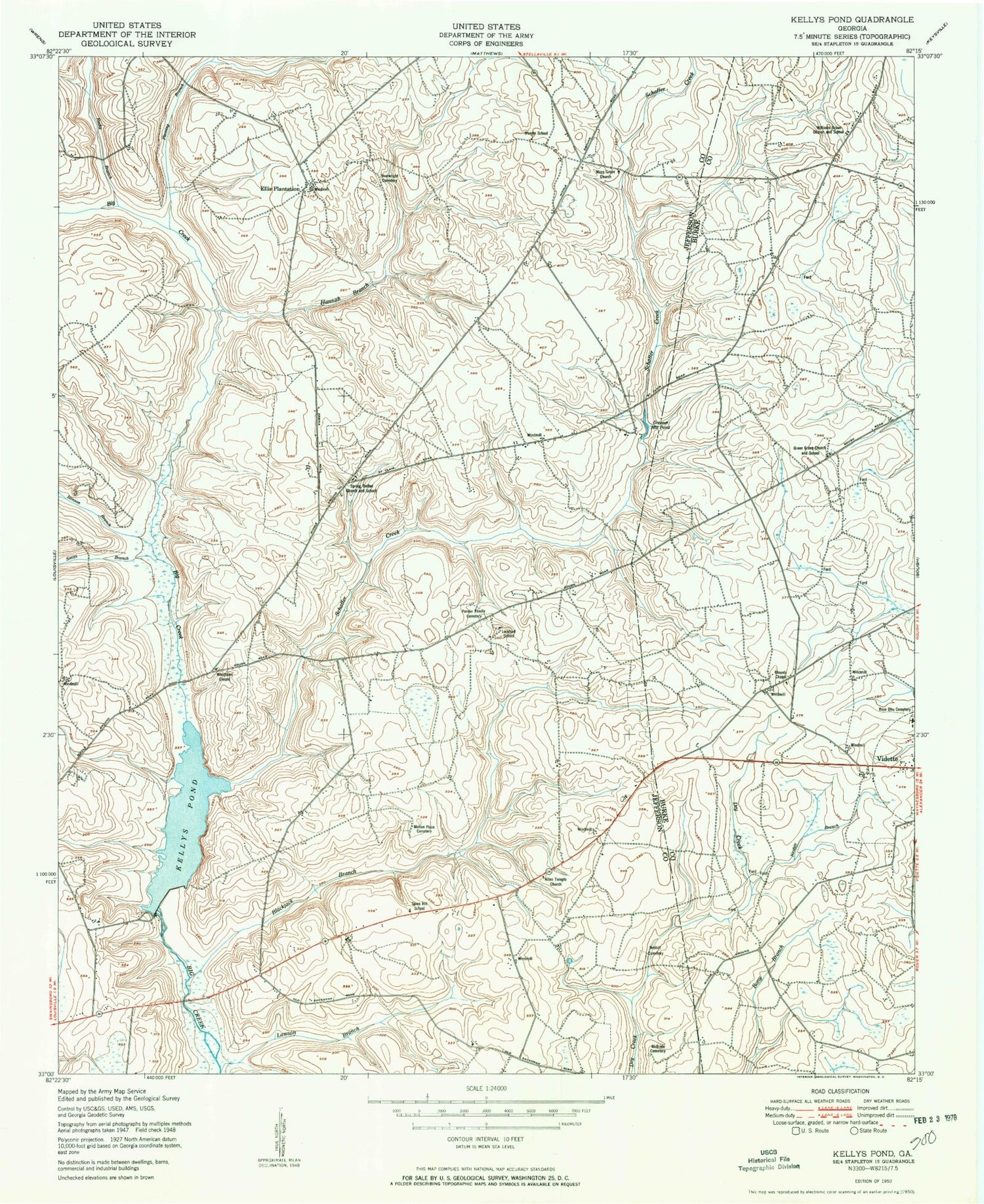
MyTopo
Classic USGS Kellys Pond Georgia 7.5'x7.5' Topo Map
Couldn't load pickup availability
Historical USGS topographic quad map of Kellys Pond in the state of Georgia. Map scale may vary for some years, but is generally around 1:24,000. Print size is approximately 24" x 27"
This quadrangle is in the following counties: Burke, Jefferson.
The map contains contour lines, roads, rivers, towns, and lakes. Printed on high-quality waterproof paper with UV fade-resistant inks, and shipped rolled.
Contains the following named places: Allen Temple Church, Blackjack Branch, Blounts Chapel, Boatwright Cemetery, Dry Creek School, Ellis Plantation, Fleming Branch, Green Grove Church, Green Grove School, Greener Mill Pond, Hannah Branch, Hickory School, Kellys Pond, Kellys Pond Dam, Lawson Branch, Lockhart School, Mays Grove Cemetery, Mays Grove Church, McBride Cemetery, Melton Place Cemetery, Munjin School, Nesbitt Branch, Nesbitt Cemetery, Newberrys Pond, Newberrys Pond Dam, Ponder Family Cemetery, Rabun Lake, Rabun Lake Dam, Rocky Branch, Rose Dhu Cemetery, Schaffer Creek, Smith Branch, Spies Hill School, Spring Bethel Church, Spring Bethel School, Stinson Branch, Williams Grove Church, Williams Grove School, Woodlawn Chapel