MyTopo
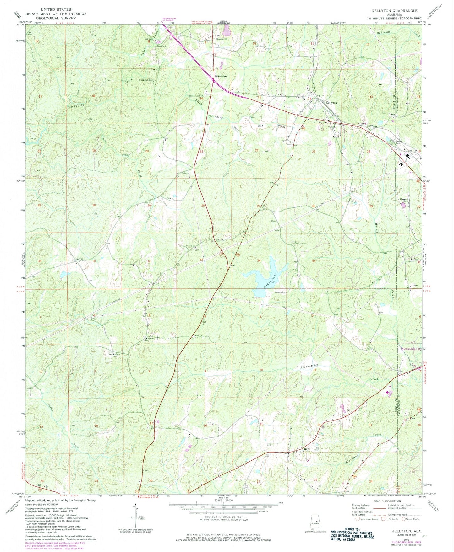
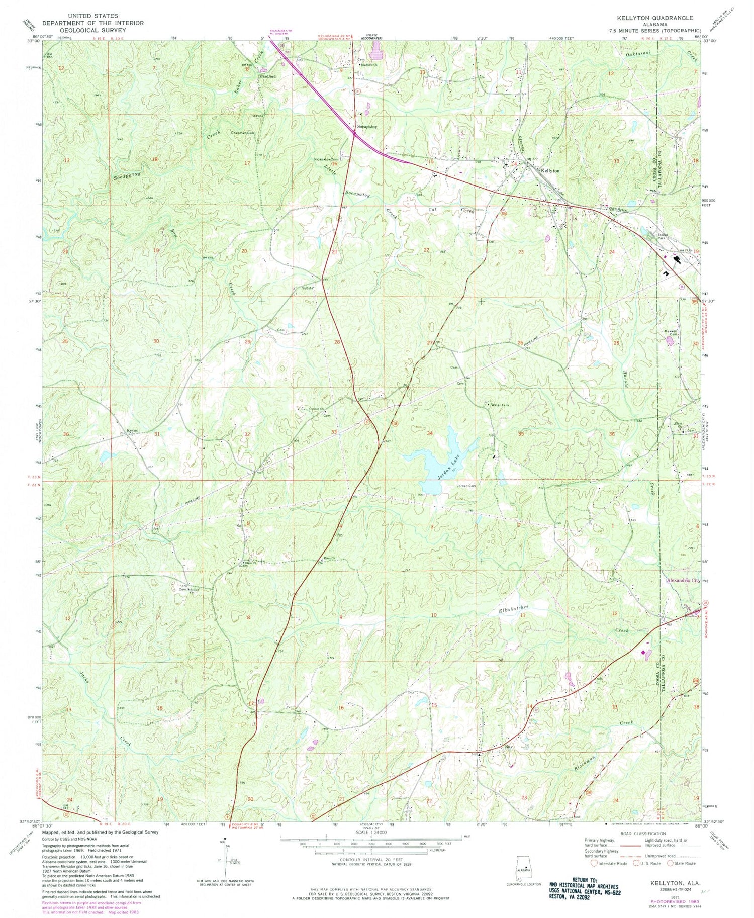
Classic USGS Kellyton Alabama 7.5'x7.5' Topo Map
Couldn't load pickup availability
Historical USGS topographic quad map of Kellyton in the state of Alabama. Map scale may vary for some years, but is generally around 1:24,000. Print size is approximately 24" x 27"
This quadrangle is in the following counties: Coosa, Tallapoosa.
The map contains contour lines, roads, rivers, towns, and lakes. Printed on high-quality waterproof paper with UV fade-resistant inks, and shipped rolled.
Contains the following named places: Alexander City Work Release Center, Ann Jordan Lake Dam, Ann Jordan Resort Area, Baker Creek, Bow Creek, Bradford, Bradford Cemetery, Bradford Methodist Church, Brooks Farm Pond, Brooks Farm Pond Dam, Cat Creek, Chapman Cemetery, Corinth Church, Doctor Kellys Private Cemetery, Dunnings Pond, Edward, Elem Church, Goodwater-Kellyton Division, Hallmans Lake, Harold Creek, Holdridge Pond, Jon, Jones Pond, Jordan Cemetery, Jordan Lake, Kellyton, Kellyton Baptist Church, Kellyton Church, Kellyton Emmanuel Holiness Church, Kellyton Junior High School, Kellyton Memory Gardens, Kellyton Methodist Church, Kellyton Post Office, Kellyton United Methodist Church, Kellyton Volunteer Fire and Rescue, Keyno, Little Socapatoy Creek, Marja School, Maxwell Cemetery, Memorial Gardens Cemetery, New Elam Number 1 Baptist Church, New Shiloh Cemetery, Nibletts Pond, Ray, Ray Baptist Church, Ray Census Designated Place, Ray Community Center, Ray Community Volunteer Fire Department, Shiloh Baptist Church, Socapatoy, Socapatoy Cemetery, Socapatoy Church, Swan Lake, Town of Kellyton, Walls Lake, Walls Lake Dam, ZIP Code: 35089