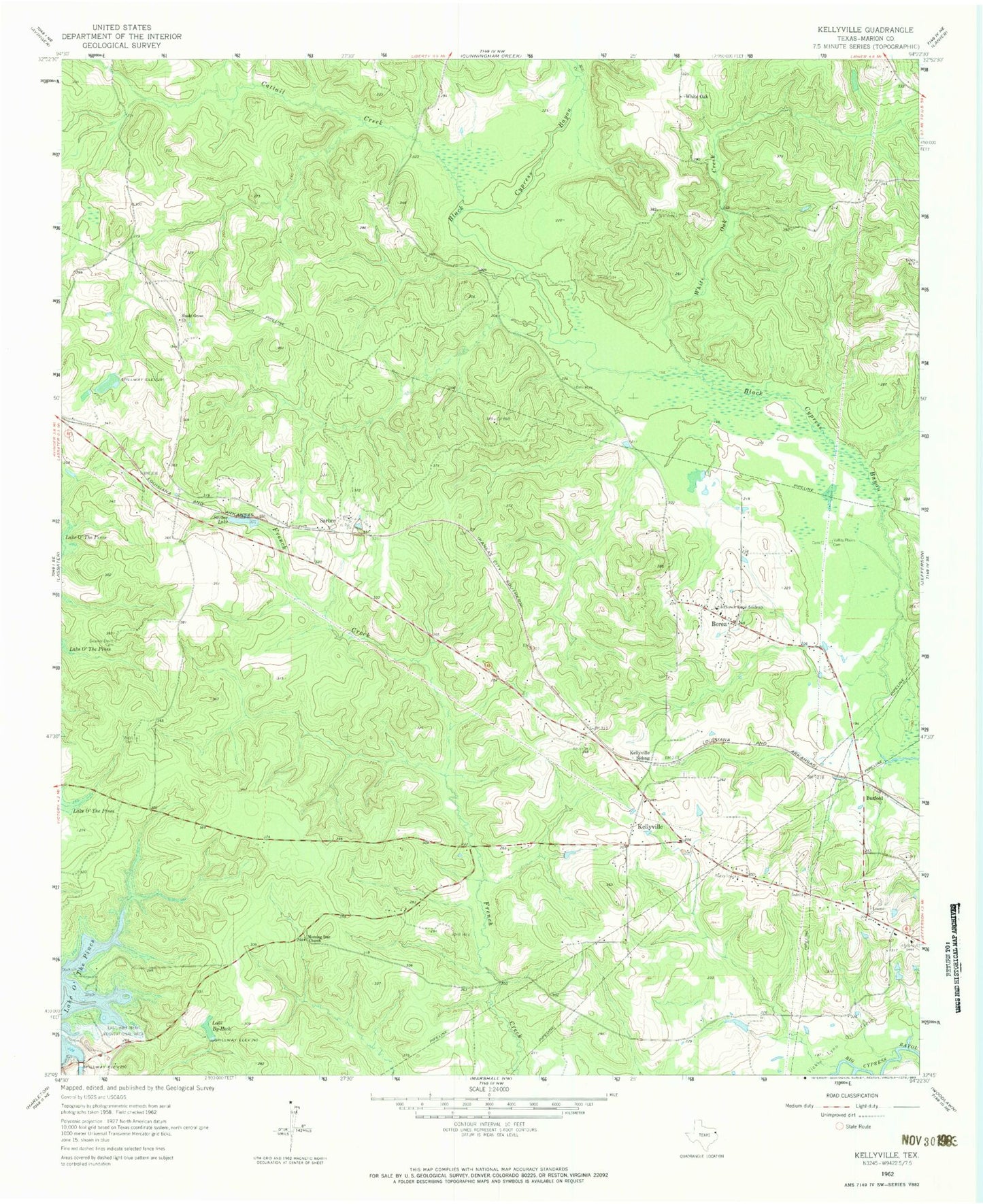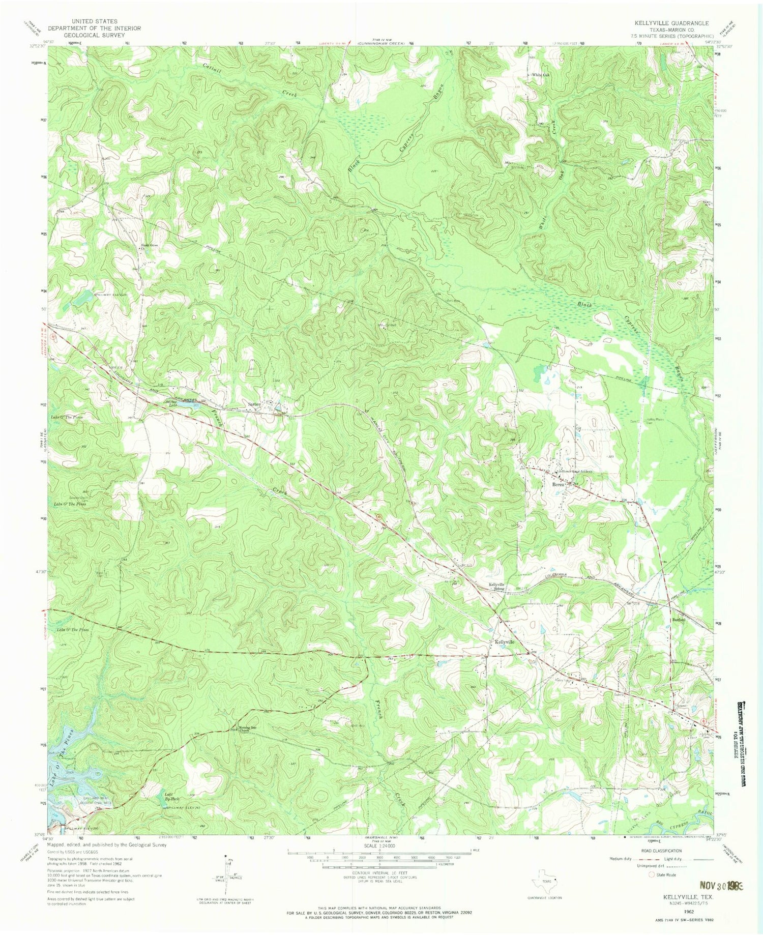
MyTopo
Classic USGS Kellyville Texas 7.5'x7.5' Topo Map
Couldn't load pickup availability
Historical USGS topographic quad map of Kellyville in the state of Texas. Map scale may vary for some years, but is generally around 1:24,000. Print size is approximately 24" x 27"
This quadrangle is in the following counties: Marion.
The map contains contour lines, roads, rivers, towns, and lakes. Printed on high-quality waterproof paper with UV fade-resistant inks, and shipped rolled.
Contains the following named places: Beamer - Davis Cemetery, Berea, Buckhorn Creek Park, Burford, Cattail Creek, East Abutment Recreation Area, Jefferson Rural Academy, Kellyville, Kellyville Siding, Lake By-Heck, Mill Creek, Morning Star Church, Pine Harbor Census Designated Place, Sarber, Sarber Lake, Shady Grove Church, Valley Plains Cemetery, Webb Cemetery, White Oak, White Oak Creek