MyTopo
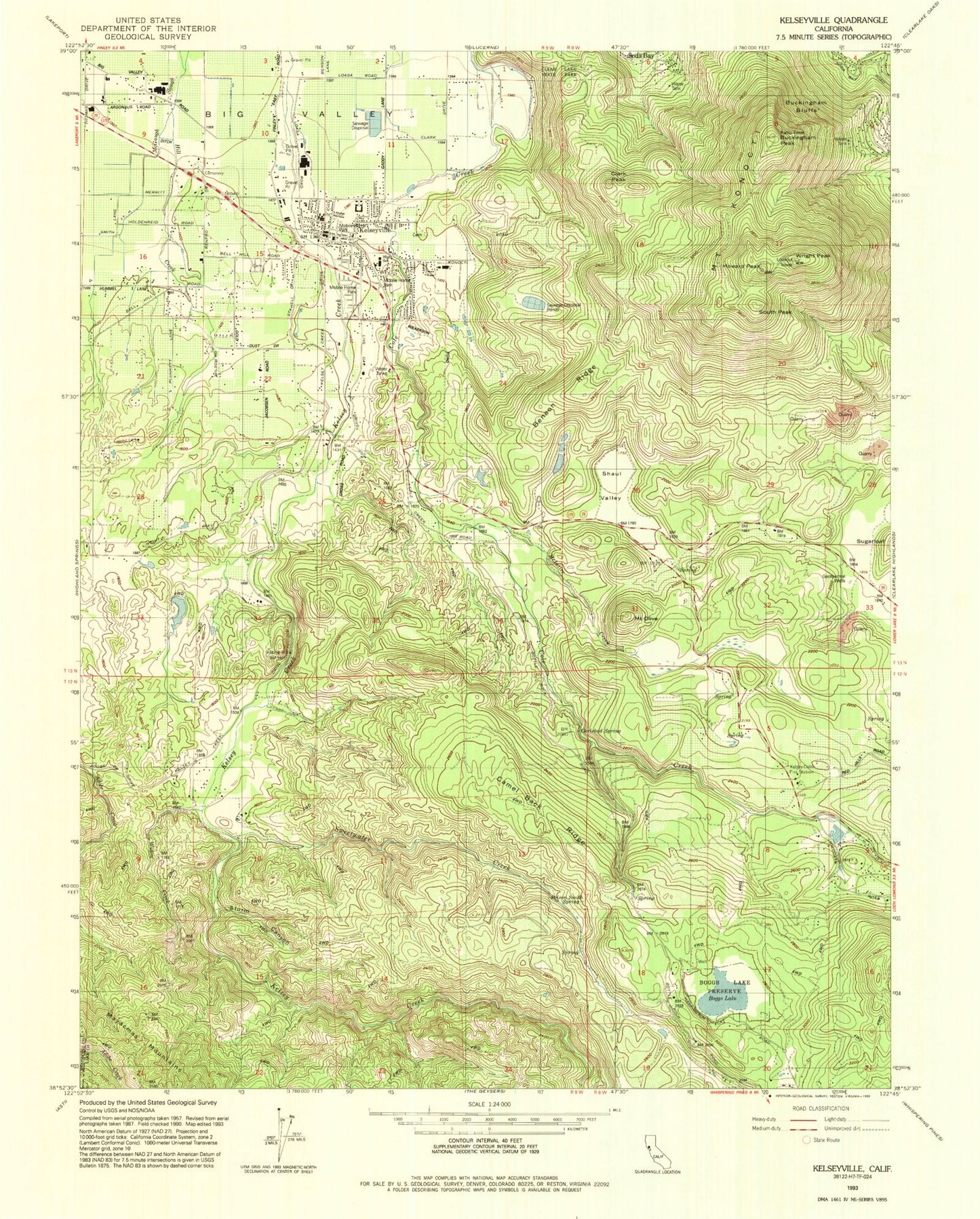
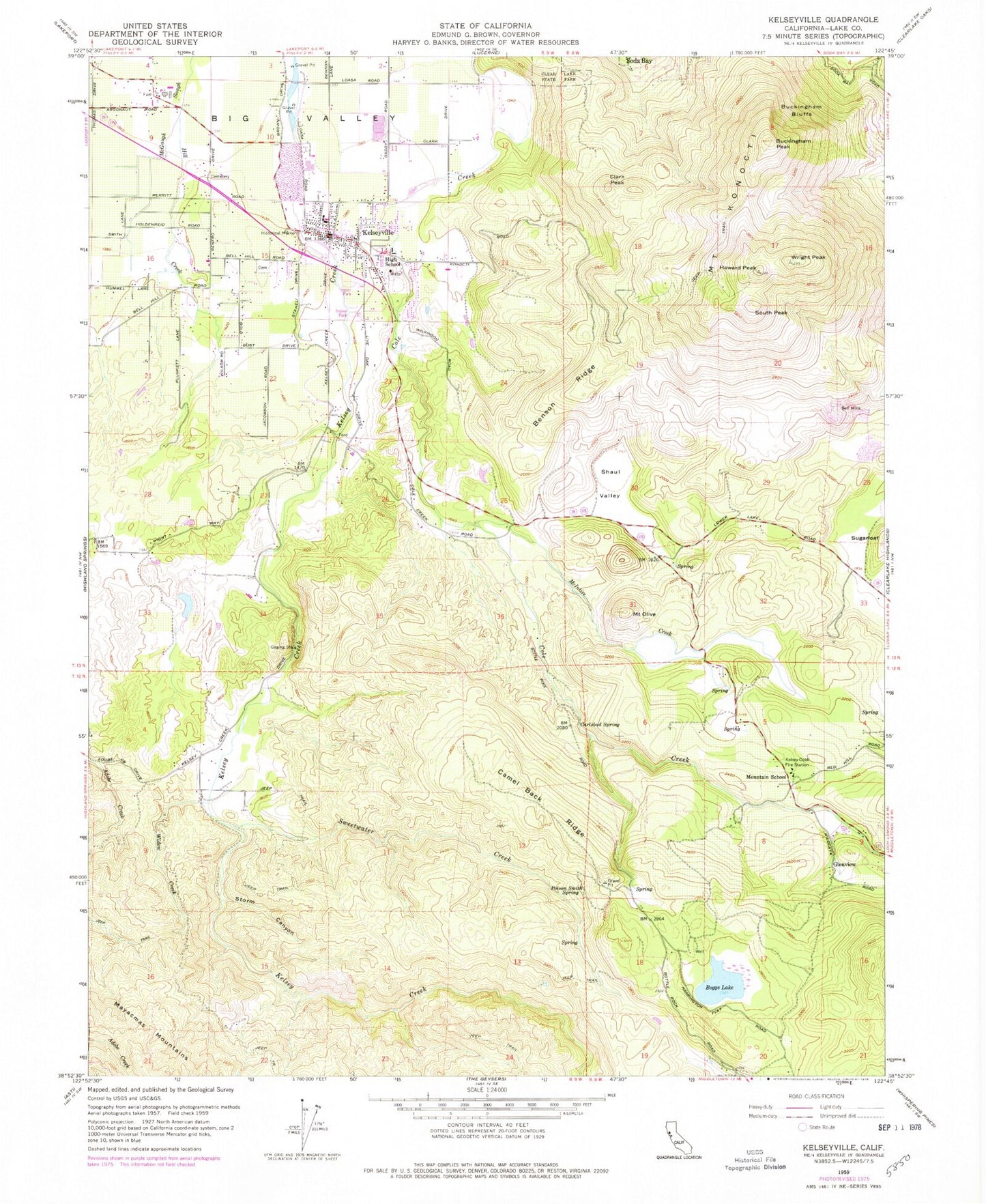
Classic USGS Kelseyville California 7.5'x7.5' Topo Map
Couldn't load pickup availability
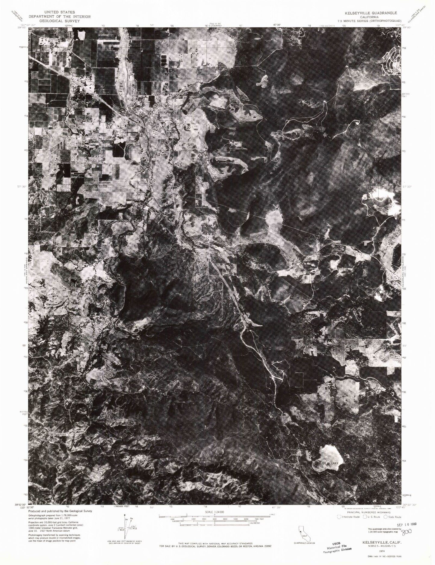
Historical USGS topographic quad map of Kelseyville in the state of California. Map scale may vary for some years, but is generally around 1:24,000. Print size is approximately 24" x 27"
This quadrangle is in the following counties: Lake.
The map contains contour lines, roads, rivers, towns, and lakes. Printed on high-quality waterproof paper with UV fade-resistant inks, and shipped rolled.
Contains the following named places: Allen 394 Dam, Bell Mine, Benson Ridge, Big Valley, Boggs Lake, Boggs Lake Preserve, Buckingham Bluffs, Buckingham Peak, California Highway Patrol Northern Division - Clear Lake, Camel Back Ridge, Carlsbad Spring, Clark Peak, Cold Creek Ranch, Fifield Ranch, Gard Street Elementary School, Glenview, Grace Evangelical Free Church, Helenthal Ranch, Hill Creek, Howard Peak, Intermountain High School, Kelsey - Cobb Fire Station, Kelsey Creek Pit, Kelsey-Cobb Fire Station, Kelseyville, Kelseyville Cemetery, Kelseyville Census Designated Place, Kelseyville Community Day High School, Kelseyville Elementary School, Kelseyville Fire Protection District Station 55, Kelseyville High School, Kelseyville Pioneer Cemetery, Kelseyville Post Office, Konoti Winery, Mahnke Ranch, McIntire Creek, McIntire Ranch, Mount Konocti, Mount Olive, Mountain School, Mountain Vista Middle School, M-Square Farms, Poison Smith Spring, Presbyterian Church of Kelseyville, S - Bar - S Quarry, Saint Peter Roman Catholic Church, Shaul Valley, South Peak, Storm Canyon, Sugarloaf, Sweetwater Creek, Sweetwater Ranch, Widow Creek, Wright Peak, ZIP Code: 95451