MyTopo
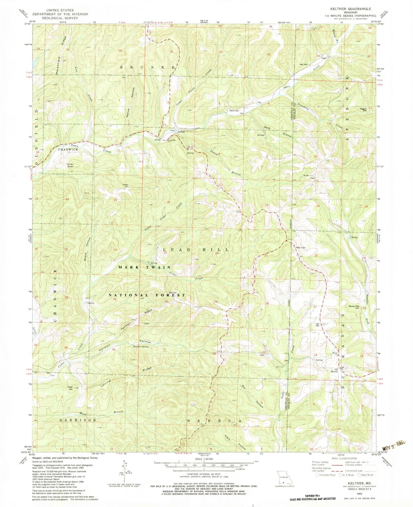
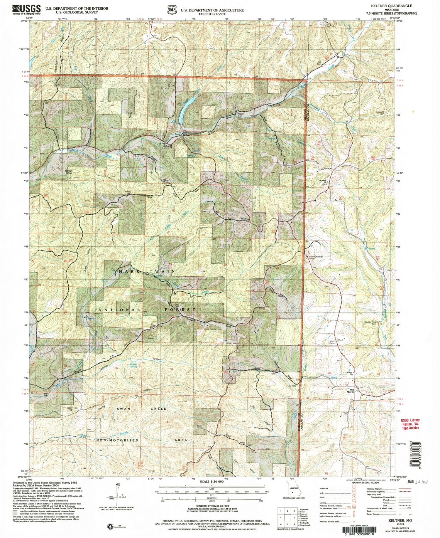
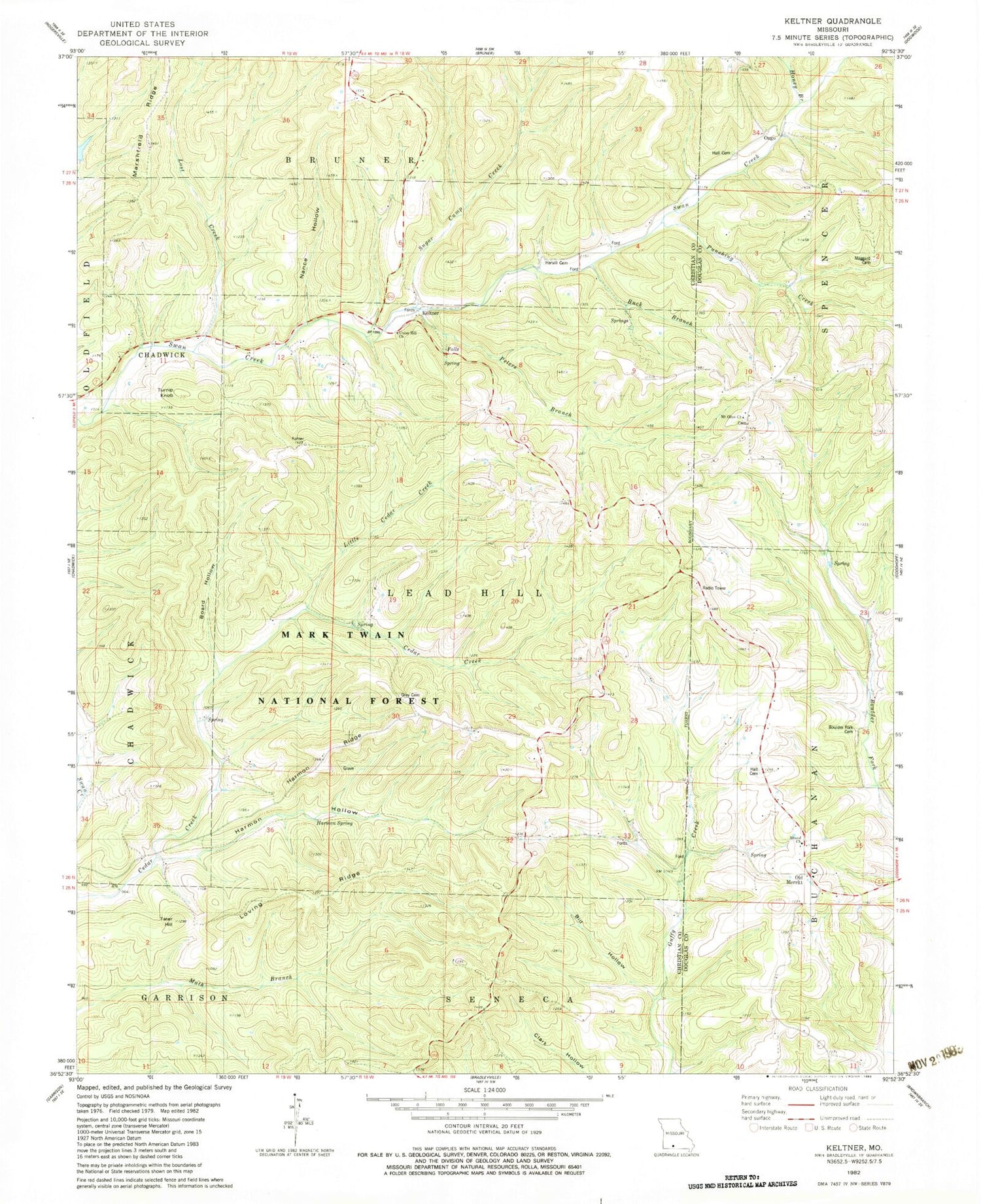
Classic USGS Keltner Missouri 7.5'x7.5' Topo Map
Couldn't load pickup availability
Historical USGS topographic quad map of Keltner in the state of Missouri. Map scale may vary for some years, but is generally around 1:24,000. Print size is approximately 24" x 27"
This quadrangle is in the following counties: Christian, Douglas.
The map contains contour lines, roads, rivers, towns, and lakes. Printed on high-quality waterproof paper with UV fade-resistant inks, and shipped rolled.
Contains the following named places: Bill Hollow, Board Hollow, Boulders Fork Cemetery, Buck Branch, Gray Cemetery, Hall Cemetery, Hall School, Harmon Hollow, Harmon Ridge, Harmon Spring, Harvill Cemetery, High Lonesome School, Honey Branch, Keltner, Lead Hill School, Little Cedar Creek, Lost Creek, Loving Ridge, Maggard Cemetery, Marshfield Ridge, Mound Church, Mound School, Mount Olive Church, Nance Hollow, Old Merritt, Ongo, Peters Branch, Punching Creek, Sugar Camp Creek, Tater Hill, Township of Lead Hill, Turnip Knob, Union Hill Church, Union Hill School, Walnut Grove School, ZIP Code: 65720