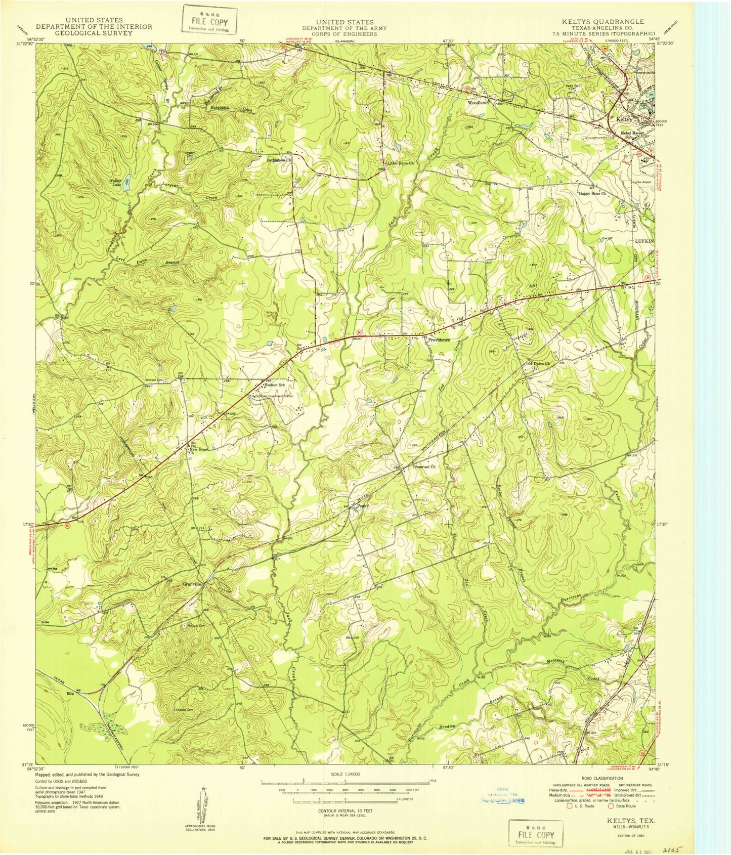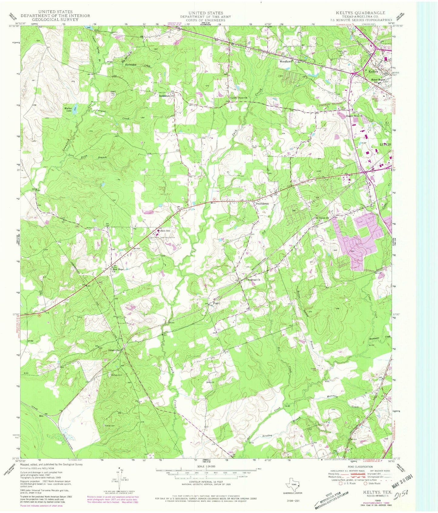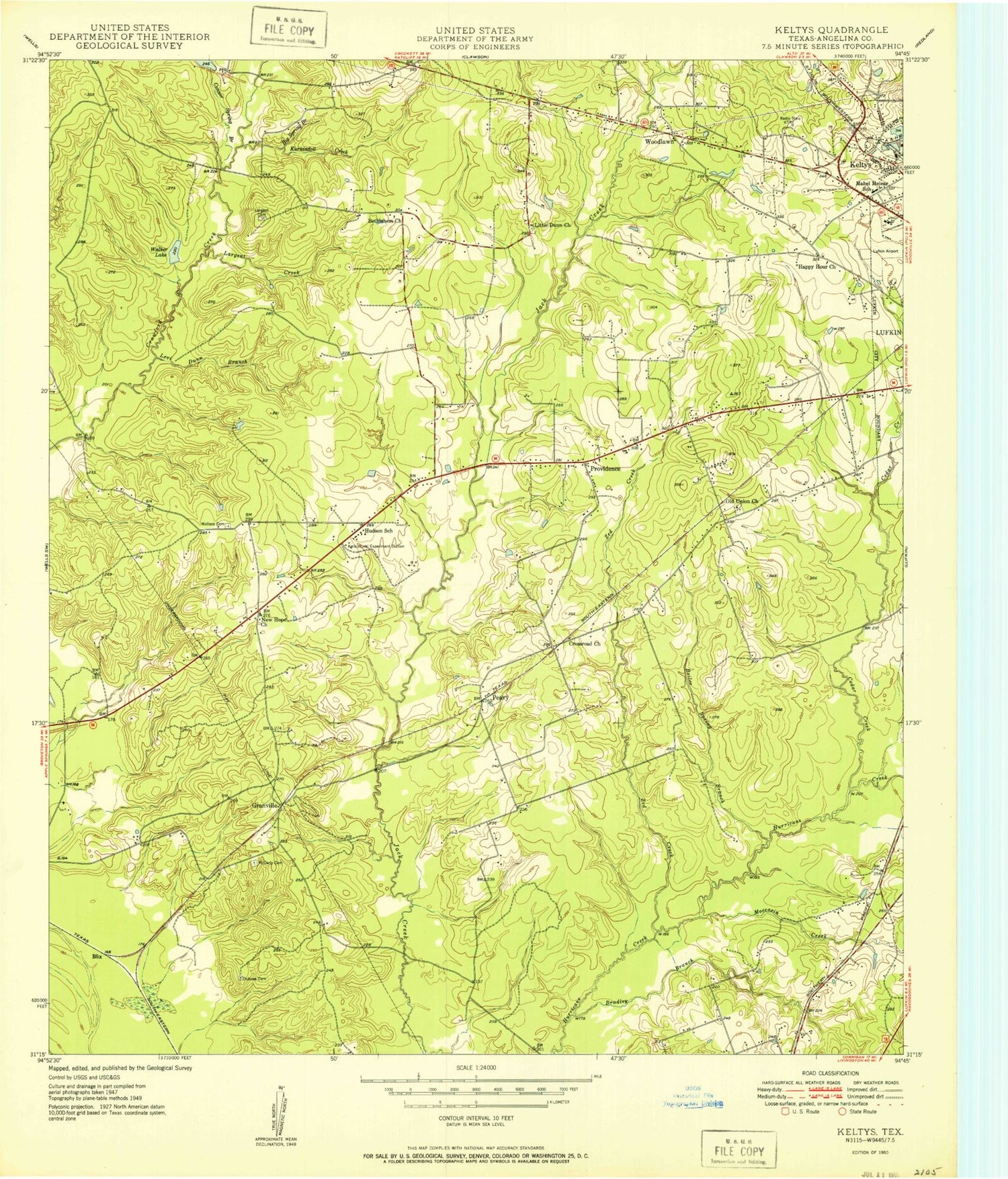

MyTopo
Classic USGS Keltys Texas 7.5'x7.5' Topo Map
Couldn't load pickup availability
Historical USGS topographic quad map of Keltys in the state of Texas. Map scale may vary for some years, but is generally around 1:24,000. Print size is approximately 24" x 27"
This quadrangle is in the following counties: Angelina, Trinity.
The map contains contour lines, roads, rivers, towns, and lakes. Printed on high-quality waterproof paper with UV fade-resistant inks, and shipped rolled.
Contains the following named places: Angelina County Constable Precinct Two, Bethlehem Church, Big Spring Branch, Blackburn Lake, Blackburn Lake Dam, Blix, Boiler Spring Branch, Bradley Branch, Brookhollow Elementary School, City of Hudson, Clark-Whitton House, Conner Spring Branch, Crossroad Church, Dubose - Fairchild Cemetery, Granville, Happy Hour Church, Hudson, Hudson City Hall, Hudson School, Hudson Volunteer Fire Department Station 1, Hudson Volunteer Fire Department Station 2, KBLZ-AM (Lufkin), Keltys, Keltys Worker Housing, KTRE Radio Tower (Huntsville), Kurkindoll Creek, Kurth-Glover House, Largent Cemetery, Largent Creek, Levi Dunn Branch, Little Dunn Church, Lufkin Fire Department Station 4, Lufkin Post Office, Mabel Melear School, McCarty Cemetery, Moccasin Creek, Morris Franks Park, New Hope Church, Old Union Church, Peavy, Providence, Stubblefield Learning Center, Walker Lake, Wallace Cemetery, Woodland Heights Medical Center, Woodlawn, Zed Creek, ZIP Code: 75904