MyTopo
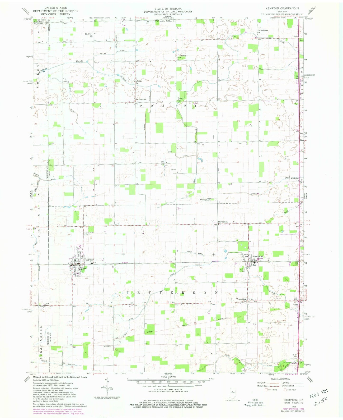
Classic USGS Kempton Indiana 7.5'x7.5' Topo Map
Couldn't load pickup availability
Historical USGS topographic quad map of Kempton in the state of Indiana. Map scale may vary for some years, but is generally around 1:24,000. Print size is approximately 24" x 27"
This quadrangle is in the following counties: Clinton, Howard, Tipton.
The map contains contour lines, roads, rivers, towns, and lakes. Printed on high-quality waterproof paper with UV fade-resistant inks, and shipped rolled.
Contains the following named places: Barr Ditch, Bethel Church, Broad Creek, Carter Ditch, Collier Ditch, Cox Ditch, Crum Ditch, Fernung Farms, Floyd Ditch, Goldsmith, Groomsville, Hopewell Church, Kemp Ditch, Kempton, Kempton Cemetery, Kempton Fire and Rescue Department, Kempton Police Department, Kempton Post Office, Kigin Ditch, Liberty Church, Lydy-Fillenworth Ditch, Magnet Ditch, Mott Ditch, Mount Lebanon Church, Mount Olive Church, Normanda, Normanda Cemetery, R Hog Farm, Shanty Creek, Tetersburg, Tetersburg Cemetery, Town of Kempton, Township of Jefferson, Township of Prairie, Tucker Cemetery, Wolford Cemetery, Yazel Ditch, ZIP Codes: 46045, 46049