MyTopo
Classic USGS Kenai B-2 NE Alaska 7.5'x7.5' Topo Map
Regular price
$16.95
Regular price
Sale price
$16.95
Unit price
per
Couldn't load pickup availability
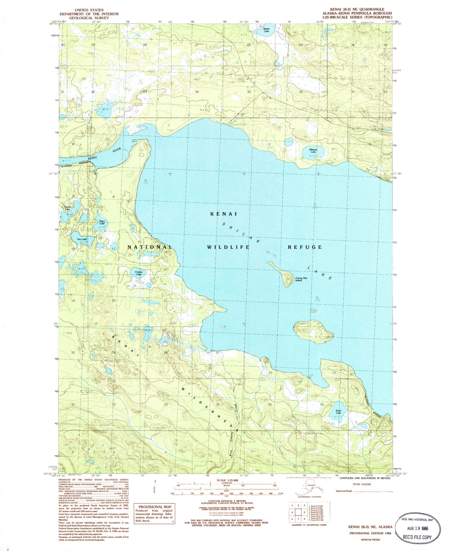
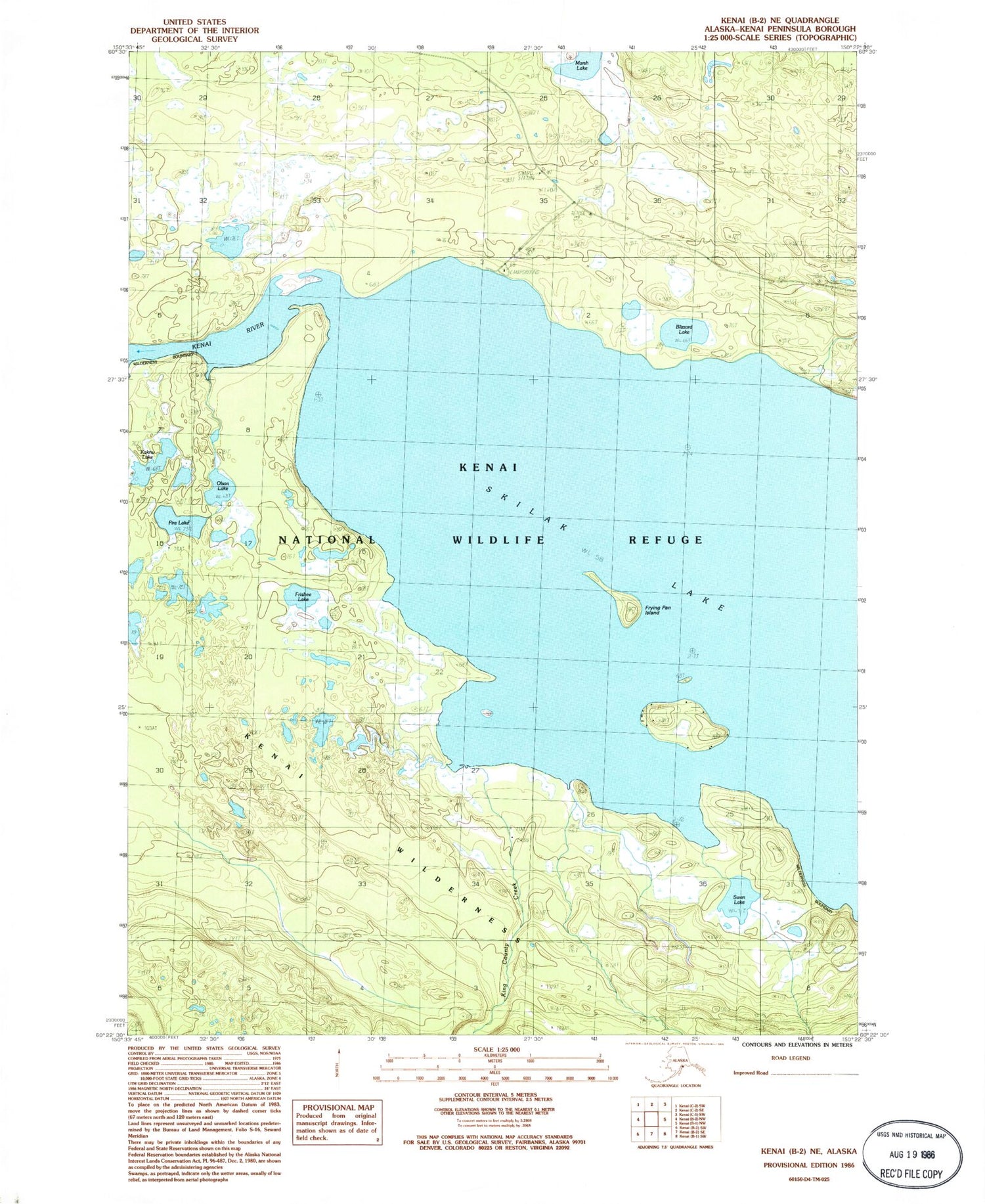
Historical USGS topographic quad map of Kenai B-2 NE in the state of Alaska. Typical map scale is 1:24,000, but may vary for certain years, if available. Print size: 24" x 27"
This quadrangle is in the following counties: Kenai Peninsula.
The map contains contour lines, roads, rivers, towns, and lakes. Printed on high-quality waterproof paper with UV fade-resistant inks, and shipped rolled.
Contains the following named places: Blizzard Lake, Caribou Island, Fire Lake, Frisbee Lake, Frying Pan Island, Kaknu Lake, King County Creek, Olson Creek, Olson Lake, Skilak Guard Station, Swan Lake, Skilak BLM Helistop Heliport (historical)