
MyTopo
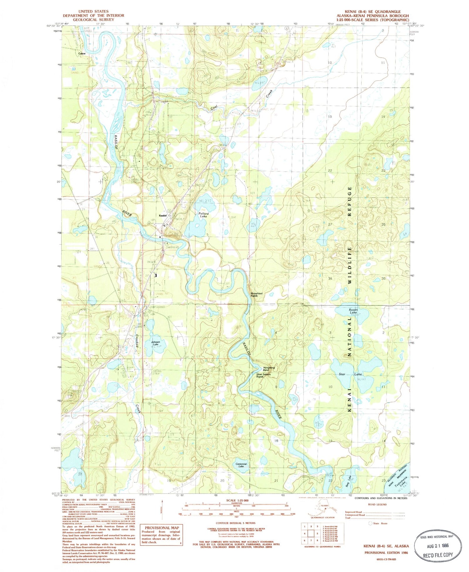
Classic USGS Kenai B-4 SE Alaska 7.5'x7.5' Topo Map
Couldn't load pickup availability
Historical USGS topographic quad map of Kenai B-4 SE in the state of Alaska. Map scale may vary for some years, but is generally around 1:24,000. Print size is approximately 24" x 27"
This quadrangle is in the following counties: Kenai Peninsula.
The map contains contour lines, roads, rivers, towns, and lakes. Printed on high-quality waterproof paper with UV fade-resistant inks, and shipped rolled.
Contains the following named places: Berg Lake, Centennial Lake, Central Emergency Services Station 6 Kasilof, Coal Creek, Cohoe, Cohoe Census Designated Place, Crooked Creek, Encelewski Lake, Encelewski Lake Seaplane Base, Hongkong Bend, Johnson Lake, Kasilof, Kasilof Airport, Kasilof Census Designated Place, Kasilof Post Office, Moosehead Rapids, Pollard Lake, Quintin Lake, Raven Lake, Roque Lake, Silver Salmon Rapids, Spruce Grove Memorial Cemetery, Star Lake


