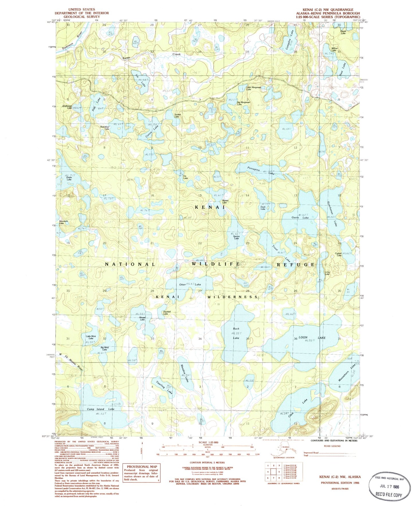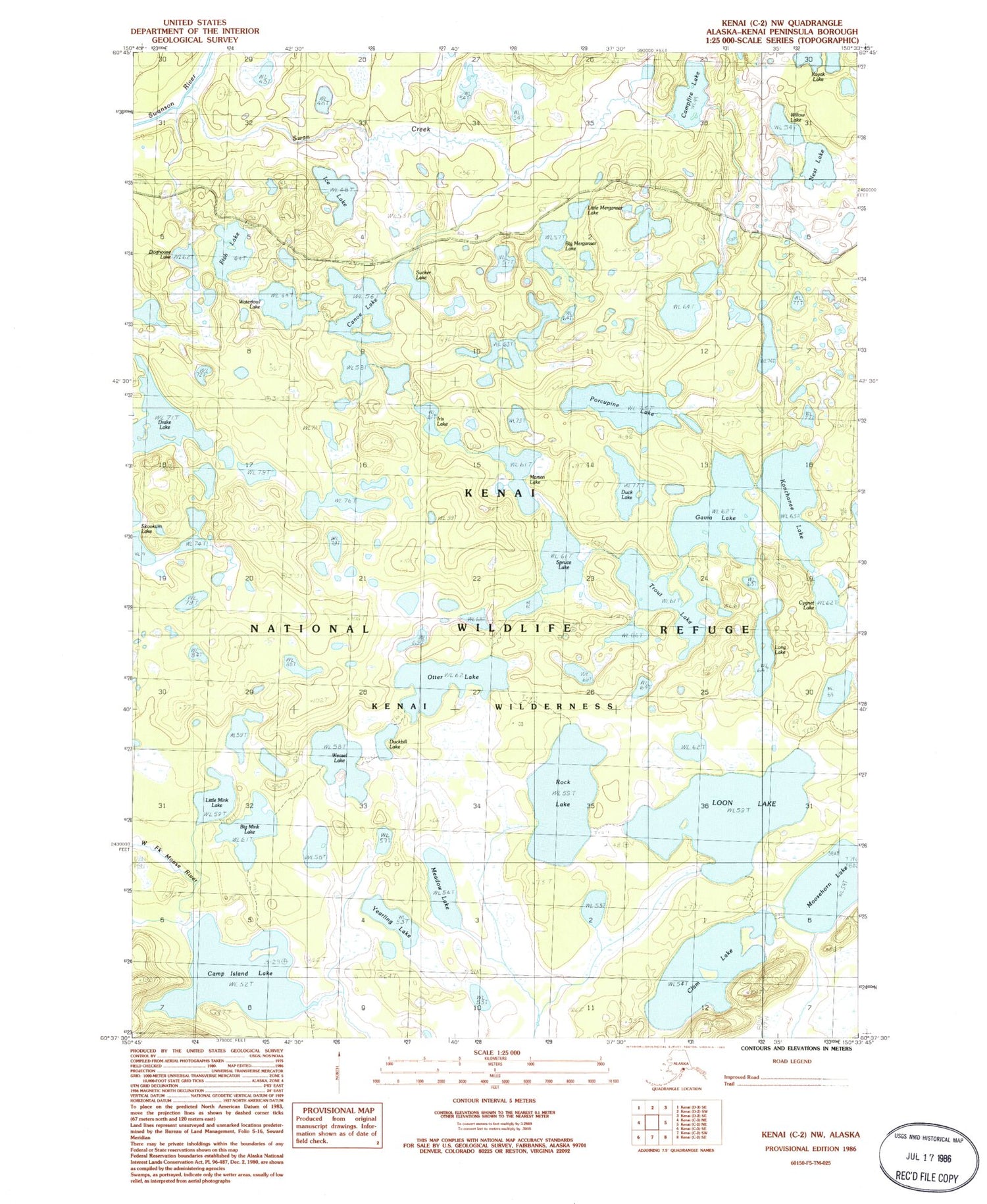
MyTopo
Classic USGS Kenai C-2 NW Alaska 7.5'x7.5' Topo Map
Couldn't load pickup availability
Historical USGS topographic quad map of Kenai C-2 NW in the state of Alaska. Typical map scale is 1:24,000, but may vary for certain years, if available. Print size: 24" x 27"
This quadrangle is in the following counties: Kenai Peninsula.
The map contains contour lines, roads, rivers, towns, and lakes. Printed on high-quality waterproof paper with UV fade-resistant inks, and shipped rolled.
Contains the following named places: Big Merganser Lake, Big Mink Lake, Camp Island Lake, Campfire Lake, Canoe Lake, Clam Lake, Contact Lake, Cygnet Lake, Doghouse Lake, Drake Lake, Duck Lake, Duckbill Lake, Fish Lake, Gavia Lake, Ice Lake, Konchanee Lake, Little Merganser Lake, Little Mink Lake, Long Lake, Loon Lake, Martin Lake, Meadow Lake, Moosehorn Lake, Nest Lake, Otter Lake, Porcupine Lake, Rock Lake, Spruce Lake, Sucker Lake, Swan Creek, Trout Lake, Waterfowl Lake, Weasel Lake, Willow Lake, Yearling Lake, Canoe Lake Chain