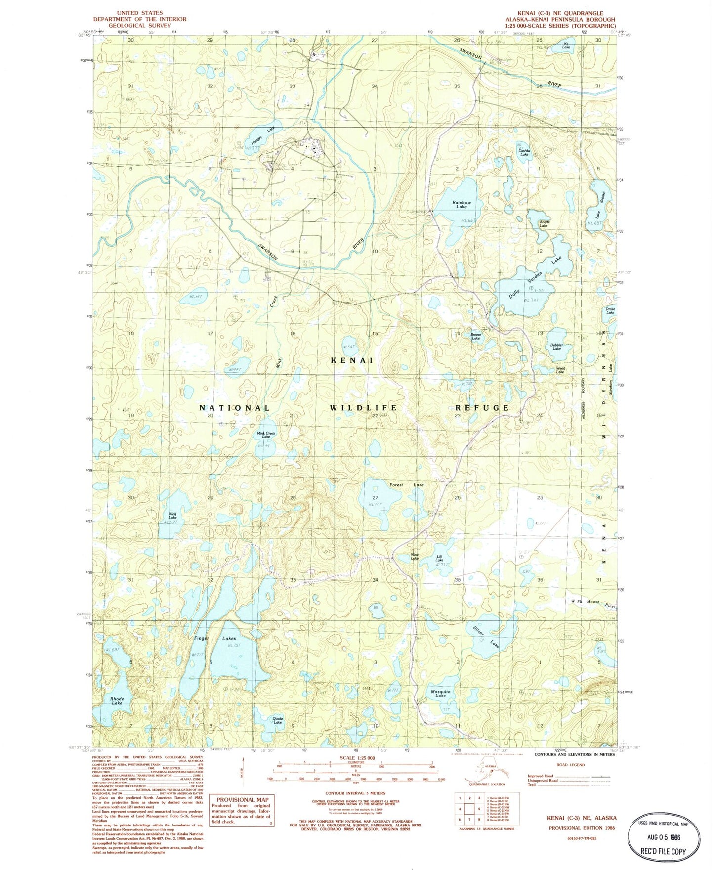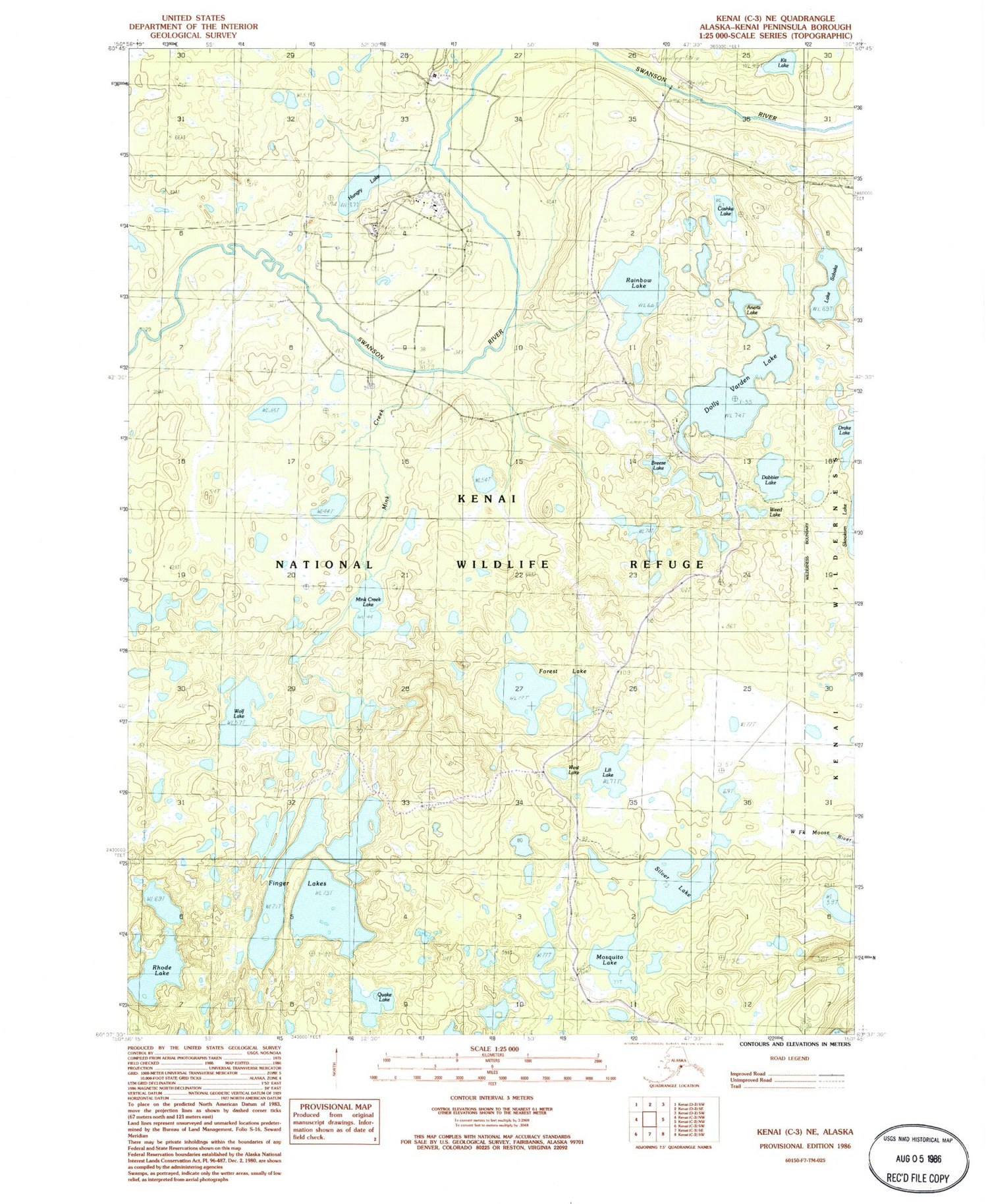
MyTopo
Classic USGS Kenai C-3 NE Alaska 7.5'x7.5' Topo Map
Couldn't load pickup availability
Historical USGS topographic quad map of Kenai C-3 NE in the state of Alaska. Typical map scale is 1:24,000, but may vary for certain years, if available. Print size: 24" x 27"
This quadrangle is in the following counties: Kenai Peninsula.
The map contains contour lines, roads, rivers, towns, and lakes. Printed on high-quality waterproof paper with UV fade-resistant inks, and shipped rolled.
Contains the following named places: Anertz Lake, Breeze Lake, Cashka Lake, Dabbler Lake, Dolly Varden Lake, Finger Lake, Forest Lake, Hungry Lake, Kit Lake, Lili Lake, Mink Creek Lake, Mosquito Lake, Quake Lake, Rainbow Lake, Rhode Lake, Lake Sabaka, Silver Lake, Weed Lake, West Lake, Wolf Lake, Swanson River Oil Field, Skookum Lake, East Finger Lake, Finger Lakes, Middle Finger Lake, South Finger Lake, West Finger Lake, West Forest Lake, West Lili Lake