MyTopo
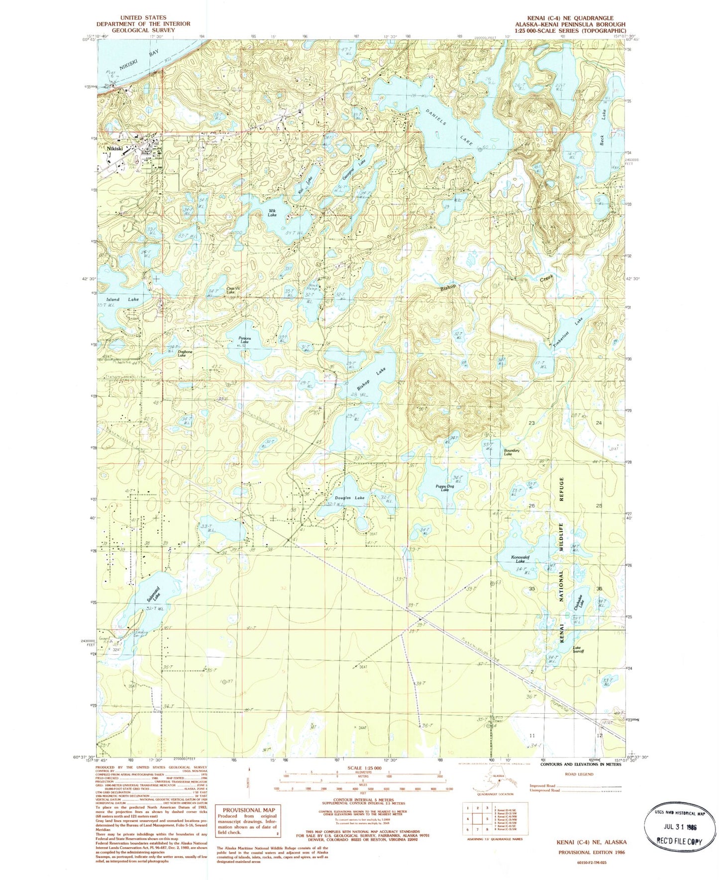
Classic USGS Kenai C-4 NE Alaska 7.5'x7.5' Topo Map
Couldn't load pickup availability
Historical USGS topographic quad map of Kenai C-4 NE in the state of Alaska. Map scale may vary for some years, but is generally around 1:24,000. Print size is approximately 24" x 27"
This quadrangle is in the following counties: Kenai Peninsula.
The map contains contour lines, roads, rivers, towns, and lakes. Printed on high-quality waterproof paper with UV fade-resistant inks, and shipped rolled.
Contains the following named places: Arness Lake Airport, Bishop Lake, Boundary Lake, Butler Aviation Airport, Carty's Airstrip, Char-Vic Lake, Chickadee Lake, Daniels Lake, Dogbone Lake, Douglas Lake, Georgina Lake, Island Lake, Island Lake Seaplane Base, Joe Clouds Seaplane Base, Kivi Lake, Konovalof Lake, Lake Ivanoff, Marie Lake, McGahan Cemetery, McGahan Industrial Airpark, Nikiski, Nikiski Bay, Nikiski Census Designated Place, Nikiski Fire Department Station 2, Nikiski Post Office, Offshore Systems-Kenai Heliport, Parsons Lake, Puppy Dog Lake, Salamatof Lake, Thetis Lake, Timberlost Lake, Tirmore Lake, Total Safety Emergency Response Services, Wik Lake