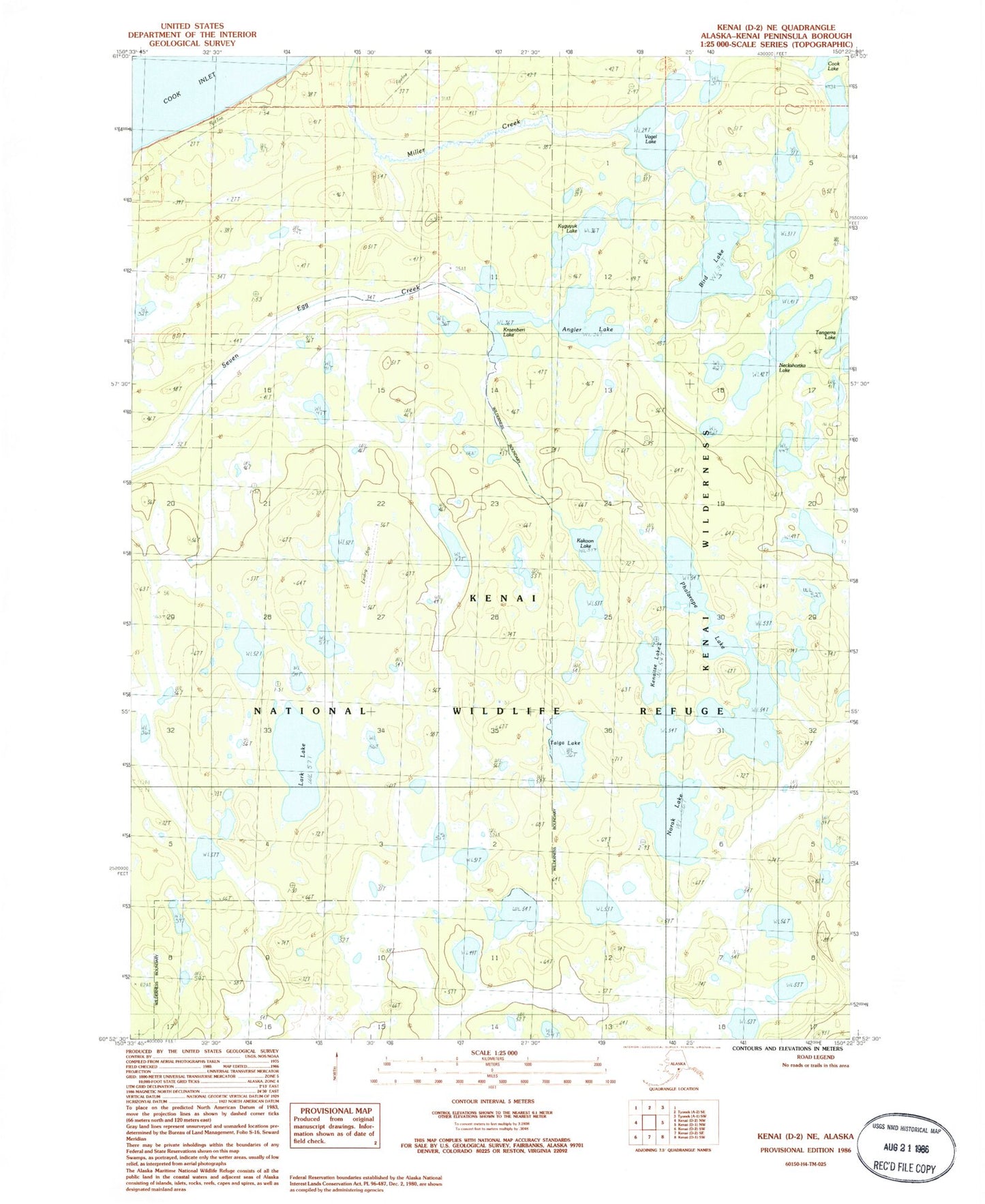
MyTopo
Classic USGS Kenai D-2 NE Alaska 7.5'x7.5' Topo Map
Regular price
$16.95
Regular price
Sale price
$16.95
Unit price
per
Couldn't load pickup availability
Historical USGS topographic quad map of Kenai D-2 NE in the state of Alaska. Map scale may vary for some years, but is generally around 1:24,000. Print size is approximately 24" x 27"
This quadrangle is in the following counties: Kenai Peninsula.
The map contains contour lines, roads, rivers, towns, and lakes. Printed on high-quality waterproof paper with UV fade-resistant inks, and shipped rolled.
Contains the following named places: Angler Lake, Bird Lake, Kakoon Lake, Kenaitze Lake, Kraenberi Lake, Kuguyuk Lake, Lark Lake, Neckshortka Lake, Norak Lake, Phalarope Lake, Taiga Lake, Twig Lake, Vogel Lake