
MyTopo
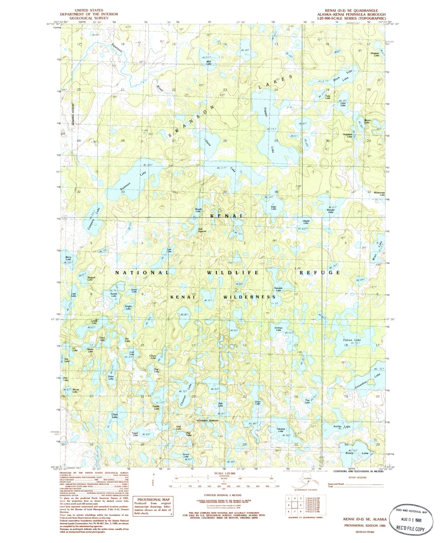
Classic USGS Kenai D-2 SE Alaska 7.5'x7.5' Topo Map
Couldn't load pickup availability
Historical USGS topographic quad map of Kenai D-2 SE in the state of Alaska. Map scale may vary for some years, but is generally around 1:24,000. Print size is approximately 24" x 27"
This quadrangle is in the following counties: Kenai Peninsula.
The map contains contour lines, roads, rivers, towns, and lakes. Printed on high-quality waterproof paper with UV fade-resistant inks, and shipped rolled.
Contains the following named places: Antler Lake, Arrow Lake, Berry Lake, Birch Tree Lake, Campers Lake, Channel Lake, Chick Lake, Chum Lake, Dog Lake, Eider Lake, Embryo Lake, Falcon Lake, Gene Lake, Ilerum Lake, Junco Lake, Kalun Lake, Kenai Wilderness (Dave Spencer Unit), Kinglet Lake, Kuviak Lake, Leaf Lake, Lo Lake, Lonely Lake, Lost Lake, Lure Lake, Lynx Lake, Mouse Lake, Nekutak Lake, Nuthatch Lake, Odd Lake, Olsjold Lake, Pad Lake, Paddle Lake, Pepper Lake, Pond Lake, Pot Lake, Red Squirrel Lake, Redpoll Lake, Rifle Lake, Shrew Lake, Snowshoe Lake, Swanson Lake, Swanson Lakes, Takukak Lake, Tine Lake, Ursus Lake, Wild Lake, Wonder Lake, Woods Lake, Wren Lake, Yugok Lake


