
MyTopo
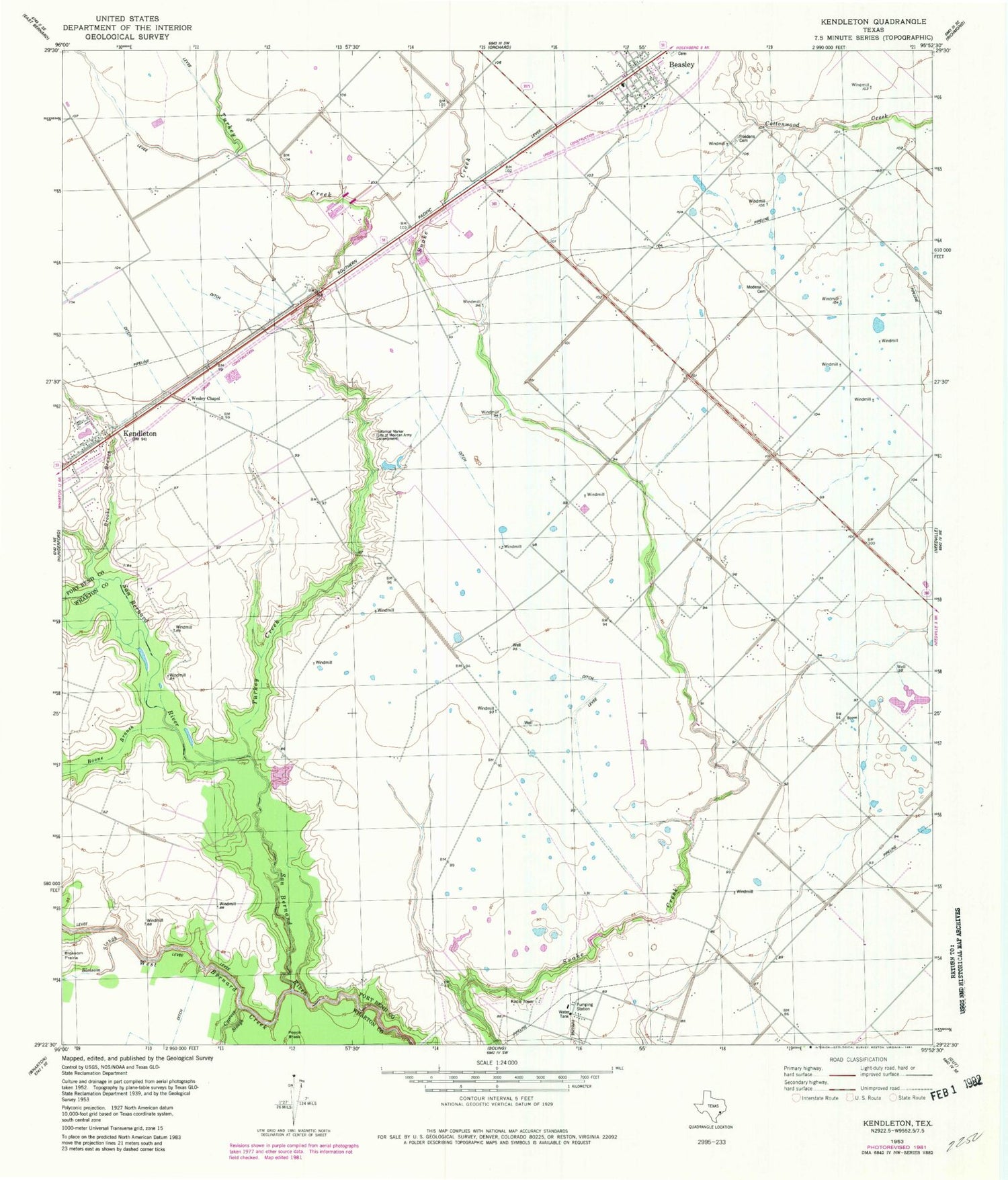
Classic USGS Kendleton Texas 7.5'x7.5' Topo Map
Couldn't load pickup availability
Historical USGS topographic quad map of Kendleton in the state of Texas. Map scale may vary for some years, but is generally around 1:24,000. Print size is approximately 24" x 27"
This quadrangle is in the following counties: Fort Bend, Wharton.
The map contains contour lines, roads, rivers, towns, and lakes. Printed on high-quality waterproof paper with UV fade-resistant inks, and shipped rolled.
Contains the following named places: Aviasud Airpark, Beasley, Beasley City Hall, Beasley Elementary School, Beasley Police Department, Beasley Post Office, Beasley Volunteer Fire Department, Boone Branch, Brooks Branch, City of Beasley, Friedens Cemetery, Henry G and Annie B Green House, Historical Marker, Houston Fort Bend Airport, Kendleton, Modena Cemetery, Newman Chapel United Methodist Church, Purdy-nielsen Memorial Airpark, Texas No Name Number 43 Dam, Turkey Creek, Wesley Chapel, West Bernard Creek, ZIP Code: 77417


