
MyTopo
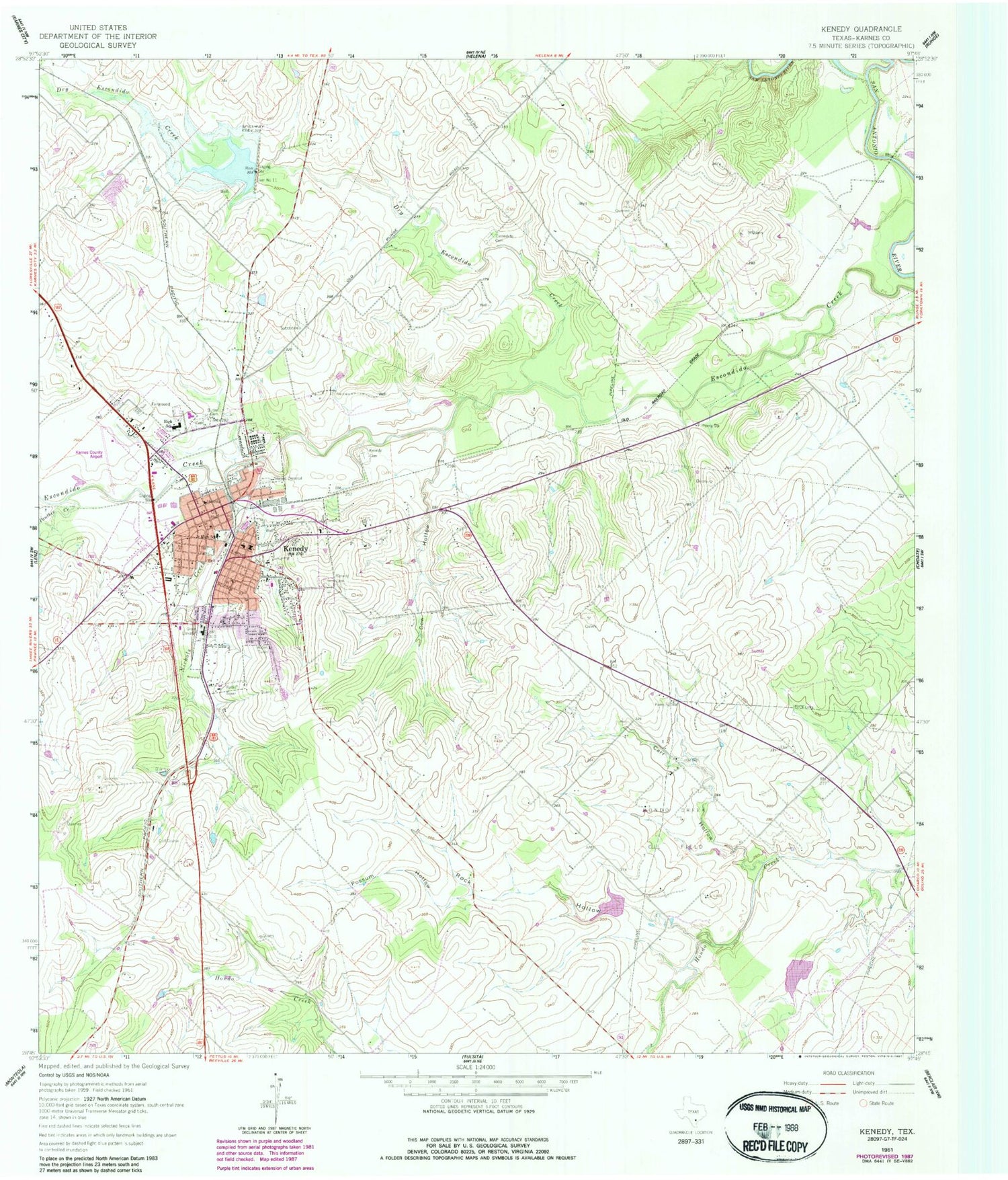
Classic USGS Kenedy Texas 7.5'x7.5' Topo Map
Couldn't load pickup availability
Historical USGS topographic quad map of Kenedy in the state of Texas. Map scale may vary for some years, but is generally around 1:24,000. Print size is approximately 24" x 27"
This quadrangle is in the following counties: Karnes.
The map contains contour lines, roads, rivers, towns, and lakes. Printed on high-quality waterproof paper with UV fade-resistant inks, and shipped rolled.
Contains the following named places: Ball Park, Butler Cemetery, Card Airfield, Carr Hollow, City of Kenedy, Community Bible Church, Cow Hollow, Dam Number 11, Dry Escondido Creek, Escondido Cemetery, First Mexican Baptist Church, Good Shephard Lutheran Church, Hondo Creek Oil Field, Karnes County Academy, Karnes County Airport, Karnes County Emergency Medical Service Ambulance, Kenedy, Kenedy Cemetery, Kenedy Church of Christ, Kenedy Division, Kenedy Elementary School, Kenedy High School, Kenedy Middle School, Kenedy Municipal Building, Kenedy Museum, Kenedy Police Department, Kenedy Post Office, Kenedy Volunteer Fire Department, Kennedy Cemetery, KTNR-FM (Kenedy), Nichols Creek, Panther Creek, Possum Hollow, Rialto Theater, Rock Hollow, Saint Matthews Episcopal Church, Soil Conservation Service Site 11 Dam, Soil Conservation Service Site 11 Reservoir, Soil Conservation Service Site 2 Dam, Soil Conservation Service Site 2 Reservoir, Soil Conservation Service Site 3 Dam, Soil Conservation Service Site 3 Reservoir, Texas Department of Criminal Justice John B Connally Unit, Unified Pentecostal Church


