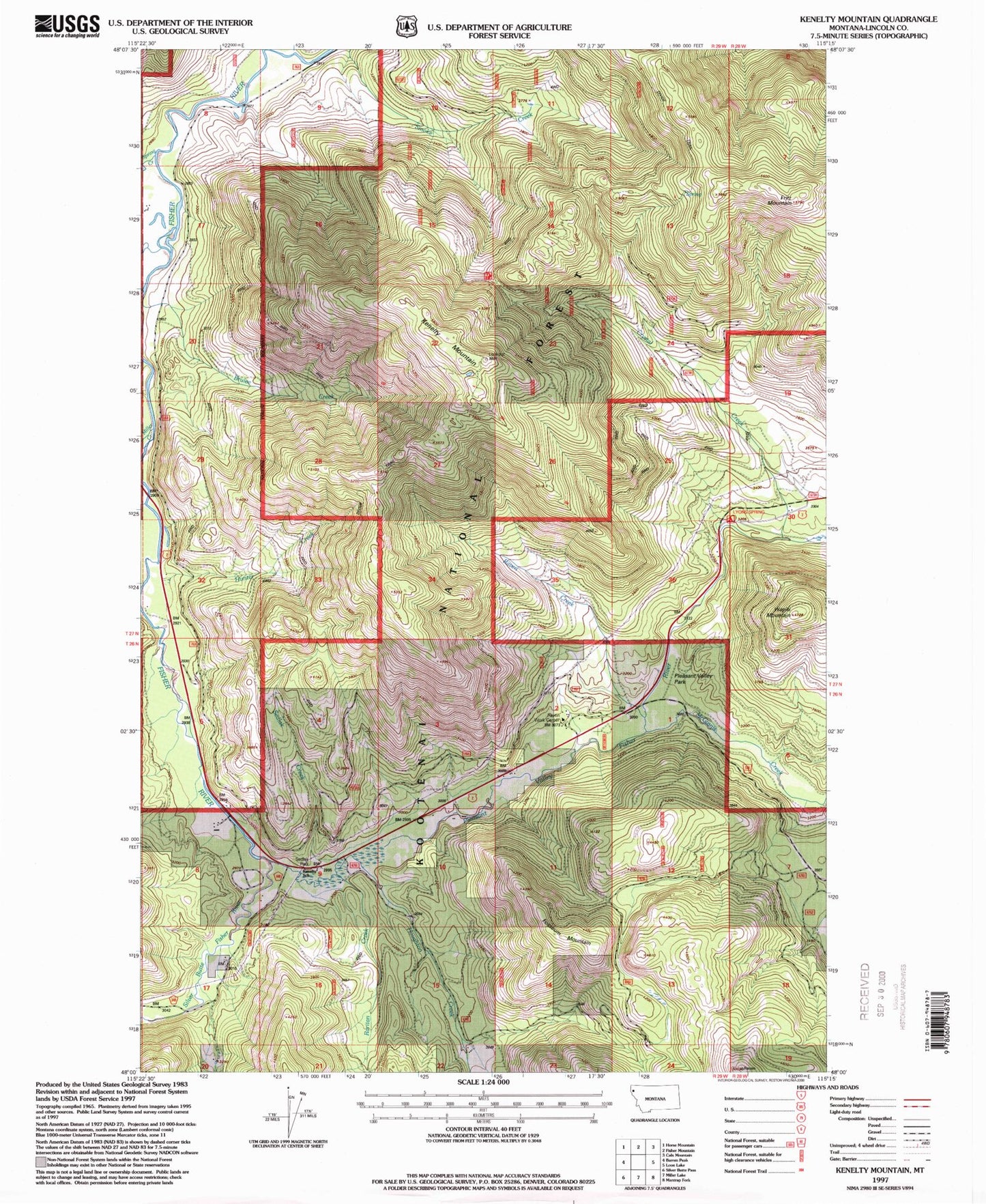
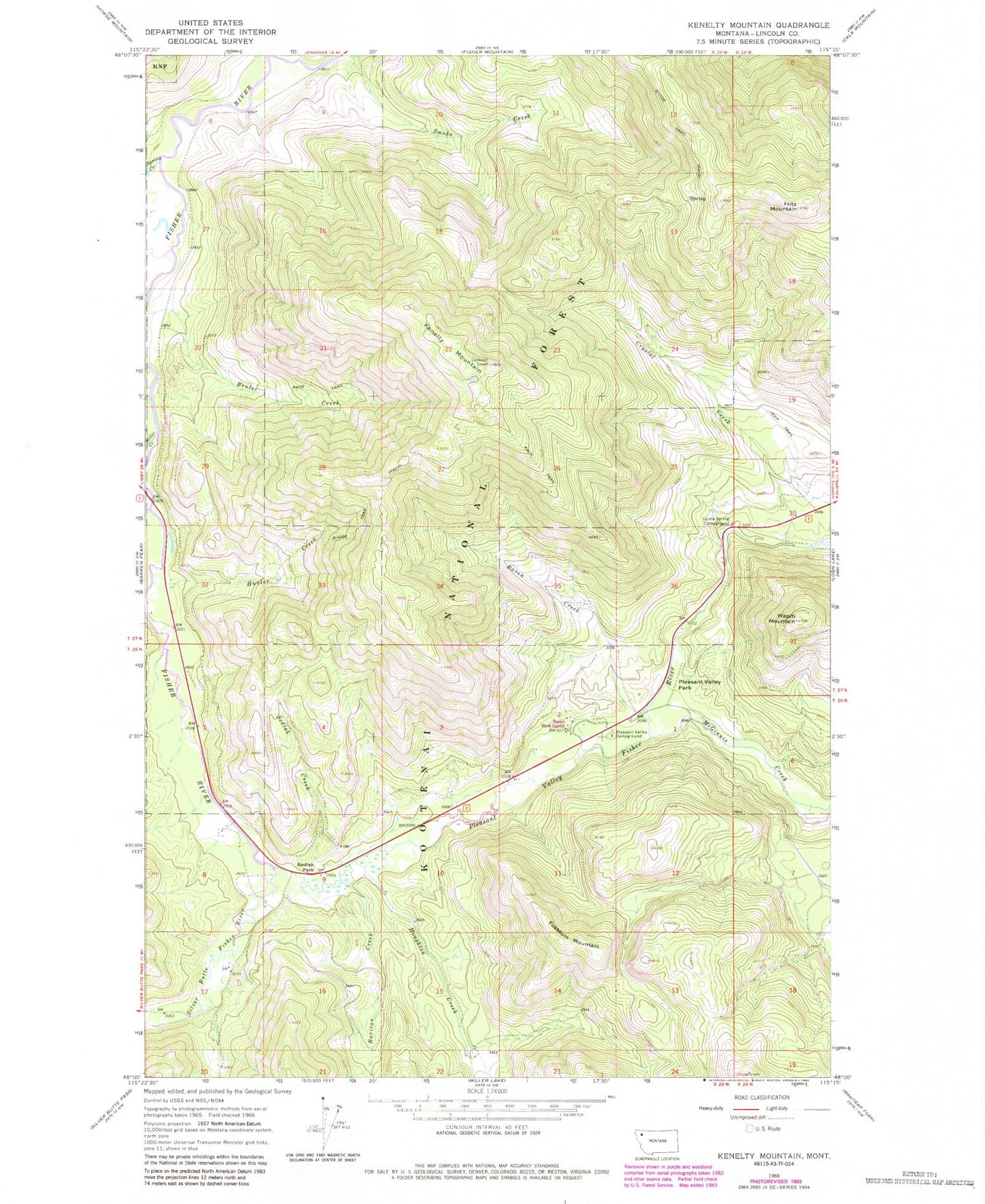
MyTopo
Classic USGS Kenelty Mountain Montana 7.5'x7.5' Topo Map
Couldn't load pickup availability
Historical USGS topographic quad map of Kenelty Mountain in the state of Montana. Map scale may vary for some years, but is generally around 1:24,000. Print size is approximately 24" x 27"
This quadrangle is in the following counties: Lincoln.
The map contains contour lines, roads, rivers, towns, and lakes. Printed on high-quality waterproof paper with UV fade-resistant inks, and shipped rolled.
Contains the following named places: Crystal Creek, Fisher River Valley Fire and Rescue Battalion 2, Fosseum Mountain, Fritz Mountain, Houghton Creek, Hunter Creek, Kenelty Mountain, Lyons Spring Campground, Manicke, Manicke Post Office, McGinnis Creek, Miller Creek, Pleasant Valley Campground, Pleasant Valley Fisher River, Pleasant Valley Park, Raritan Creek, Raven Creek, Raven Ranger Station, Raven Work Center, Schrieber Creek, Sedlak Creek, Sedlak Park, Silver Butte Fisher River, Spring Creek, Wapiti Mountain