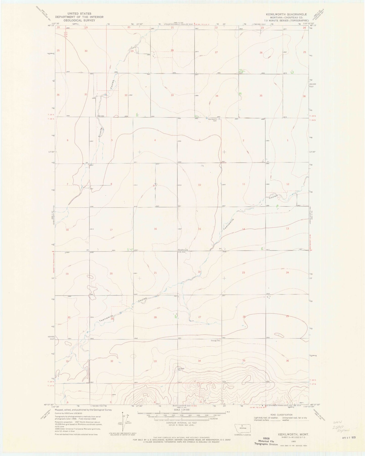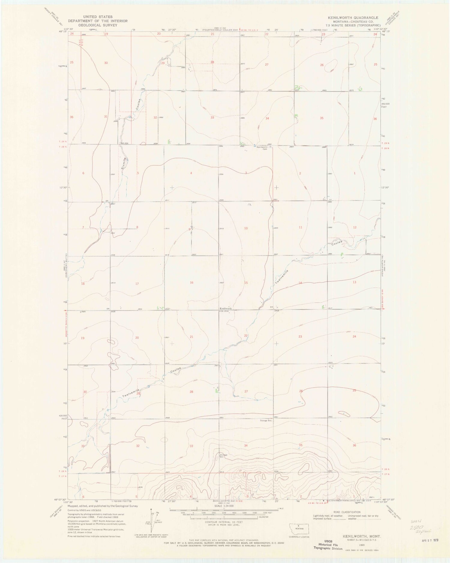
MyTopo
Classic USGS Kenilworth Montana 7.5'x7.5' Topo Map
Couldn't load pickup availability
Historical USGS topographic quad map of Kenilworth in the state of Montana. Map scale may vary for some years, but is generally around 1:24,000. Print size is approximately 24" x 27"
This quadrangle is in the following counties: Chouteau.
The map contains contour lines, roads, rivers, towns, and lakes. Printed on high-quality waterproof paper with UV fade-resistant inks, and shipped rolled.
Contains the following named places: 28N10E02DD__01 Well, 28N10E02DDDB01 Well, 28N10E03AB__01 Well, 28N10E07DA__01 Well, 28N10E09DB__01 Well, 28N10E10AB__01 Well, 28N10E10BA__01 Well, 28N10E12DA__01 Well, 28N10E12DBDD01 Well, 28N10E13BA__01 Well, 28N10E14AB__01 Well, 28N10E14CC__01 Well, 28N10E14DD__01 Well, 28N10E15AD__01 Well, 28N10E15CC__01 Well, 28N10E17AA__01 Well, 28N10E17DD__01 Well, 28N10E19BA__01 Well, 28N10E20DD__01 Well, 28N10E23BB__01 Well, 28N10E23CC__01 Well, 28N10E25BB__01 Well, 28N10E25BBBA01 Well, 28N10E27BB__01 Well, 28N10E28AB__01 Well, 28N10E29AA__01 Well, 29N10E25CC__01 Well, 29N10E26BA__01 Well, 29N10E26CC__01 Well, 29N10E28CB__01 Well, 29N10E28CBBD01 Well, 29N10E29AC__01 Well, 29N10E29ACDC01 Well, 29N10E31DA__01 Well, 29N10E31DA__02 Well, Kenilworth, Kenilworth Cemetery, Kenilworth Post Office, Kenilworth School