MyTopo
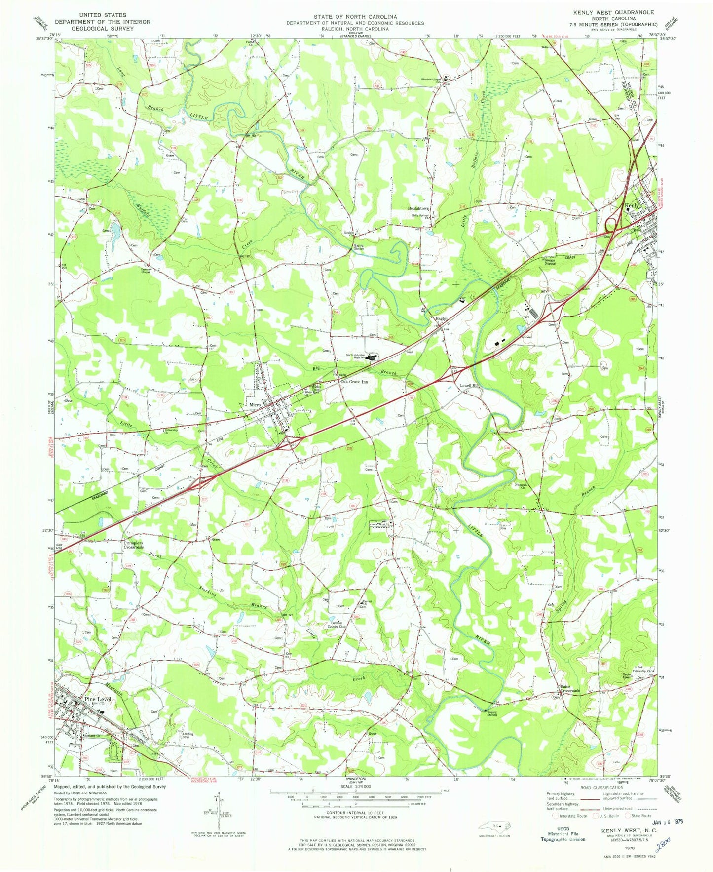
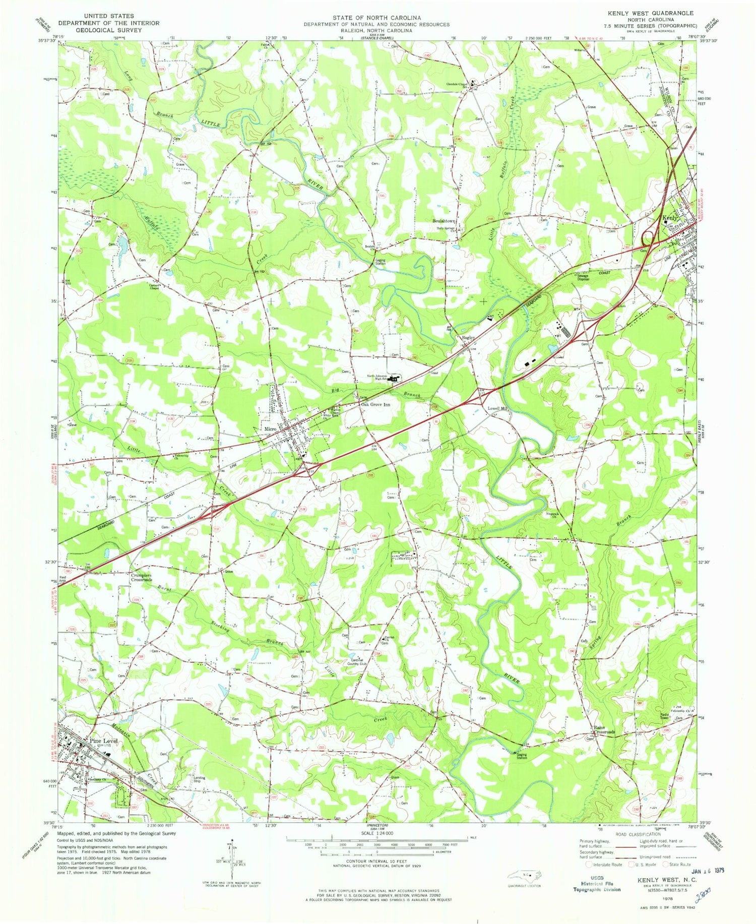
Classic USGS Kenly West North Carolina 7.5'x7.5' Topo Map
Couldn't load pickup availability
Historical USGS topographic quad map of Kenly West in the state of North Carolina. Map scale may vary for some years, but is generally around 1:24,000. Print size is approximately 24" x 27"
This quadrangle is in the following counties: Johnston, Wilson.
The map contains contour lines, roads, rivers, towns, and lakes. Printed on high-quality waterproof paper with UV fade-resistant inks, and shipped rolled.
Contains the following named places: Bagley, Bethany Church, Beulah Church, Beulahtown, Big Branch, Browns Pond Dam, Buffalo Creek, Burnt Stocking Branch, Cardinal Country Club, Carters Chapel, Country Squire Mobile Estates, Crumplers Crossroads, Faith Church, Fellowship Church, Giles Chapel, Glendale Chapel School, Holly Springs Church, Kenly Elementary School, Kenly Volunteer Fire Department, Lake Benson, Little Buffalo Creek, Little Creek, Long Branch, Lowell Mill, Micro, Micro - Pine Level Elementary School, Micro Elementary School, Micro Police Department, Micro Post Office, Micro Volunteer Fire Department, Niagara Church, North Johnston Emergency Medical Services - Micro, North Johnston High School, Oak Grove Inn, Parrish Church, Pine Level, Pine Level Fire Department, Pine Level Police Department, Pine Level Post Office, Rains Crossroads, Ramblewood Mobile Home Park, Town of Kenly, Town of Micro, Town of Pine Level, Township of Beulah, Township of Micro, Township of Pine Level, Warren Chapel, White Rock Church, ZIP Codes: 27542, 27555, 27568