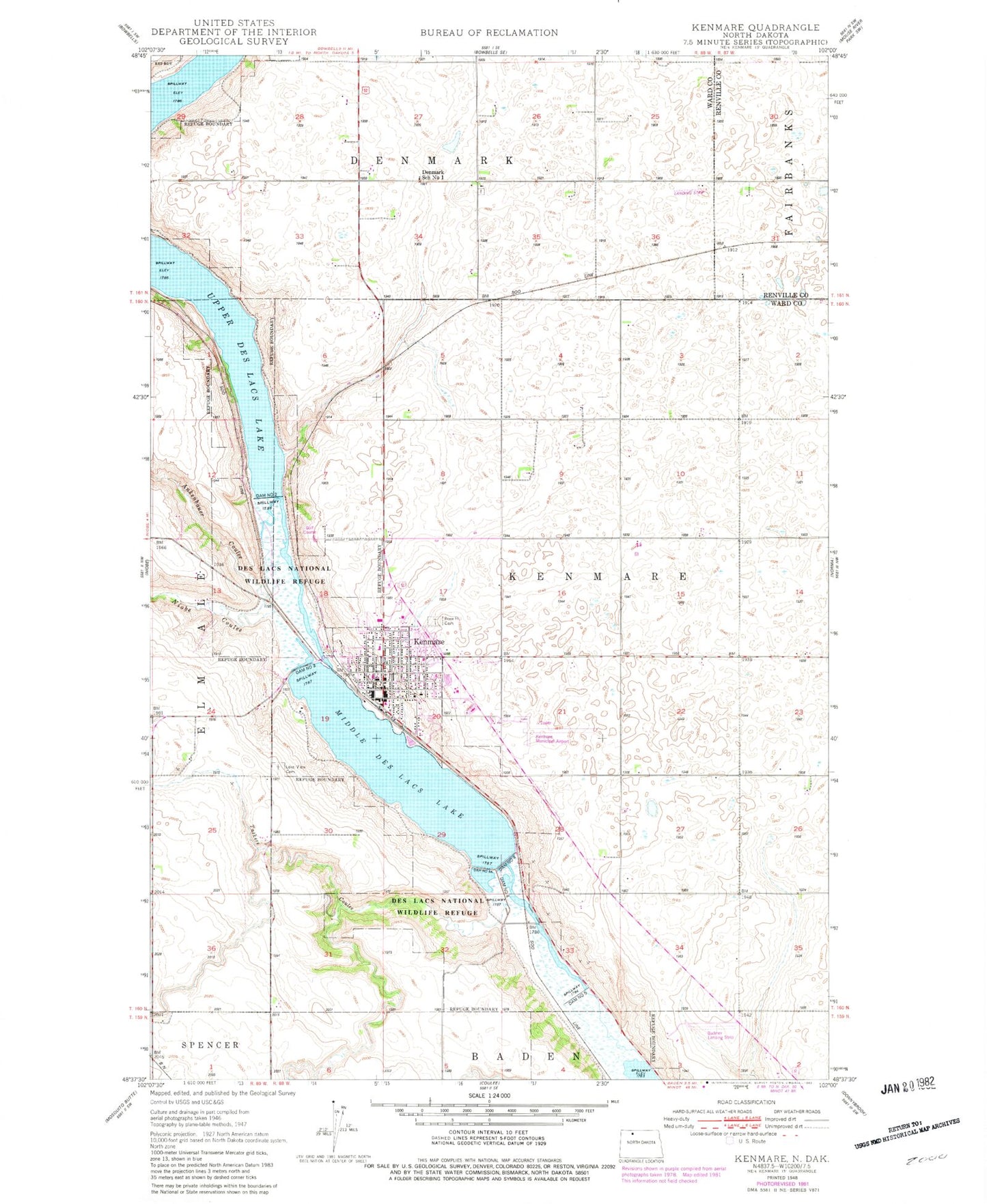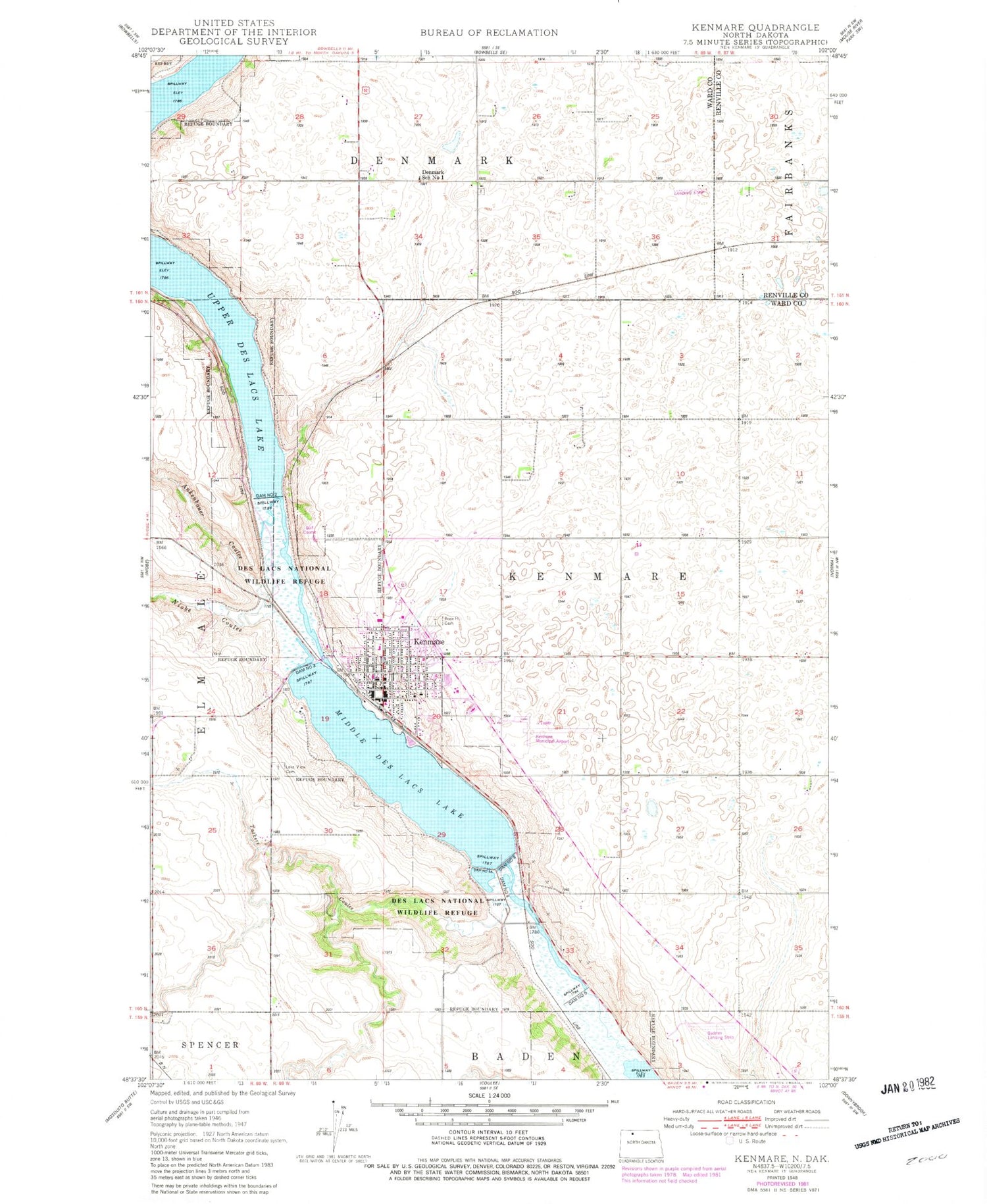
MyTopo
Classic USGS Kenmare North Dakota 7.5'x7.5' Topo Map
Couldn't load pickup availability
Historical USGS topographic quad map of Kenmare in the state of North Dakota. Map scale may vary for some years, but is generally around 1:24,000. Print size is approximately 24" x 27"
This quadrangle is in the following counties: Renville, Ward.
The map contains contour lines, roads, rivers, towns, and lakes. Printed on high-quality waterproof paper with UV fade-resistant inks, and shipped rolled.
Contains the following named places: Ankenbauer Coulee, City of Kenmare, Dam Number 2, Dam Number 3, Dam Number 4, Dam Number 4A, Dam Number 6, Danish Mill, Denmark School Number 1, Des Lacs National Wildlife Refuge, Kenmare, Kenmare Branch Library, Kenmare City and Rural Fire Department, Kenmare City Hall, Kenmare City Police Department, Kenmare Elementary School, Kenmare High School, Kenmare Municipal Airport, Kenmare Post Office, Lake County Historical Museum, Lakeview Cemetery, Middle Des Lacs Lake, Niobe Coulee, Pool Three Reservoir, Rose Hill Cemetery, Saint Agnes Catholic Cemetery, Taskers Coulee, Township of Kenmare, Trinity County Hospital, ZIP Code: 58746