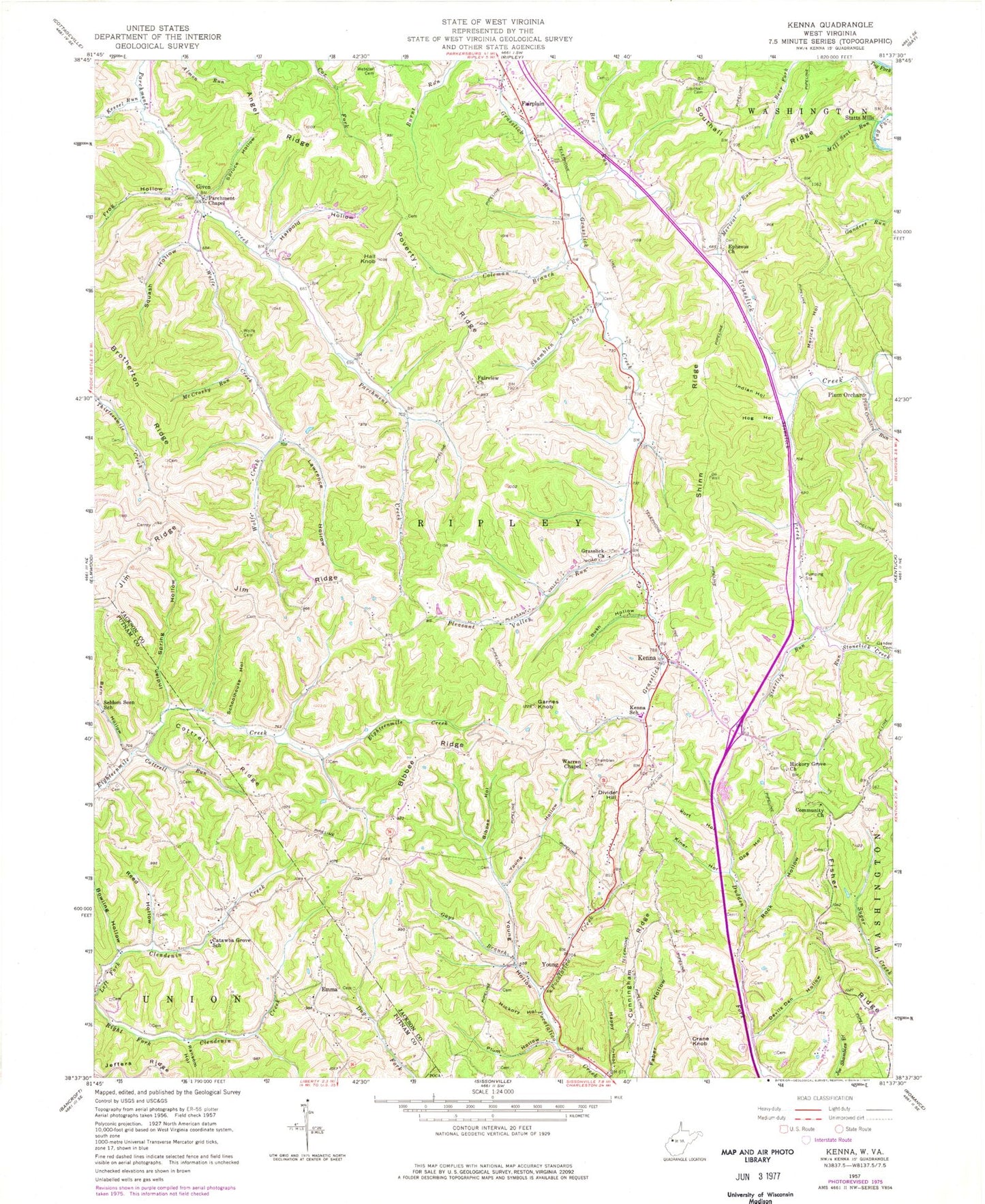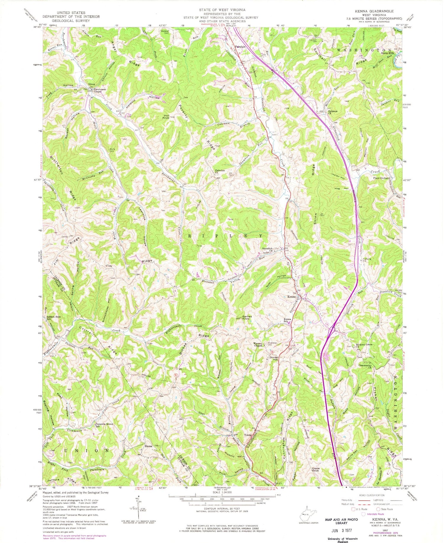
MyTopo
Classic USGS Kenna West Virginia 7.5'x7.5' Topo Map
Couldn't load pickup availability
Historical USGS topographic quad map of Kenna in the state of West Virginia. Map scale may vary for some years, but is generally around 1:24,000. Print size is approximately 24" x 27"
This quadrangle is in the following counties: Jackson, Kanawha, Putnam.
The map contains contour lines, roads, rivers, towns, and lakes. Printed on high-quality waterproof paper with UV fade-resistant inks, and shipped rolled.
Contains the following named places: Alice Parsons Farm Pond Dam, Angel Ridge, Barn Hollow, Bee Run, Bibbee Hollow, Bibbee Ridge, Big Pine Cemetery, Boggess - Shamblen Cemetery, Bowling Hollow, Brotherton Ridge, Bush Hollow, Casto - Crane Cemetery, Castro Spring, Catwba Grove School, Centerview Ridge Grave, Coleman Branch, Community Church, Cottrell Ridge, Cottrell Run, Crane Knob, Cunningham Ridge, Devils Den Hollow, Divide Hill, Dog Hollow, Edgar, Emma, Ephesus Baptist Church Cemetery, Ephesus Church, F.F. Morris Memorial Bridge, Fairplain Elementary School, Fairview Cemetery, Fairview Church, Fisher Ridge, Frog Hollow, Garnes Knob, Gays Branch, Gin Run, Given, Given Cemetery, Given Post Office, Goodwill Church Cemetery, Grass Lick Cemetery, Grasslick Church, Grasslick Run, H C Fisher Fishing Lake Number Three Dam, Hall Knob, Happy Hollow, Harold Starcher Spring, Harpold Cemetery, Harpold Hollow, Hickory Grove Cemetery, Hickory Grove Church, Hickory Hollow, Hog Hollow, Indian Hollow, Indian Spring Hollow, Jackson County Emergency Medical Services Station 403, Kenna, Kenna Elementary School, Kenna Post Office, Kessel Run, Kiner Hollow, Kurt Hollow, Lawrence Hollow, Marshall R Parsons Farm Pond Dam, McCrosky Run, McCumber Run, Merical Hollow, Merical Run, Mill Seat Run, Parchment Chapel, Pleasant Valley Run, Plum Hollow, Plum Orchard, Plum Orchard Run, Poverty Ridge, Ransom Hollow, Reed Hollow, Rock Hollow, Schoolhouse Hollow, Seldom Seen School, Shamblen Cemetery, Shamblen Run, Shinn Ridge, Southall Cemetery, Southern Jackson Volunteer Fire Department, Spruce Hollow, Squash Hollow, Steerlick Run, Stonelick Church Cemetery, Stonelick Creek, Twin Pines Cemetery, Warren Chapel, Warren Chapel Cemetery, Webster Cemetery, Wolfe Cemetery, Wolfe Creek, Young, Young Hollow