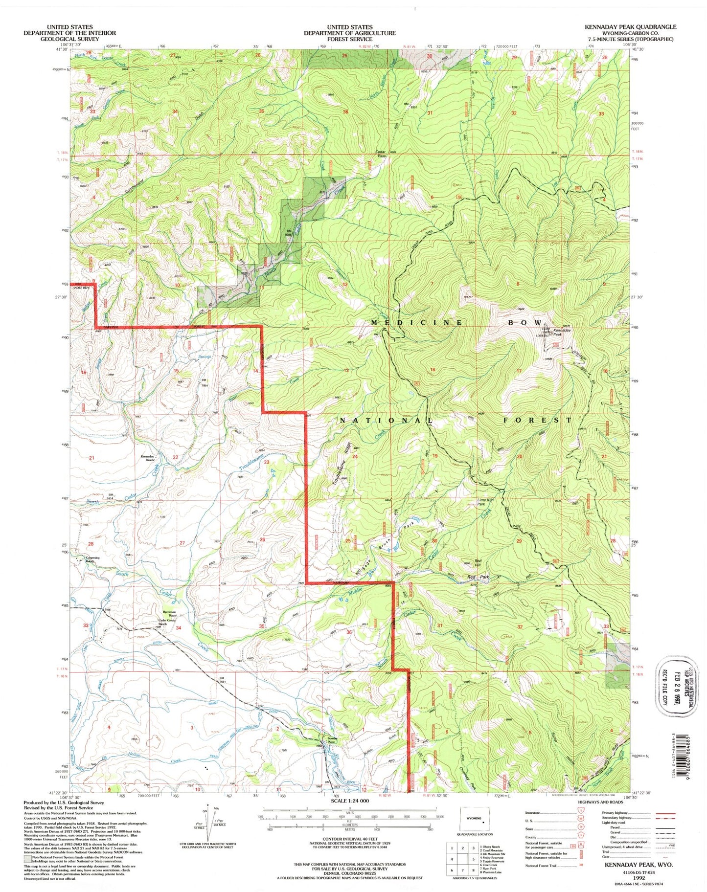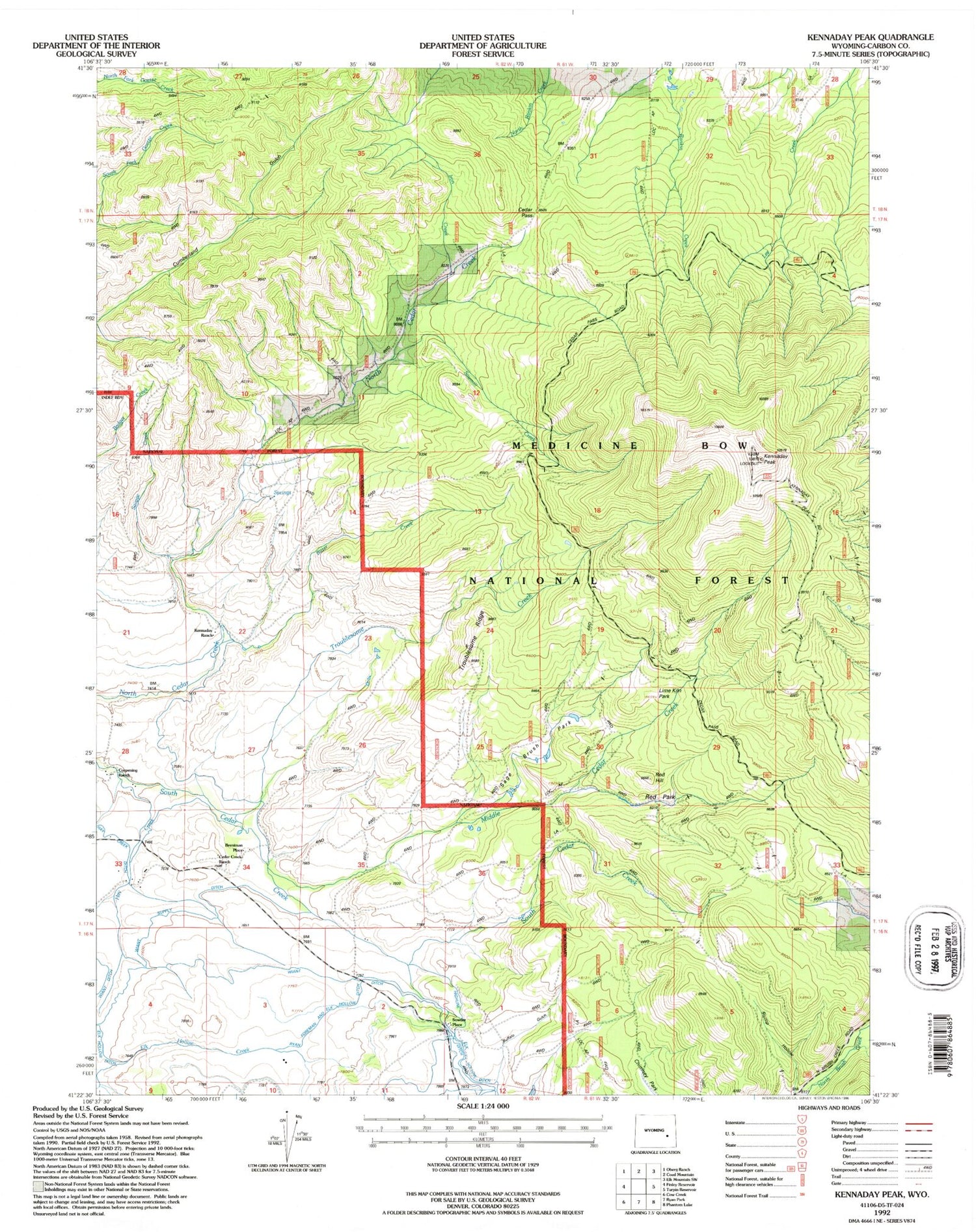
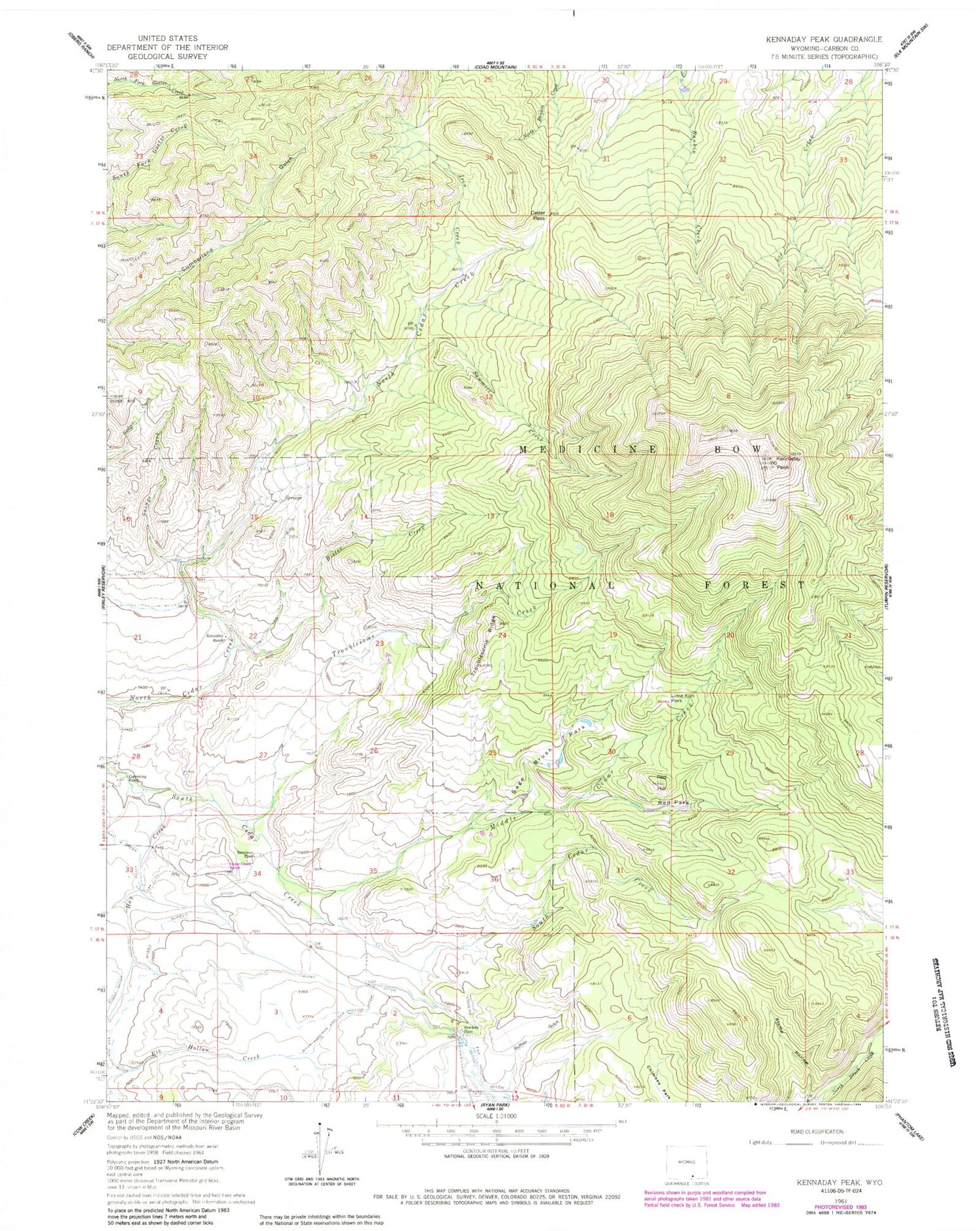
MyTopo
Classic USGS Kennaday Peak Wyoming 7.5'x7.5' Topo Map
Couldn't load pickup availability
Historical USGS topographic quad map of Kennaday Peak in the state of Wyoming. Map scale may vary for some years, but is generally around 1:24,000. Print size is approximately 24" x 27"
This quadrangle is in the following counties: Carbon.
The map contains contour lines, roads, rivers, towns, and lakes. Printed on high-quality waterproof paper with UV fade-resistant inks, and shipped rolled.
Contains the following named places: Bitter Creek, Breniman Place, Cedar Creek Ranch Airport, Cedar Pass, Corpening Ranch, Hay Creek, Iron Creek, Kennaday Peak, Kennaday Ranch, Lime Kiln Park, Middle Cedar Creek, Red Hill, Red Hill Park, Red Park, Ryan Foreman and Elk Hollow Ditch, Sage Brush Park, Savage Creek, Sawmill Creek, Sowders Place, Troublesome Creek, Troublesome Ridge, Troublesome Trail, Wiant Supply Ditch