MyTopo
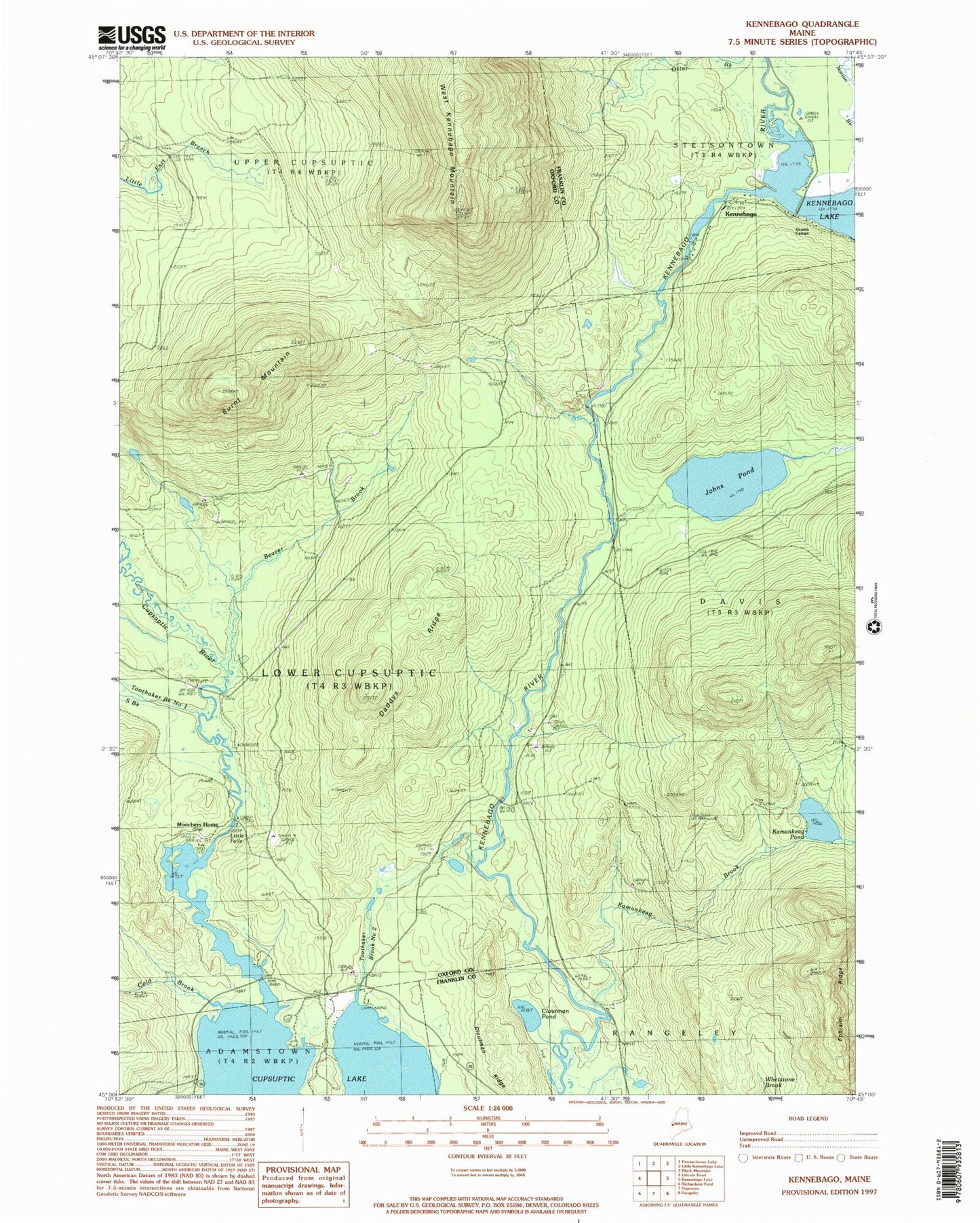
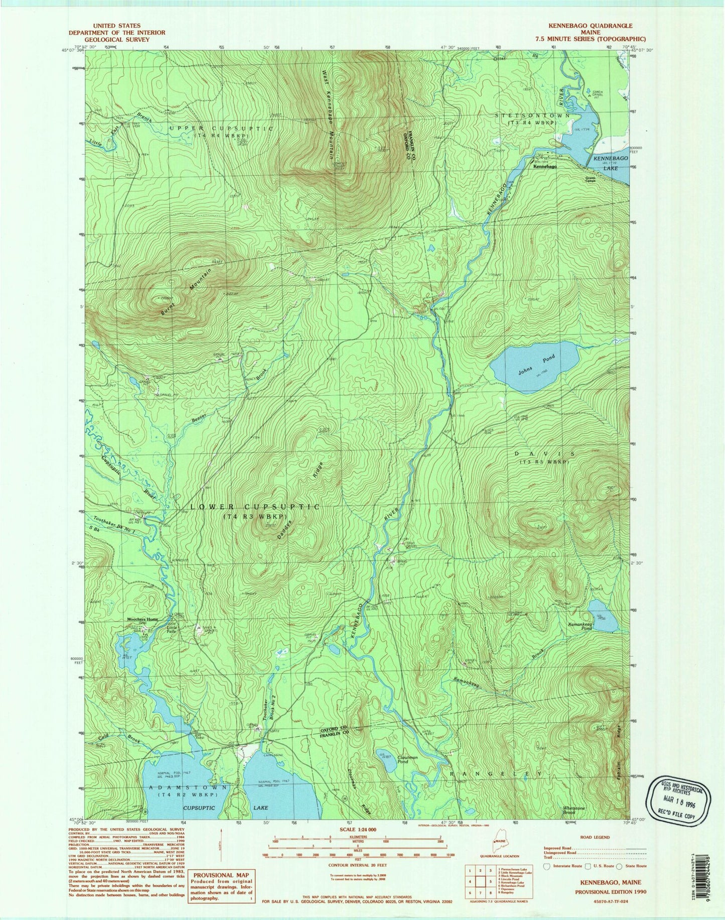
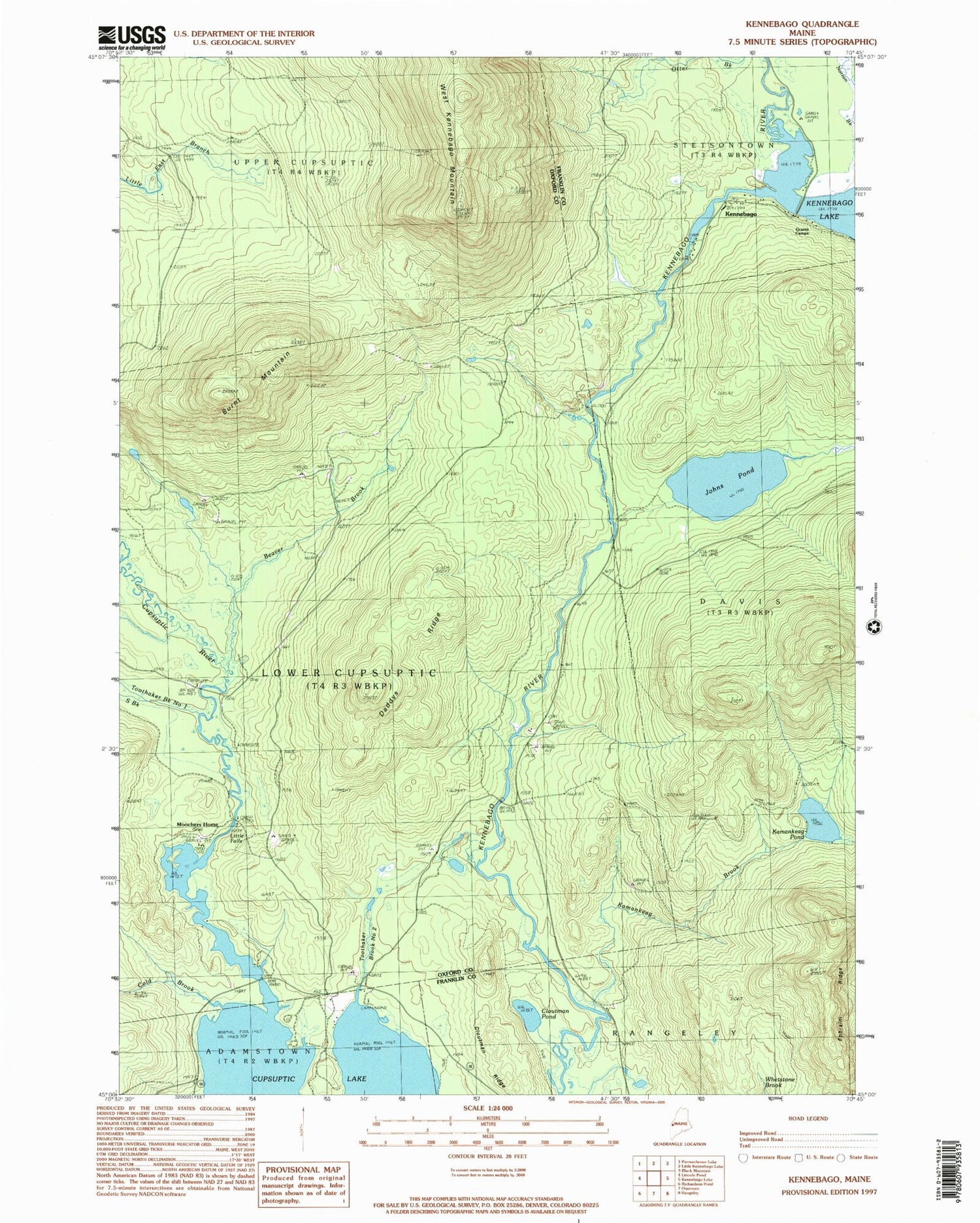
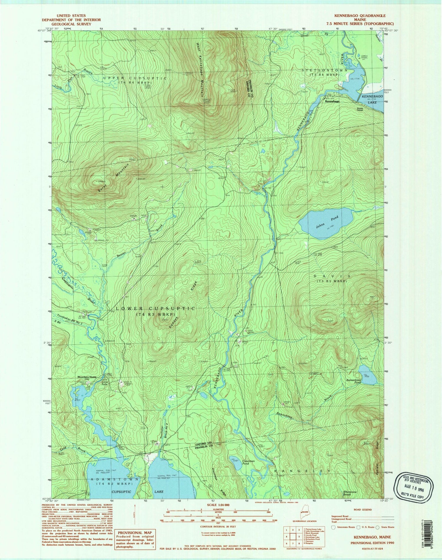
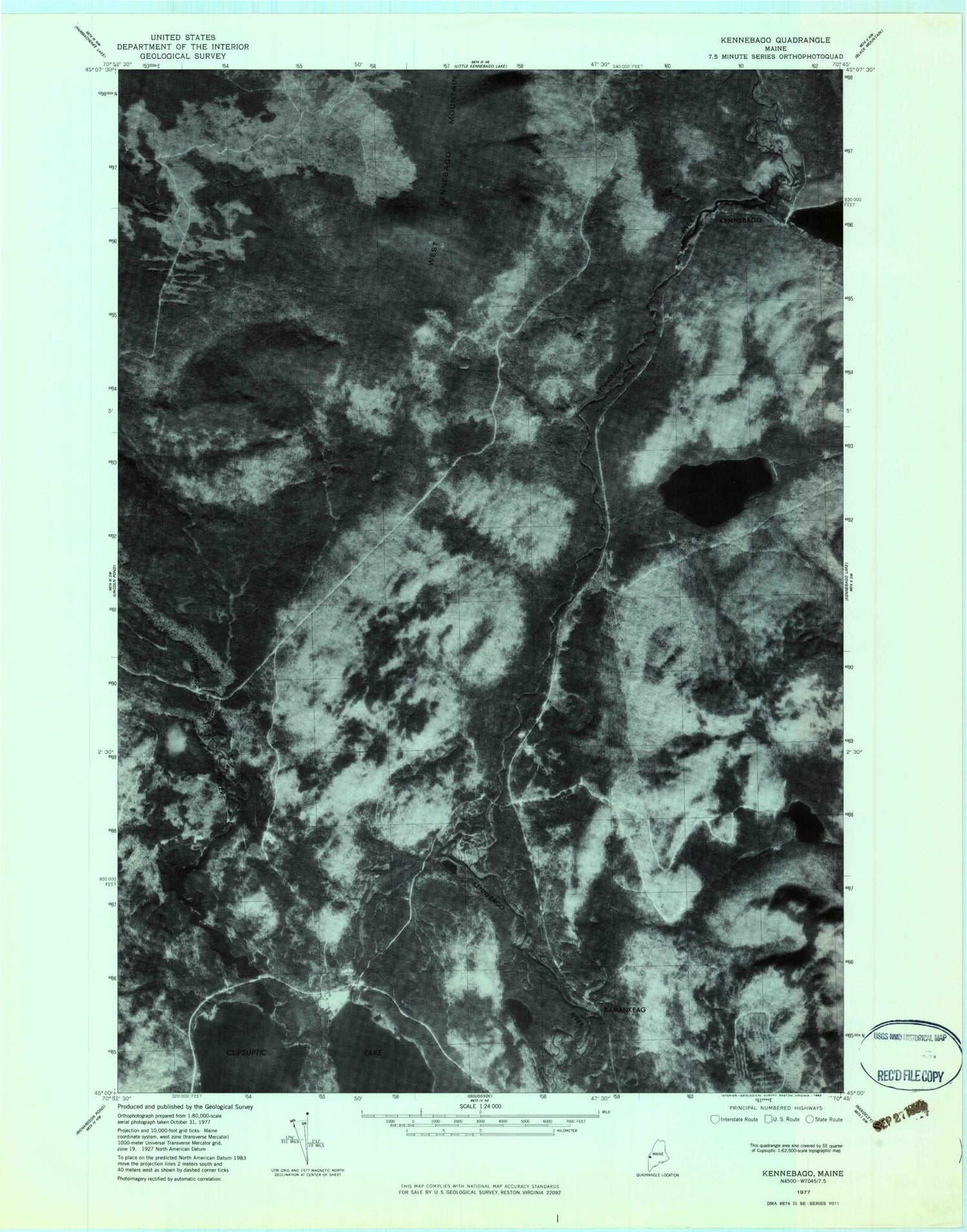
Classic USGS Kennebago Maine 7.5'x7.5' Topo Map
Couldn't load pickup availability
Historical USGS topographic quad map of Kennebago in the state of Maine. Typical map scale is 1:24,000, but may vary for certain years, if available. Print size: 24" x 27"
This quadrangle is in the following counties: Franklin, Oxford.
The map contains contour lines, roads, rivers, towns, and lakes. Printed on high-quality waterproof paper with UV fade-resistant inks, and shipped rolled.
Contains the following named places: Beaver Brook, Burnt Mountain, Burrells Camp (historical), Camp Dorothy (historical), Cloutman Pond, Cloutman Ridge, Cold Brook, Cupsuptic Nursery (historical), Cupsuptic River, Cupsuptic Sporting Camp (historical), Daddys Ridge, Ephraim Ridge, Johns Pond, Johns Pond, Kamankeag Brook, Kamankeag Pond, Little Falls, Moochers Home, Realty (historical), South Brook, Toothaker Brook Number One, Toothaker Brook Number Two, West Kennebago Mountain, Johns Pond, Davis Town, Kamankeag (historical), Kennebago, Upper Station Dam, Lower Station Dam, Cupsuptic Campground, Lower Cupsuptic Township, Beaver Brook, Burnt Mountain, Burrells Camp (historical), Camp Dorothy (historical), Cloutman Pond, Cloutman Ridge, Cold Brook, Cupsuptic Nursery (historical), Cupsuptic River, Cupsuptic Sporting Camp (historical), Daddys Ridge, Ephraim Ridge, Johns Pond, Johns Pond, Kamankeag Brook, Kamankeag Pond, Little Falls, Moochers Home, Realty (historical), South Brook, Toothaker Brook Number One, Toothaker Brook Number Two, West Kennebago Mountain, Johns Pond, Davis Town, Kamankeag (historical), Kennebago, Upper Station Dam, Lower Station Dam, Cupsuptic Campground, Lower Cupsuptic Township