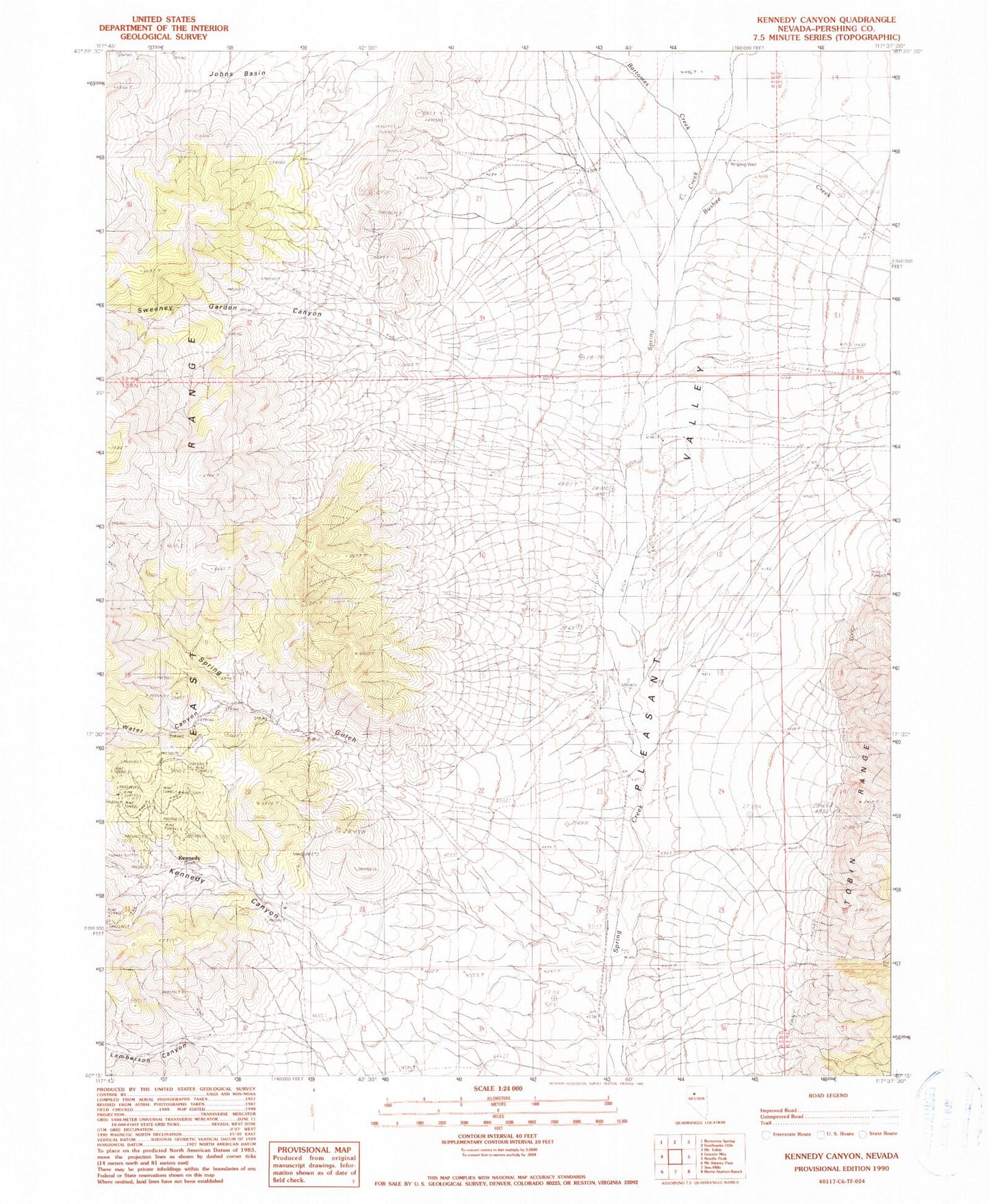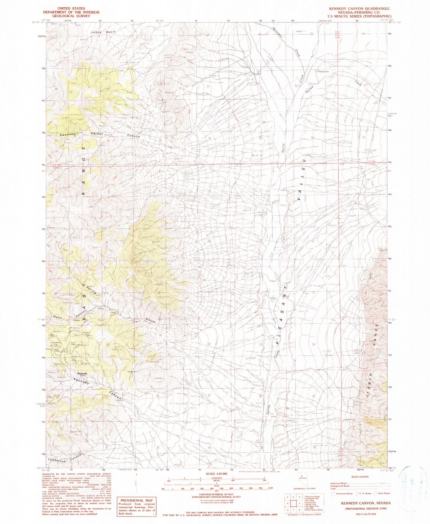
MyTopo
Classic USGS Kennedy Canyon Nevada 7.5'x7.5' Topo Map
Couldn't load pickup availability
Historical USGS topographic quad map of Kennedy Canyon in the state of Nevada. Map scale may vary for some years, but is generally around 1:24,000. Print size is approximately 24" x 27"
This quadrangle is in the following counties: Pershing.
The map contains contour lines, roads, rivers, towns, and lakes. Printed on high-quality waterproof paper with UV fade-resistant inks, and shipped rolled.
Contains the following named places: Bushee Creek, Guthrie Ranch, Hidden Treasure Mine, Imperial Mill, Imperial Mines, Jackpot Mine, Kennedy, Kennedy Canyon, Kennedy Mine, Kennedy Post Office, Kennedy School, Lamberson Canyon, North Cinnabar Creek, Pole Creek, Ringing Well, Sarret Ranch, Spring Gulch, Sunnyside Mines, Sweeney Garden Canyon, Water Canyon