MyTopo
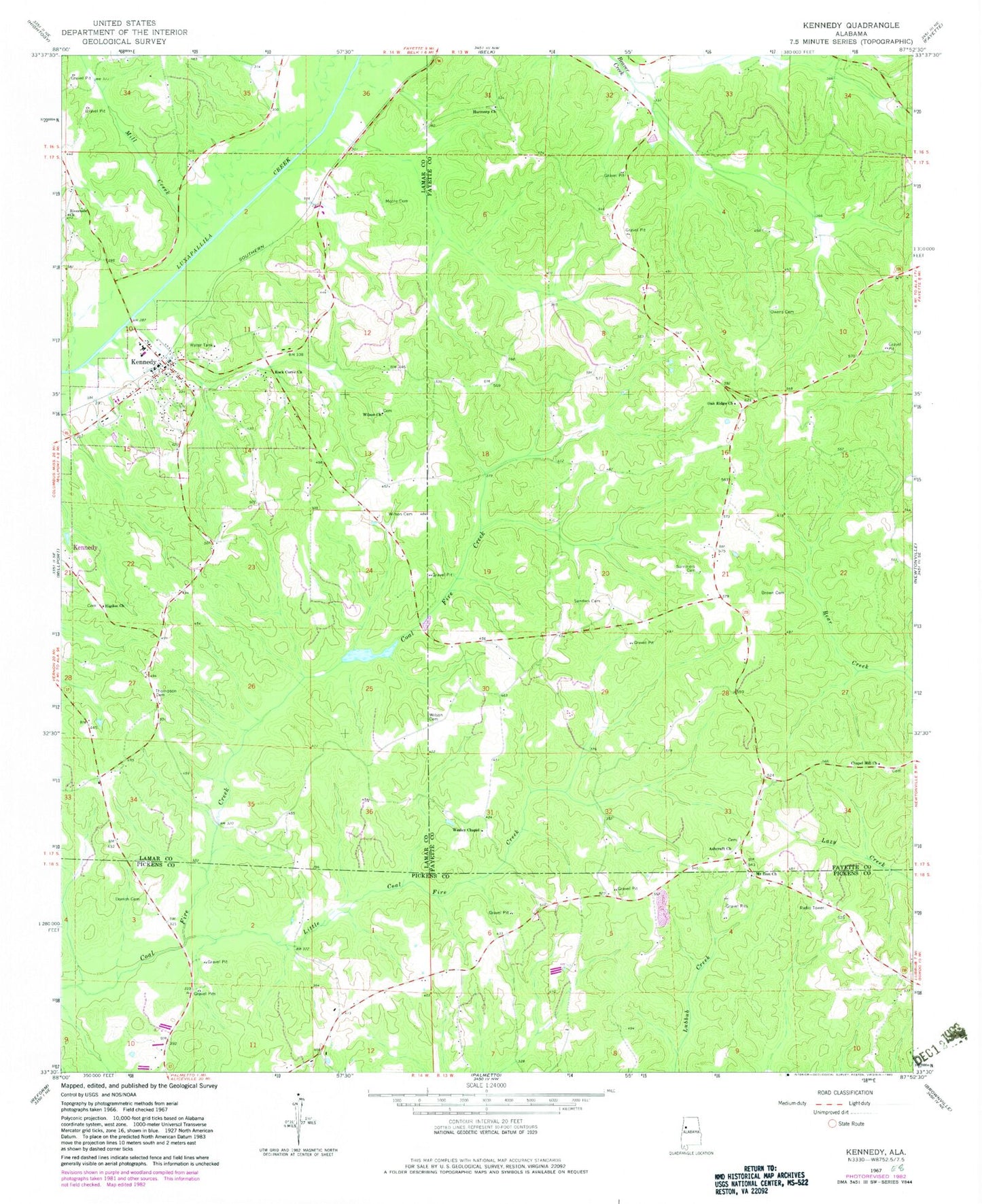
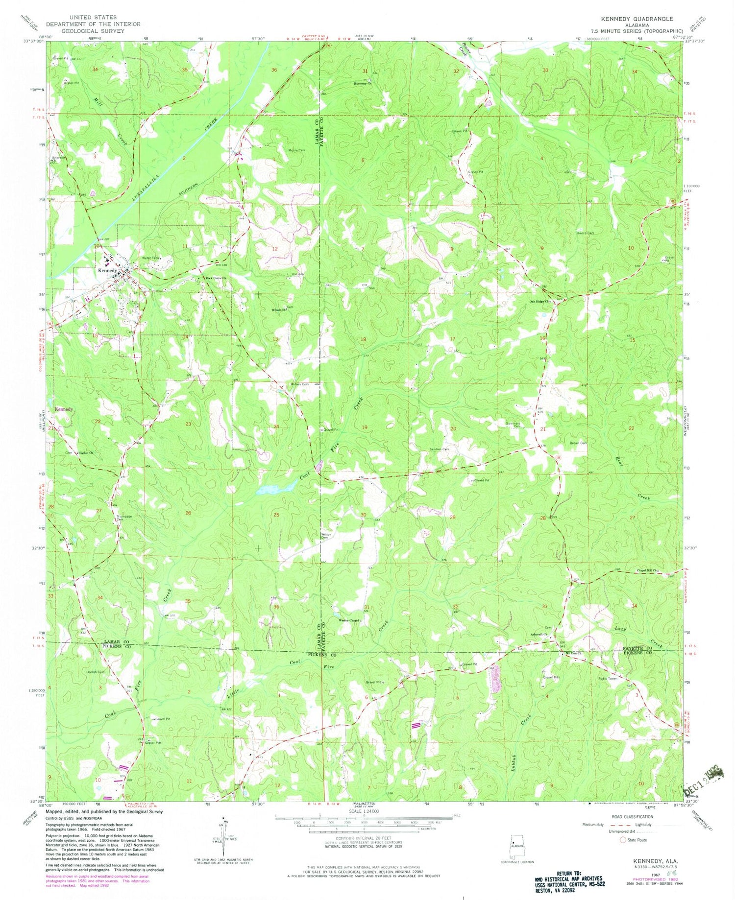
Classic USGS Kennedy Alabama 7.5'x7.5' Topo Map
Couldn't load pickup availability
Historical USGS topographic quad map of Kennedy in the state of Alabama. Map scale may vary for some years, but is generally around 1:24,000. Print size is approximately 24" x 27"
This quadrangle is in the following counties: Fayette, Lamar, Pickens.
The map contains contour lines, roads, rivers, towns, and lakes. Printed on high-quality waterproof paper with UV fade-resistant inks, and shipped rolled.
Contains the following named places: Asbury Post Office, Ashcraft Corner, Ashcraft Corner Baptist Church, Ashcraft Corner Cemetery, Brown Cemetery, Chapel Hill Baptist Church, Chapel Hill Cemetery, Dorroh Cemetery, Harmony Primitive Baptist Church, Higdon Church, Higdon Memorial Cemetery, Kennedy, Kennedy Cemetery, Kennedy High School, Kennedy Post Office, Kennedy Volunteer Fire Department, Little Coal Fire Creek, Lubbub Creek Gas Field, Mill Creek, Moore Cemetery, Mount Zion Cemetery, Mount Zion Church, New Wesley Chapel Cemetery, Oak Ridge Baptist Church, Oak Ridge Cemetery, Owens Cemetery, Pilgrim Church, Riverside Church, Rock Curve Church, Sanders Cemetery, Summers Cemetery, Thompson Cemetery, Town of Kennedy, Wesley Chapel Methodist Church, WHKW-FM (Fayette), Wilson Cemetery, Wilson Church, ZIP Code: 35574