MyTopo
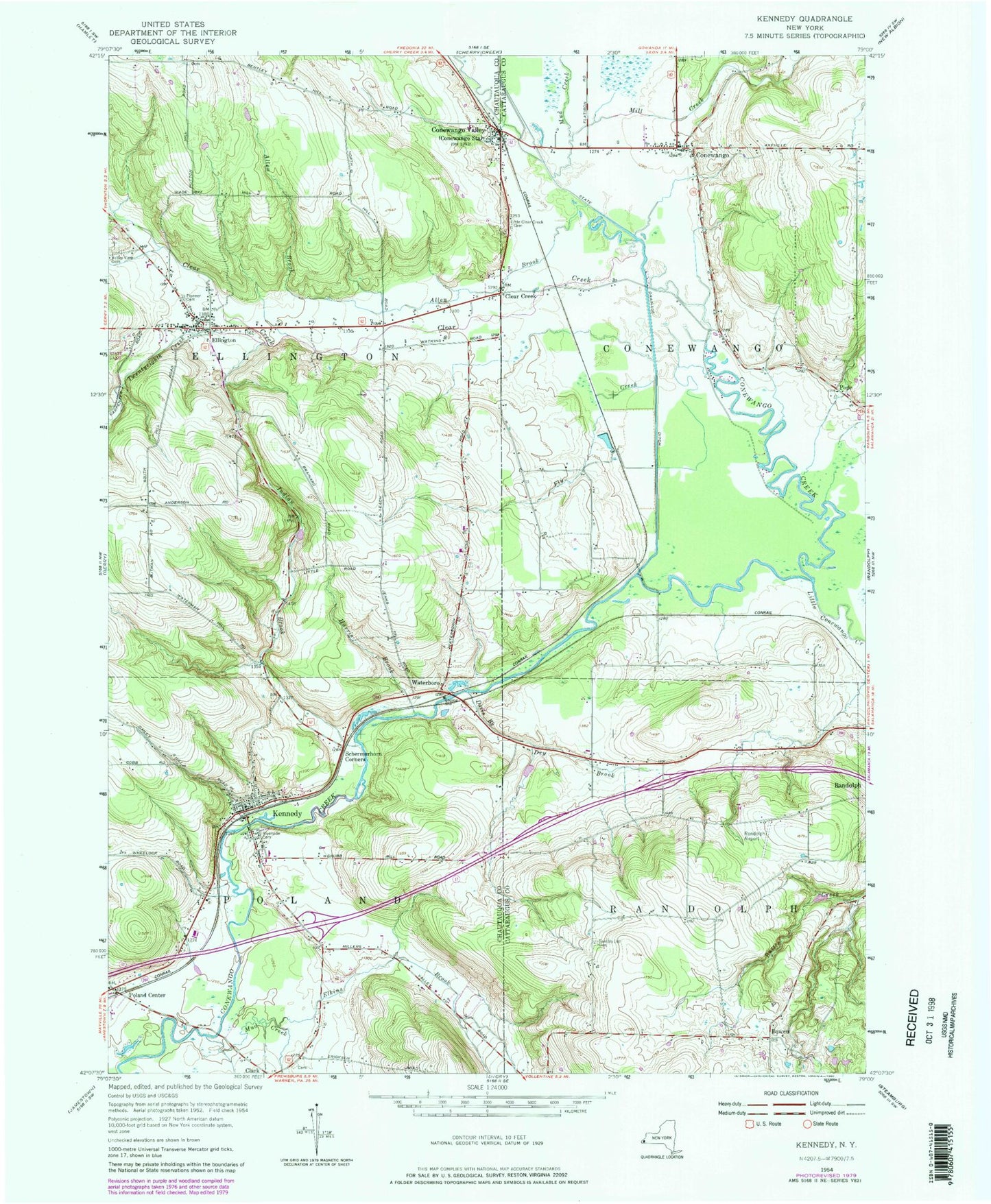
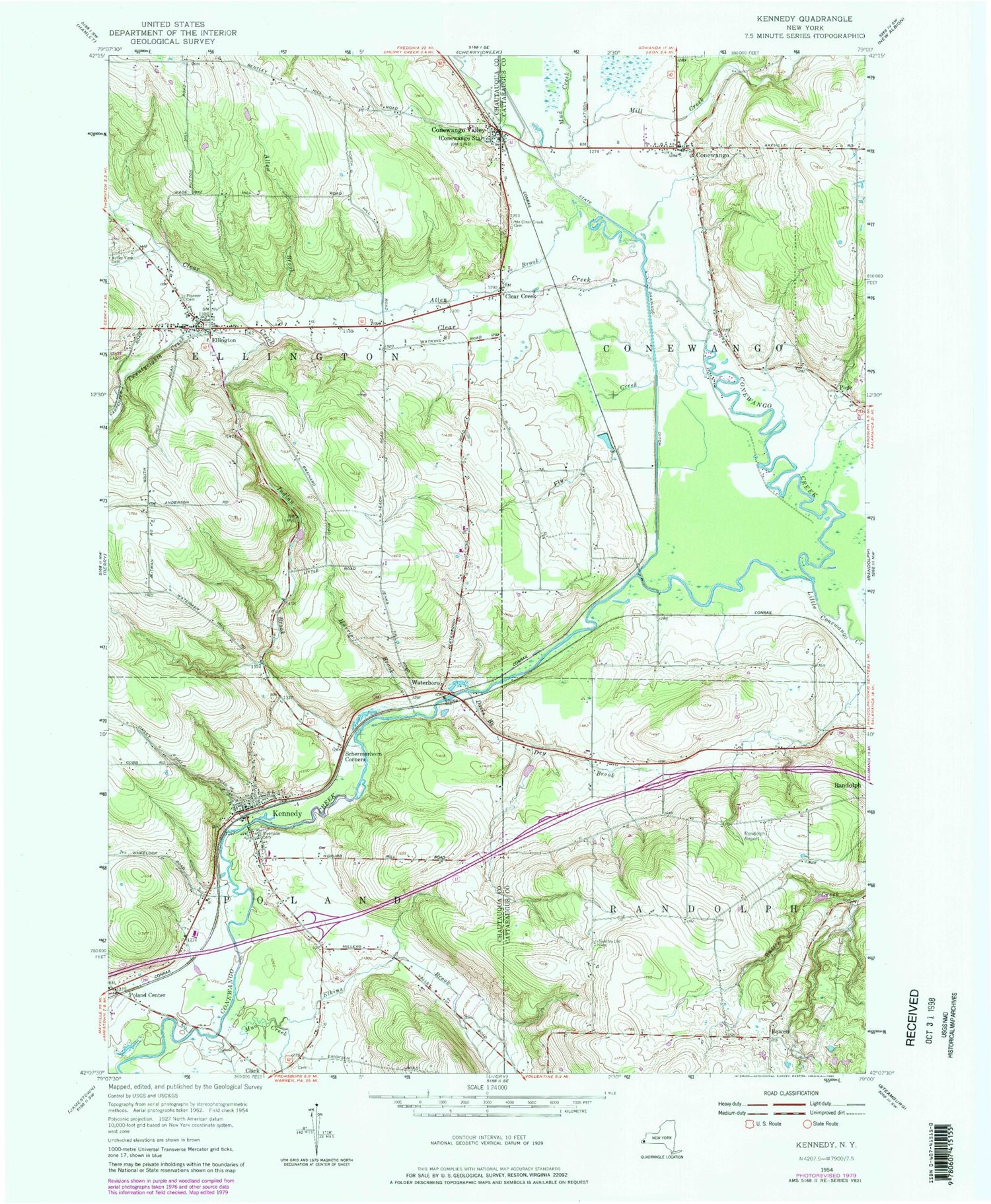
Classic USGS Kennedy New York 7.5'x7.5' Topo Map
Couldn't load pickup availability
Historical USGS topographic quad map of Kennedy in the state of New York. Map scale may vary for some years, but is generally around 1:24,000. Print size is approximately 24" x 27"
This quadrangle is in the following counties: Cattaraugus, Chautauqua.
The map contains contour lines, roads, rivers, towns, and lakes. Printed on high-quality waterproof paper with UV fade-resistant inks, and shipped rolled.
Contains the following named places: Abers Acres, Allen Brook, Beavers Dairy Farm, Bowen, Campbell Field, Clear Creek, Conewango, Conewango Fire Department, Conewango Valley, Conewango Valley Post Office, Davis Brook, Dry Brook, Elkins Brook, Ellington, Ellington Congregational Church, Ellington Fire Department, Ellington Post Office, Ellington United Methodist Church, Farman Free Library, Fly Creek, Harris Brook, Indian Brook, Kennedy, Kennedy Baptist Church, Kennedy Census Designated Place, Kennedy Fire Department, Kennedy First United Methodist Church, Kennedy Free Library, Kennedy Post Office, Little Clear Creek Cemetery, Little Conewango Creek, Mill Creek, Mud Creek, Myrtle Cemetery, Ormond Farm, Paul B D Temple Elementary School, Pioneer Cemetery, Poland Center, Pope, Pope Haven Campground, Riverside Cemetery, Rutledge Rural Cemetery, Sample Hill Cemetery, Schermerhorn Corners, Town of Conewango, Town of Ellington, Town of Poland, Town of Randolph, Twentyeighth Creek, Waterboro, ZIP Codes: 14732, 14747