MyTopo
Classic USGS Kensett Arkansas 7.5'x7.5' Topo Map
Couldn't load pickup availability
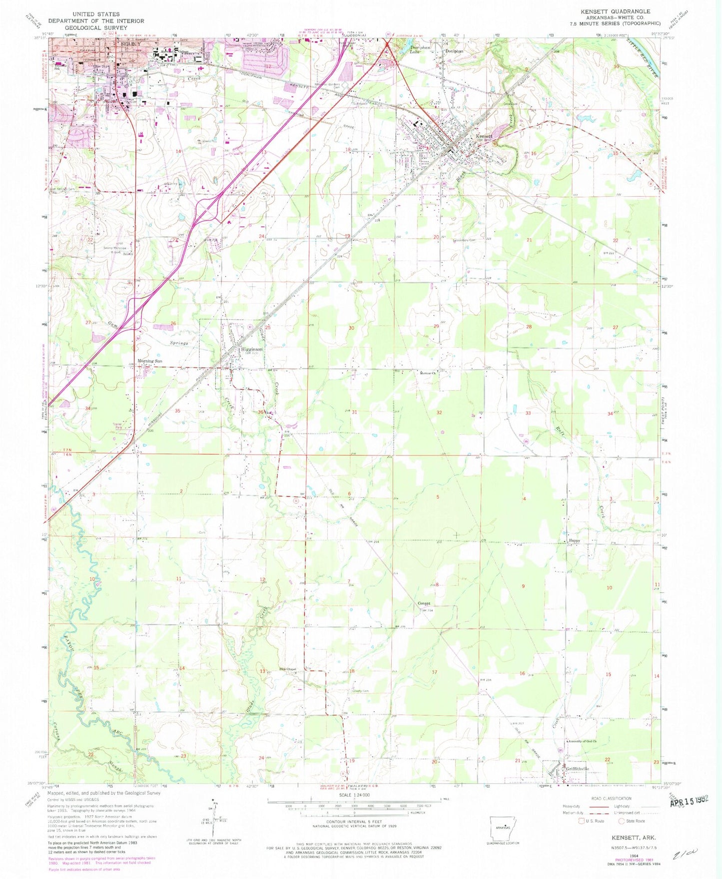
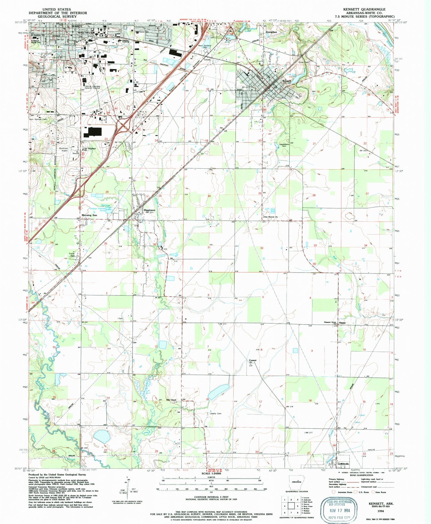
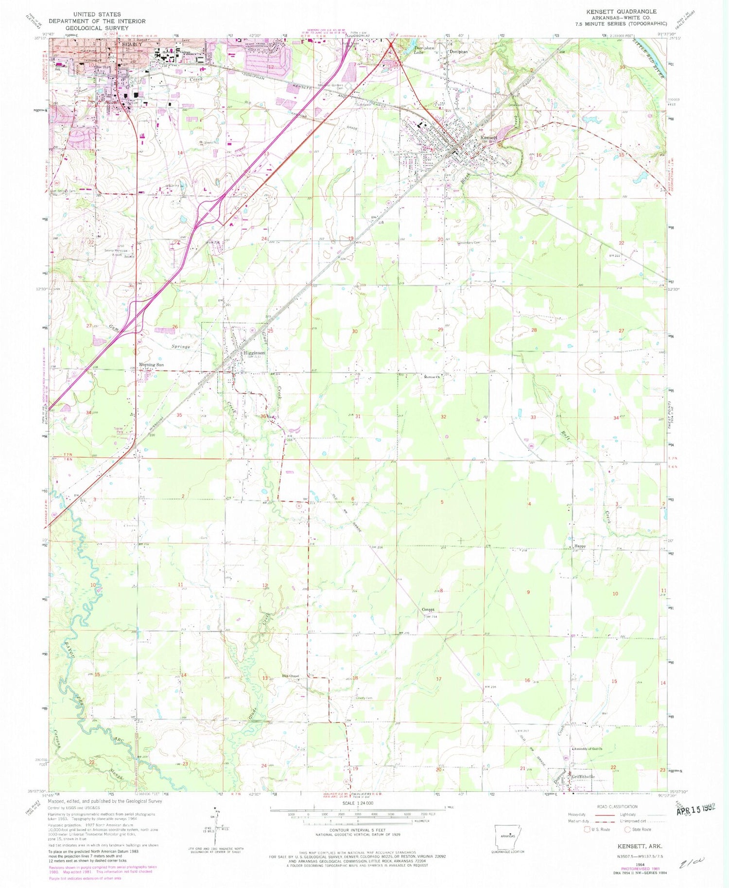
Historical USGS topographic quad map of Kensett in the state of Arkansas. Map scale may vary for some years, but is generally around 1:24,000. Print size is approximately 24" x 27"
This quadrangle is in the following counties: White.
The map contains contour lines, roads, rivers, towns, and lakes. Printed on high-quality waterproof paper with UV fade-resistant inks, and shipped rolled.
Contains the following named places: Assembly of God Church, Central Arkansas Hospital Heliport, City of Kensett, City of Searcy, Conant, Crow Cemetery, Doniphan, Ellis Chapel United Methodist Church, First Baptist Church, First United Methodist Church, Goodman Cemetery, Gum Springs, Gum Springs Creek, Happy, Harding University, Hedrick, Higginson, Higginson Post Office, Higginson Volunteer Fire Department, Kensett, Kensett Elementary School, Kensett High School, Kensett Middle School, Kensett Police Department, Kensett Post Office, Kensett Volunteer Fire Department, Lessenbery Cemetery, Liberty Cemetery, Memorial Gardens Cemetery, Morning Sun, Morrow Church, Northstar Emergency Medical Service Searcy Station 1, Pleasant Grove Church, Reorganized Church of Jesus Christ of Latter Day Saints, Searcy Carrier Annex - Post Office, Searcy Fire Department Central Station, Searcy Municipal Airport, Searcy Police Department, Sidney Deener Elementary School, Southwest Middle School, Sunshine School, Town of Higginson, Township of Higginson, Township of Kensett, Trinity Episcopal Church, Unity Health - Specialty Care Advanced Care Hospital, Walker School, White County Sheriff's Office, Williams School, ZIP Codes: 72068, 72082, 72143, 72149