MyTopo
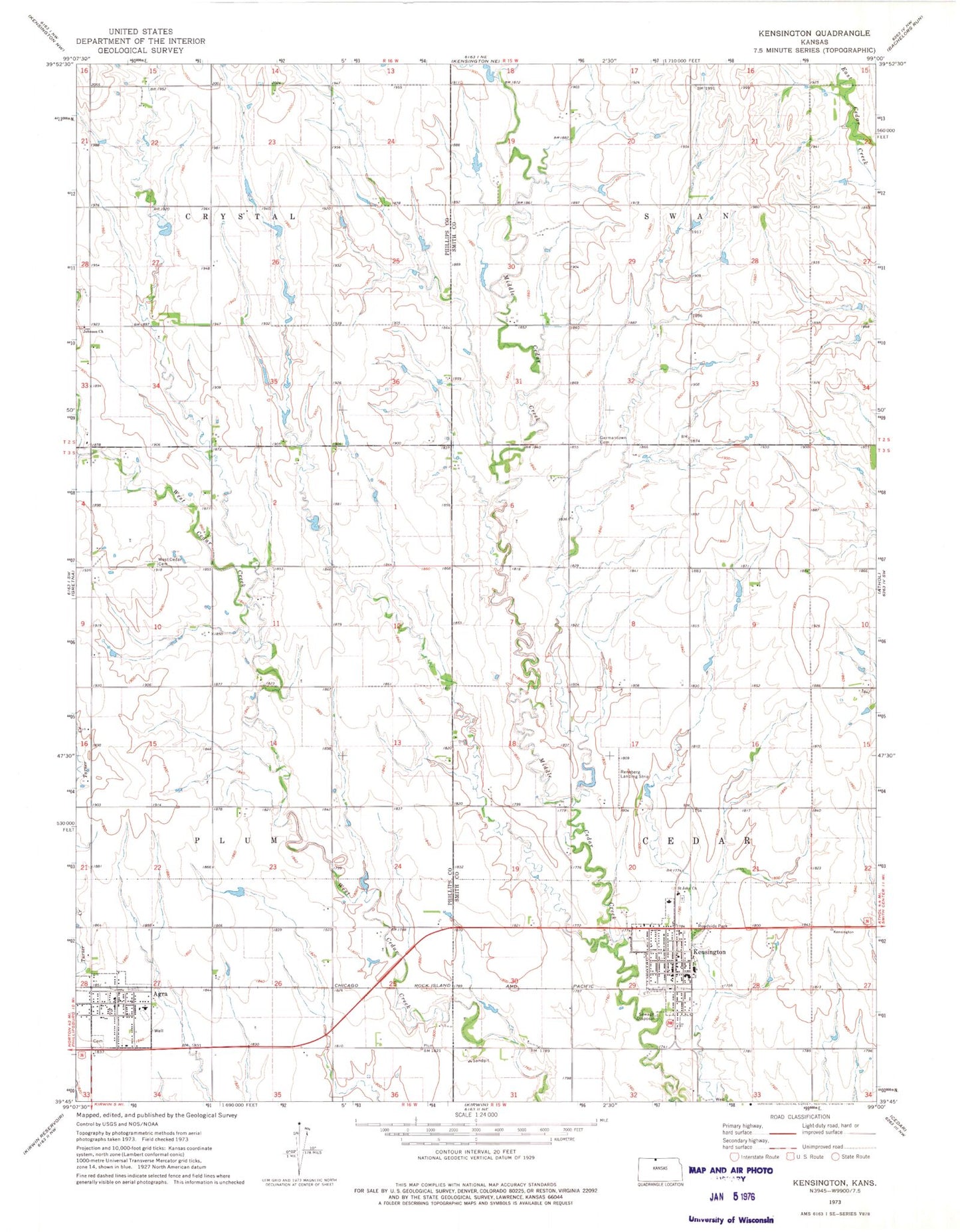
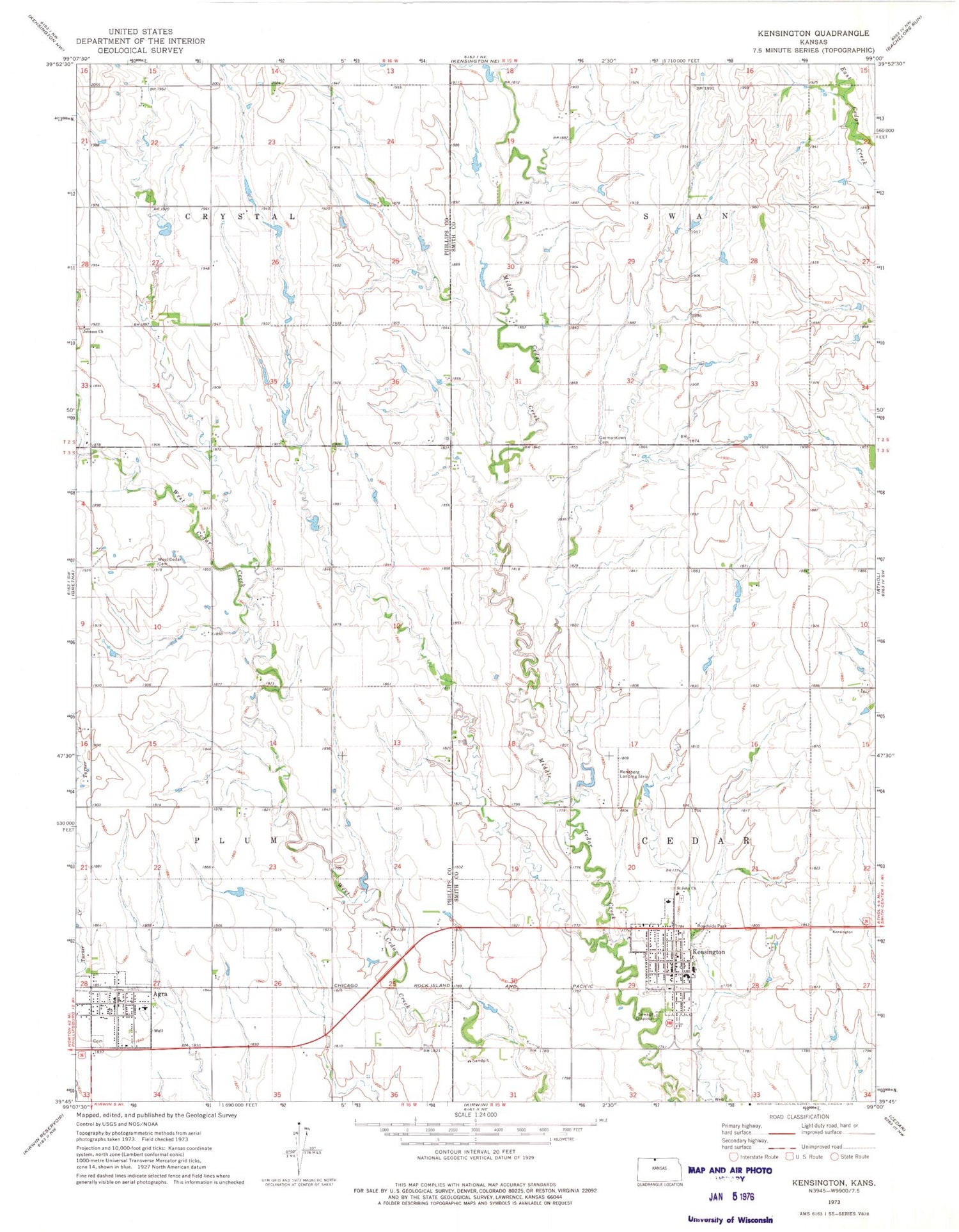
Classic USGS Kensington Kansas 7.5'x7.5' Topo Map
Couldn't load pickup availability
Historical USGS topographic quad map of Kensington in the state of Kansas. Map scale may vary for some years, but is generally around 1:24,000. Print size is approximately 24" x 27"
This quadrangle is in the following counties: Phillips, Smith.
The map contains contour lines, roads, rivers, towns, and lakes. Printed on high-quality waterproof paper with UV fade-resistant inks, and shipped rolled.
Contains the following named places: Agra, Agra American Legion Hall, Agra Cemetery, Agra Church of Christ, Agra City Hall, Agra Post Office, Agra United Methodist Church, Bloomfield, City of Agra, City of Kensington, F Lee Doctor Library, First Saint John Lutheran Church, Germantown, Germantown Cemetery, Johnson Church, Kensington, Kensington Post Office, Kensington School Community Library, Kensington Senior Community Center, Kensington Wastewater Plant, Phillips County Fire District 3A, Reneberg Landing Strip, Rural Fire Protection District 1, Saint John Lutheran Church, Thunder Ridge Elementary School, Thunder Ridge High School, Thunder Ridge Middle School, Township of Cedar, Township of Crystal, Township of Plum, Township of Swan, United Church of Kensington, West Cedar, West Cedar Cemetery, ZIP Code: 66951