
MyTopo
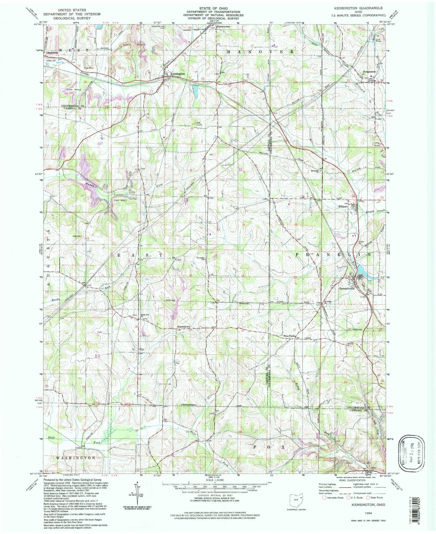
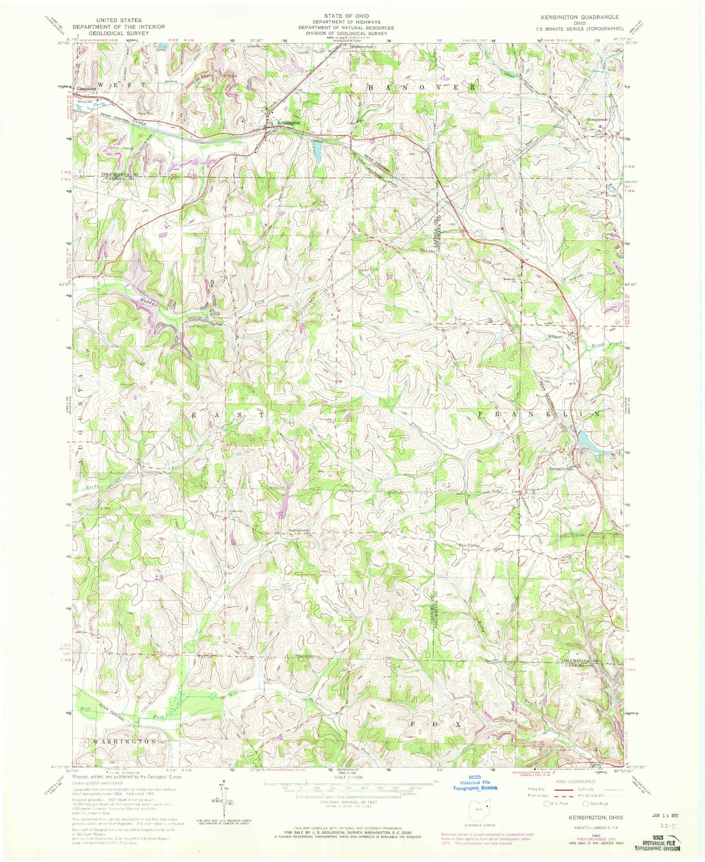
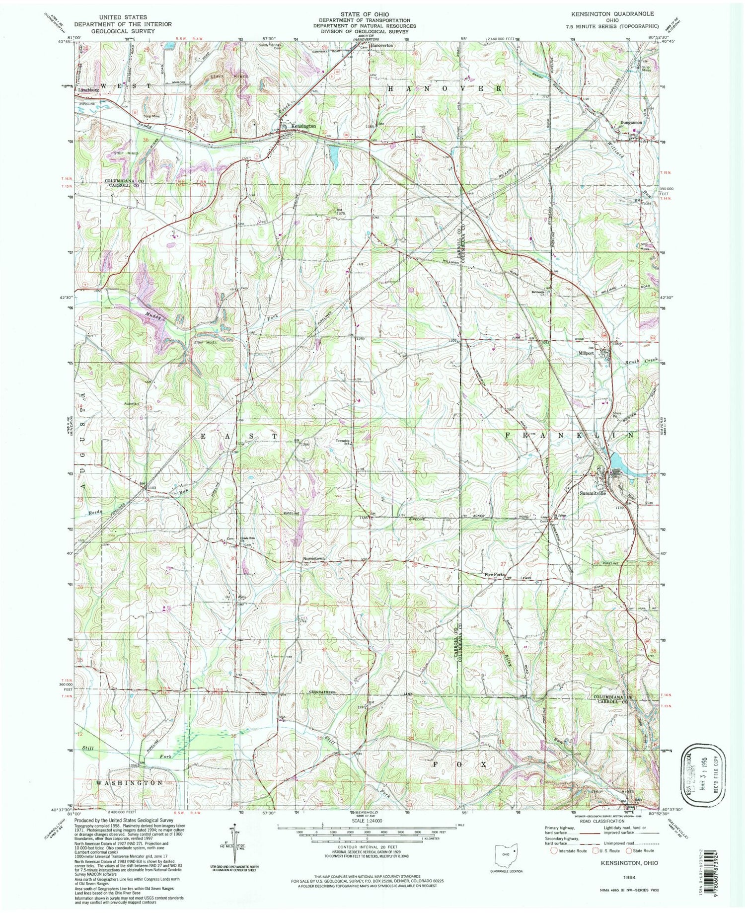
Classic USGS Kensington Ohio 7.5'x7.5' Topo Map
Couldn't load pickup availability
Historical USGS topographic quad map of Kensington in the state of Ohio. Typical map scale is 1:24,000, but may vary for certain years, if available. Print size: 24" x 27"
This quadrangle is in the following counties: Carroll, Columbiana.
The map contains contour lines, roads, rivers, towns, and lakes. Printed on high-quality waterproof paper with UV fade-resistant inks, and shipped rolled.
Contains the following named places: Bethesda Church, Five Forks, Glade Run Church, Saint Johns Church, Sandy Beaver Canal, Sandy Springs Cemetery, Franklin Elementary School, Glade Run Cemetery, Roudebush Cemetery, Lynchburg, Millport, Summitville, Dungannon, Kensington, Norristown, Manfull Lake Dam, Manfull Lake, Summitville Clay Products Lake Dam, Summitville Clay Products Lake, France Lake Dam, France Lake, Summitville Clay Works Pond Dam, Summitville Clay Works Pond Dam, Norristown Post Office (historical), Township of East, Township of Franklin, Bethesda Cemetery, Dungannon Post Office (historical), Kensington Post Office, Summitville Post Office, Millport Post Office (historical), Village of Summitville, Franklin Township Volunteer Fire Department, Maple Cotton Funeral Home Ambulance Service, Buckeye Tree Farm