
MyTopo
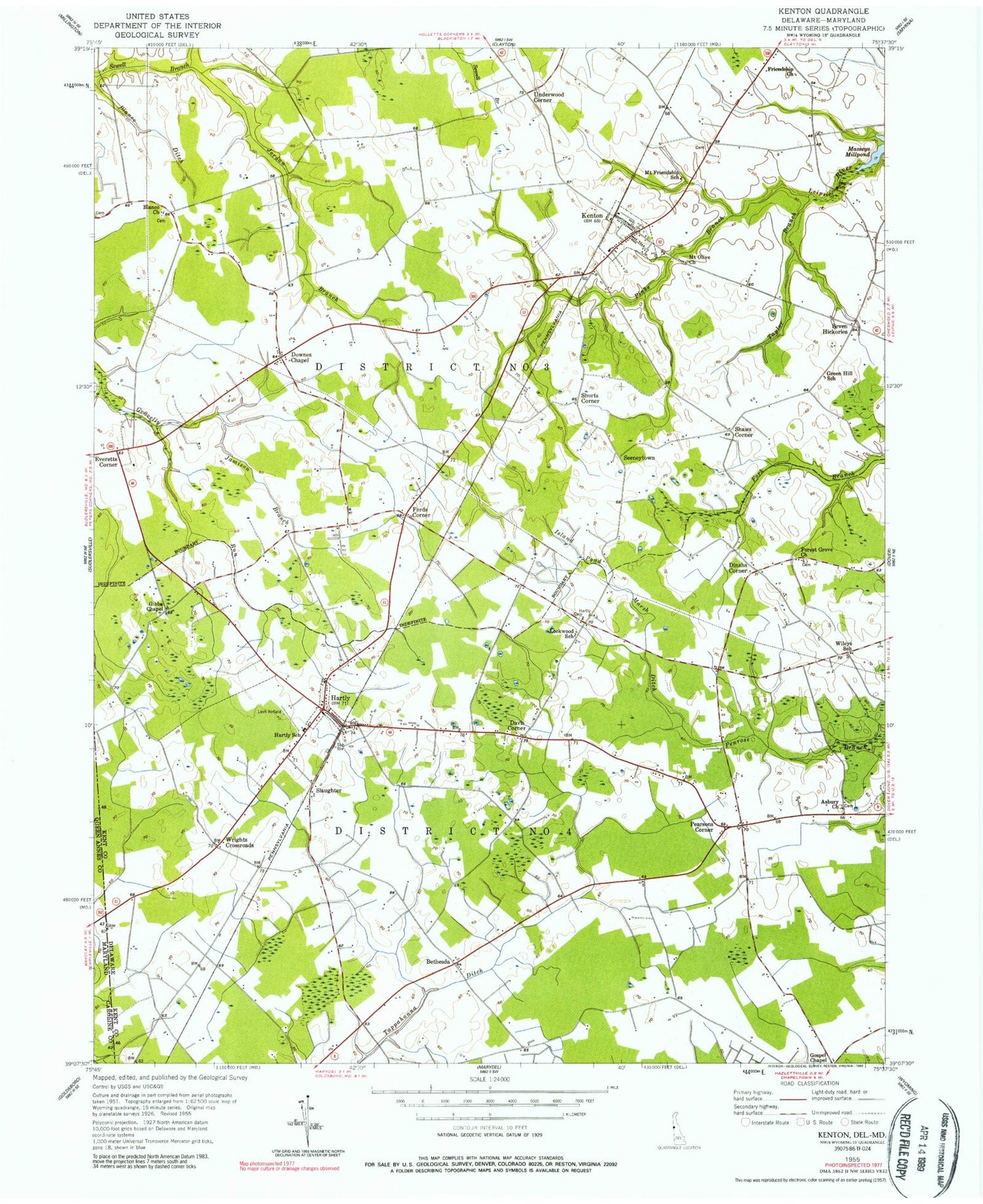
Classic USGS Kenton Delaware 7.5'x7.5' Topo Map
Couldn't load pickup availability
Historical USGS topographic quad map of Kenton in the state of Delaware. Map scale may vary for some years, but is generally around 1:24,000. Print size is approximately 24" x 27"
This quadrangle is in the following counties: Caroline, Kent, Queen Anne's.
The map contains contour lines, roads, rivers, towns, and lakes. Printed on high-quality waterproof paper with UV fade-resistant inks, and shipped rolled.
Contains the following named places: Asbury Cemetery, Bechers Brook, Bethesda, Bethesda M P Cemetery, Bethesda M P Church, Blackiston Wildlife Area, Blanco Cemetery, Blanco Church, Bryn Zion Cemetery, Calvary Baptist Church, Cedar Grove School, Central Christian School, Central Mennonite Church, Christ Deliverance Church, Davis Corner, Delaware State College Farm, Dinahs Corner, Downs Chapel, Emmanuel American Methodist Episcopal Church, Emmanuel Cemetery, Everetts Corner, Faith Baptist Church, Flying C Airport, Fords Corner, Forest Gate, Forest Grove Seventh Day Adventist Church, Forrest Grove Village Mobile Home Park, Gospel Chapel, Green Briar, Green Hill Amish School, Hartly, Hartly Elementary School, Hartly Post Office, Hartly Town Hall, Hartly United Methodist Church, Hartly Volunteer Fire Company, Hidden Acres, Hourglass, Island Pond Marsh Ditch, Jamison Branch, Jordan Branch, Kenton, Kenton Church, Kenton Division, Kenton Hundred, Kenton Mennonite Church, Kenton Post Office, Kenton Town Hall, Kenton United Methodist Church, Lockwood School, Mount Friendship Circuit Church, Mount Friendship School, Mount Olive Church, Muddy Bottom Ditch, New Hope Church, Oak Forest Estates, Pearsons Corner, Pinks Branch, Rehak, Reynard Crossing, Rolling Meadows, Saint Johns Holy Church, Seeneytown, Seven Hickories, Seventh Day Adventist Church, Shady Lane School, Shaws Corner, Shorts Corner, Slaughter, Taylor Branch, Town of Hartly, Town of Kenton, Underwood Corner, Victory Chapel, Warrens Mobile Home Park, West Center School, West Dover Hundred, Whigville, Wiley School, Wrights Crossroads, ZIP Codes: 19953, 19955


