MyTopo
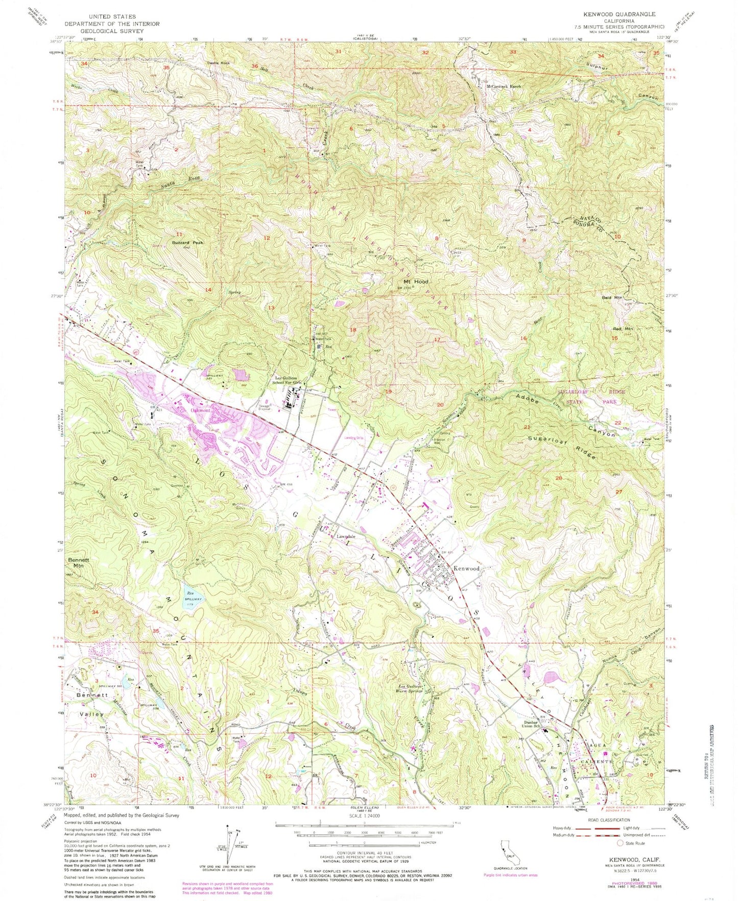
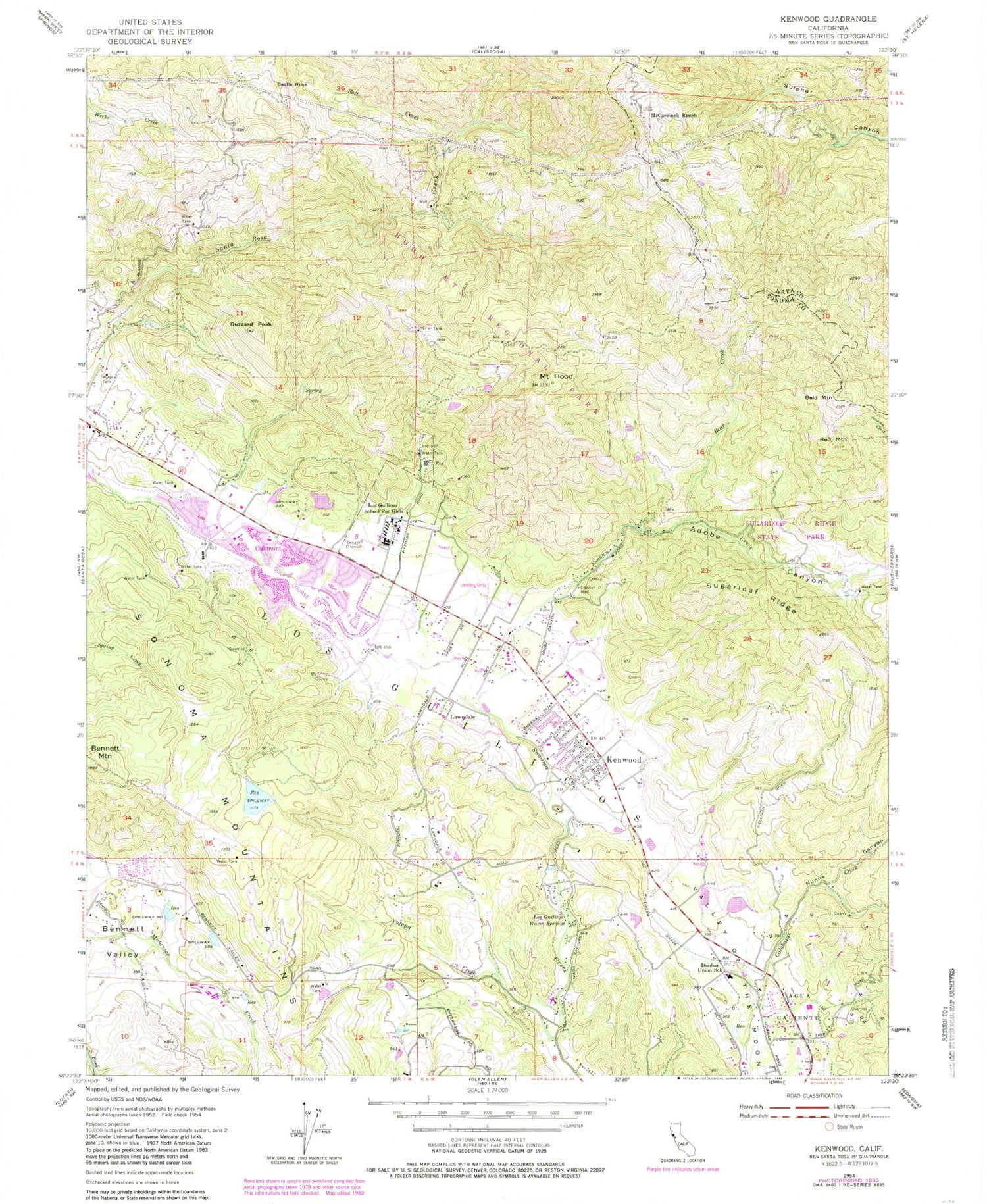
Classic USGS Kenwood California 7.5'x7.5' Topo Map
Couldn't load pickup availability
Historical USGS topographic quad map of Kenwood in the state of California. Typical map scale is 1:24,000, but may vary for certain years, if available. Print size: 24" x 27"
This quadrangle is in the following counties: Napa, Sonoma.
The map contains contour lines, roads, rivers, towns, and lakes. Printed on high-quality waterproof paper with UV fade-resistant inks, and shipped rolled.
Contains the following named places: Adobe Canyon, Bald Mountain, Bear Creek, Bennett Mountain, Buzzard Peak, Castle Rock, Dunbar Elementary School, Mount Hood, Kenwood, Los Guilicos, Los Guilicos Juvenile Hall, Los Guilicos Warm Springs, McCormick Ranch, Nunns Canyon, Red Mountain, Salt Creek, Sugarloaf Ridge, Sugarloaf Ridge State Park, Yulupa Creek, Lawndale, Graywood Ranch Airport, Oakmont, Silver Shoon Ranch 2422 Dam, Beltaine (historical), Enterprise School (historical), Felice (historical), Los Alamos School (historical), Los Guilicos, Wildwood (historical), Alder Park, Annadel State Park, Basalt Trail, Buick Meadow, Channel Trail, Chateau Saint Jean Winery, Frey Canyon, Grand Cru Vineyards, Grand Cru Winery, Kenwood Community Church, Kenwood Elementary School, Kenwood Post Office, Kenwood Winery, Kunde Winery, Lake Trail, Landmark Vineyards, Lawndale Trail, Ledson Marsh, Louis Trail, Madrone Spring, Marsh Trail, Middle Steves Trail, Oakmont Golf Course, Pig Flat Trail, Pine Flat Picnic Area, Plaza Park, Quarry Picnic Area, Redwood Springs, Rhyolite Trail, Ridge Trail, Saint Francis Winery, Schultz Canyon, Schultz Trail, Shaw Park, South Burma Trail, Two Quarry Trail, Upper Steves Trail, Alder Glen Picnic Area, Azalea Creek Picnic Area, Bald Mountain Trail, Bandiera Winery, Columbine Meadow, Creekside Nature Trail, Headwaters Trail, Homestead Meadow Picnic Area, Hood Mountain Trail, Lower Bald Mountain Trail, Meadow Trail, Pony Gate Gulch, Pony Gate Trail, Pony Trail, Rattlesnake Creek, Santa Rosa Creek Trail, Smothers Winery, Stem Trail, Vista Trail, Hood House, Pythian Home Cemetery, Bridges of Sonoma Private School, Kenwood Census Designated Place, Kenwood Fire Protection District, Santa Rosa Fire Department Station 7, Sonoma Life Support Post 15, Cambou Quarry, Joulie Quarry