
MyTopo
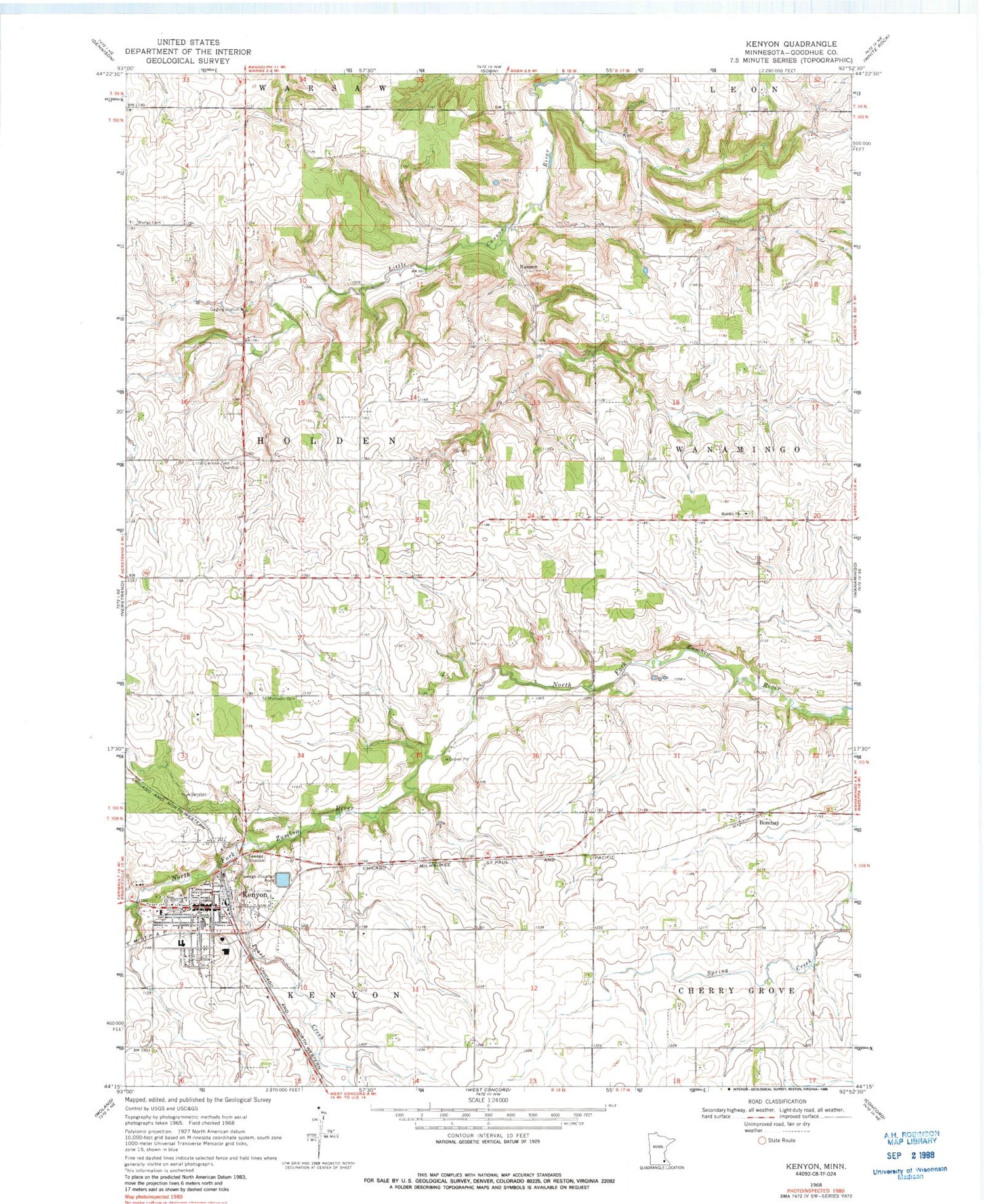
Classic USGS Kenyon Minnesota 7.5'x7.5' Topo Map
Couldn't load pickup availability
Historical USGS topographic quad map of Kenyon in the state of Minnesota. Map scale may vary for some years, but is generally around 1:24,000. Print size is approximately 24" x 27"
This quadrangle is in the following counties: Goodhue.
The map contains contour lines, roads, rivers, towns, and lakes. Printed on high-quality waterproof paper with UV fade-resistant inks, and shipped rolled.
Contains the following named places: Bombay, City of Kenyon, Holden Church, Holden Norwegian Lutheran Cemetery, Kanyon Mayo Family Practice Center, Kenyon, Kenyon Elementary School, Kenyon Fire Department, Kenyon Heliport, Kenyon High School, Kenyon Police Department, Kenyon Post Office, Kenyon Public Library, Kenyon Sunset Home, Little Cannon Cemetery, Nansen, Nansen Post Office, Pearl Creek, Saint John's United Church of Christ, Saint Michael's Catholic Church, Saint Michaels Cemetery, Township of Holden, United Methodist Church, Valley View Orchard, Wangs Cemetery, ZIP Code: 55946


