MyTopo
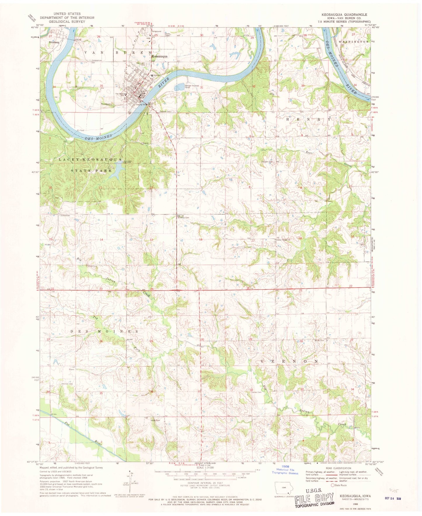
Classic USGS Keosauqua Iowa 7.5'x7.5' Topo Map
Couldn't load pickup availability
Historical USGS topographic quad map of Keosauqua in the state of Iowa. Map scale may vary for some years, but is generally around 1:24,000. Print size is approximately 24" x 27"
This quadrangle is in the following counties: Van Buren.
The map contains contour lines, roads, rivers, towns, and lakes. Printed on high-quality waterproof paper with UV fade-resistant inks, and shipped rolled.
Contains the following named places: Boley Incorporated Elevator, Center Chapel Cemetery, Center Chapel Church, Chequest Creek, Christian Church, City of Keosauqua, Columbus Cemetery, Congregational Church, Coppers Creek, Dodson Cemetery, Duckworth Creek, Elys Creek, Fellows Cemetery, Jones Cemetery, Keosauqua, Keosauqua Baptist Fellowship, Keosauqua City Hall, Keosauqua Family Chiropractic Center, Keosauqua Fire Department, Keosauqua Medical Clinic, Keosauqua Municipal Airport, Keosauqua Post Office, Keosauqua Public Library, Lacey-Keosauqua State Park, Lippincott Cemetery, Oak Lawn Cemetery, Old Military Road Historical Marker, Our Saviour's Lutheran Church, Peacock Ball Park, Phillips Cemetery, Pittsburg, Pittsburg Cemetery, Pittsburg Post Office, Pleasant Hill, Pleasant Hill Post Office, Prall Cemetery, Purdom Cemetery, The Church of Jesus Christ of Latter Day Saints, Town Branch, Township of Henry, Township of Vernon, Tri-County Grain Elevator, Tug Fork Big Indian Creek, United Church of Christ, United Methodist Church, Valley Branch, Van Buren County Courthouse, Van Buren County Hospital, Van Buren County Sheriff's Office, Van Buren Good Samaritan Center, Van Buren High School, Van Buren Middle School, Van Buren Recreation Area Golf, Watkins Cemetery, White Cemetery, Wiley Cemetery, Wolf Cemetery, Wolfe Clinic Eye Center, ZIP Codes: 52565, 52573