
MyTopo
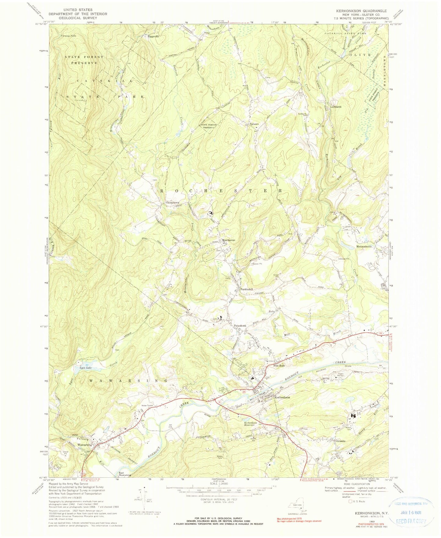
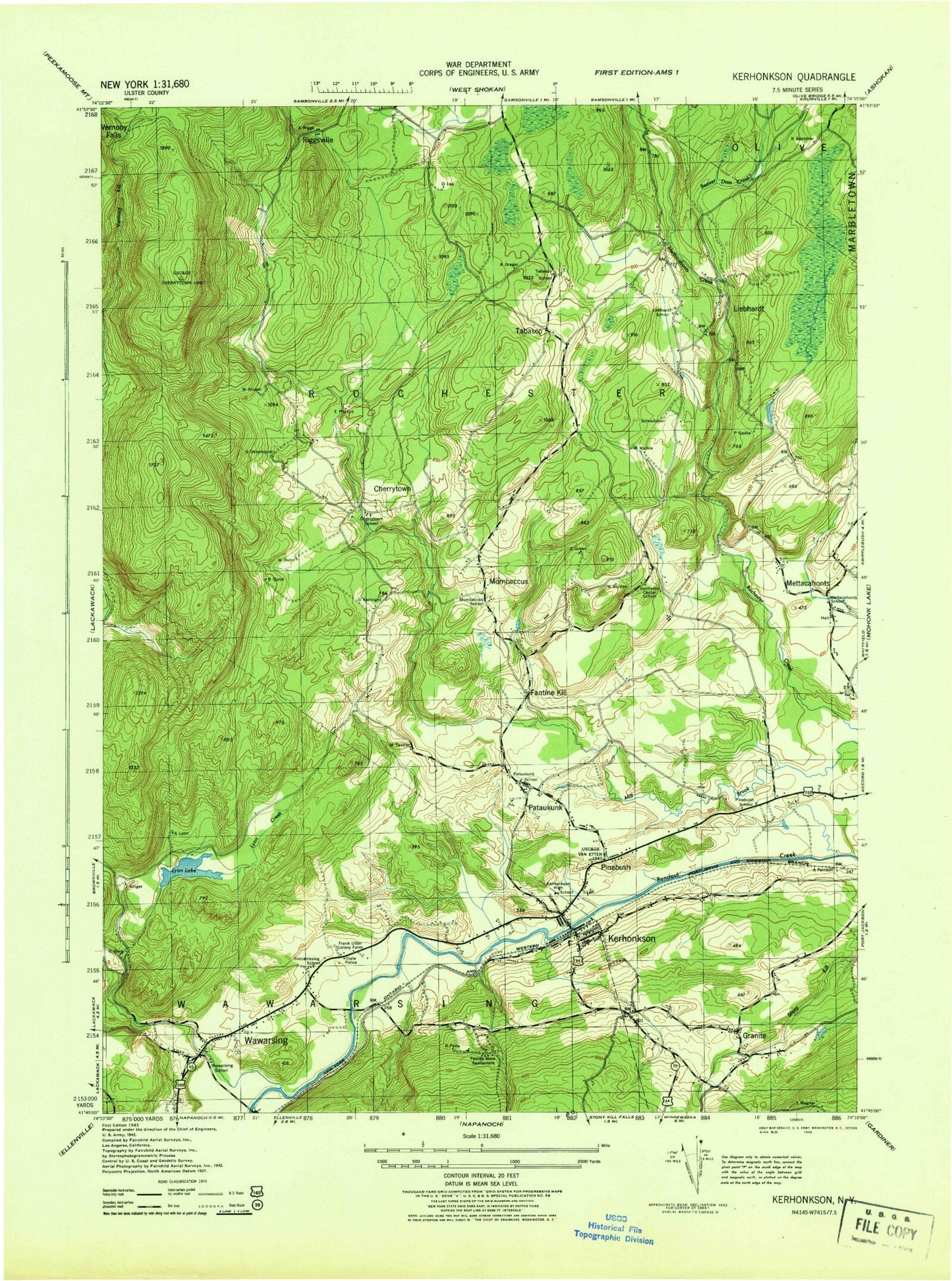
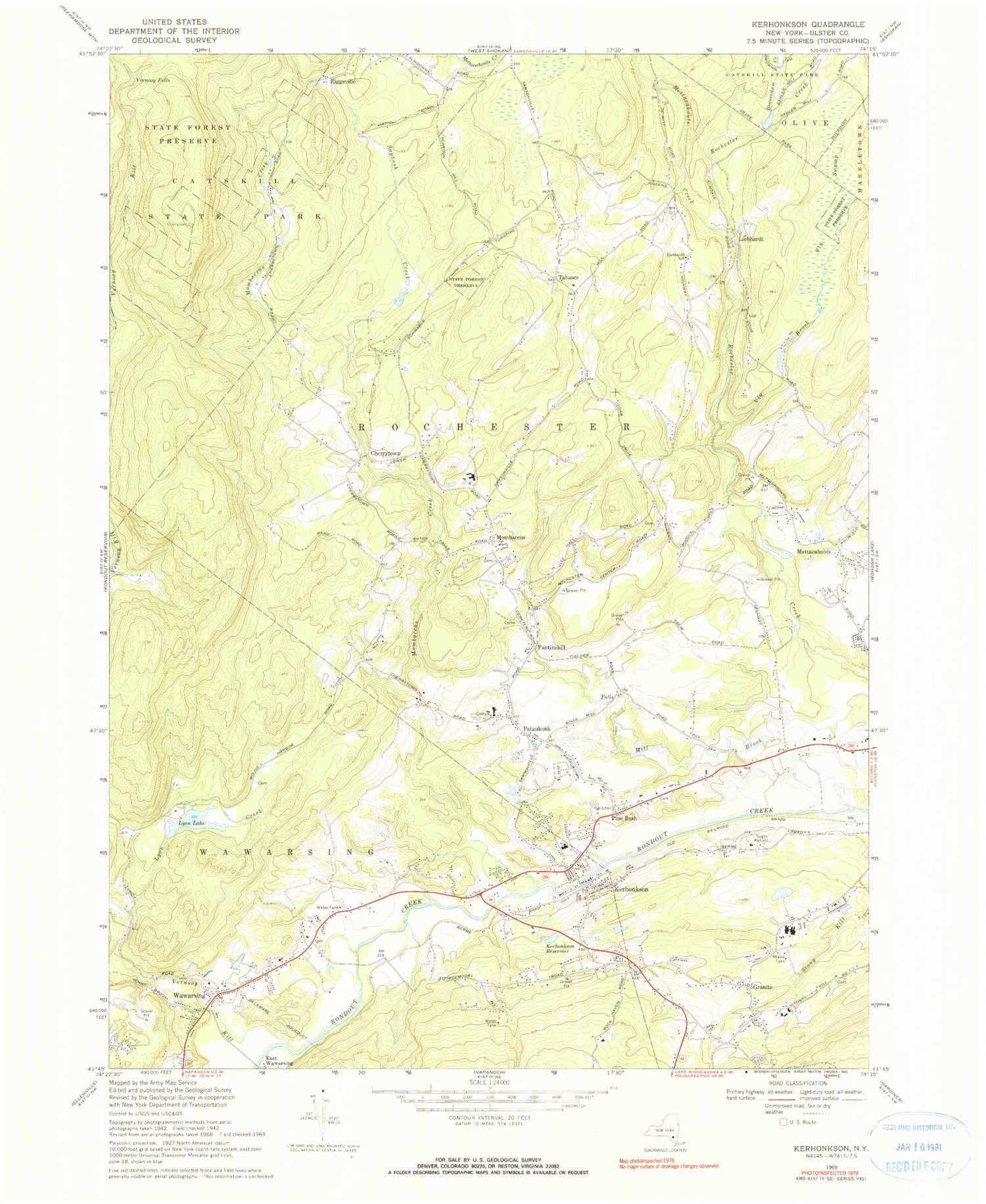
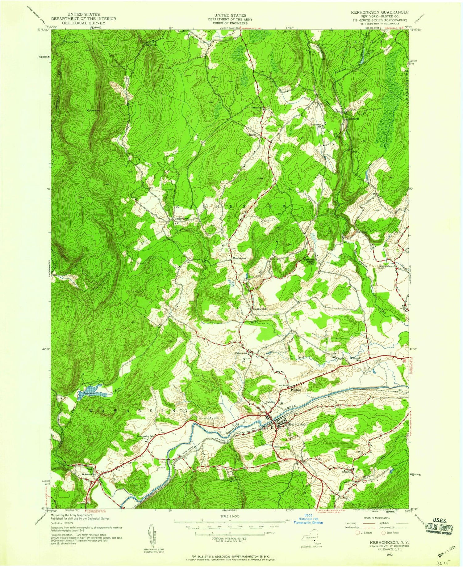
Classic USGS Kerhonkson New York 7.5'x7.5' Topo Map
Couldn't load pickup availability
Historical USGS topographic quad map of Kerhonkson in the state of New York. Typical map scale is 1:24,000, but may vary for certain years, if available. Print size: 24" x 27"
This quadrangle is in the following counties: Ulster.
The map contains contour lines, roads, rivers, towns, and lakes. Printed on high-quality waterproof paper with UV fade-resistant inks, and shipped rolled.
Contains the following named places: Beaverdam Creek, Fantinekill, Granite, Kerhonkson, Kerhonkson Reservoir, Liebhardt School, Lyon Creek, Lyon Lake, Mettacahonts, Mombaccus, Pataukunk, Pine Bush, Sapbush Creek, Vernooy Falls, Vernooy Kill, Vly Brook, Vly Swamp, Wawarsing, Mettacahonts Creek, Cherrytown, Liebhardt, Riggsville, Tabasco, Piolis Brookside Airport, Town of Rochester, Mine Hole Brook, Foords More Sanitarium (historical), Frank Utter Colony Farm, Cherrytown School (historical), Kerhonkson High School, Mettacahonts School (historical), Mombaccus School (historical), Pataukunk School (historical), Pinebush School (historical), Rochester Center School (historical), Soccanissing School (historical), Tabasco School (historical), Wawarsing School (historical), Napanoch Census Designated Place, Kerhonkson Census Designated Place, Bell's Tree Farm, Burd Farm, Kelder's Farm, Pinegrove Dude Ranch, Arrowhead Farms, Catskill Native Nursery, Escot Valley Farm, Loosestrife Farm, Norwegian Wood Farm, One Earth Farm, Rolling Meadow Stables, Sugarbrook Maple Farm, Pine Bush Cemetery, Wawarsing Christian Academy, Community Bible Church, Kingdom Hall of Jehovahs Witnesses, Ukrainian Catholic Church, Federated Church of Kerhonkson, Kerhonkson Post Office, Granite Road Mobile Home Park, Hidden Forest Mobile Home Park, Rondout Valley Camping Resort, Hudson Valley Resort, Kerhonkson Elementary School, Kerhonkson Fire Company, Accord Fire District Rochester Volunteer Fire Company 2, Napanoch Volunteer Fire Department Station 2, Gray Brook, Wawarsing Post Office, Rochester Center Cemetery, Beaverdam Creek, Fantinekill, Granite, Kerhonkson, Kerhonkson Reservoir, Liebhardt School, Lyon Creek, Lyon Lake, Mettacahonts, Mombaccus, Pataukunk, Pine Bush, Sapbush Creek, Vernooy Falls, Vernooy Kill, Vly Brook, Vly Swamp, Wawarsing, Mettacahonts Creek, Cherrytown, Liebhardt, Riggsville, Tabasco, Piolis Brookside Airport, Town of Rochester, Mine Hole Brook, Foords More Sanitarium (historical), Frank Utter Colony Farm, Cherrytown School (historical), Kerhonkson High School, Mettacahonts School (historical), Mombaccus School (historical), Pataukunk School (historical), Pinebush School (historical), Rochester Center School (historical), Soccanissing School (historical), Tabasco School (historical), Wawarsing School (historical), Napanoch Census Designated Place, Kerhonkson Census Designated Place, Bell's Tree Farm, Burd Farm, Kelder's Farm, Pinegrove Dude Ranch, Arrowhead Farms, Catskill Native Nursery, Escot Valley Farm, Loosestrife Farm, Norwegian Wood Farm, One Earth Farm, Rolling Meadow Stables, Sugarbrook Maple Farm, Pine Bush Cemetery, Wawarsing Christian Academy, Community Bible Church, Kingdom Hall of Jehovahs Witnesses, Ukrainian Catholic Church, Federated Church of Kerhonkson, Kerhonkson Post Office, Granite Road Mobile Home Park, Hidden Forest Mobile Home Park, Rondout Valley Camping Resort, Hudson Valley Resort, Kerhonkson Elementary School, Kerhonkson Fire Company, Accord Fire District Rochester Volunteer Fire Company 2, Napanoch Volunteer Fire Department Station 2, Gray Brook, Wawarsing Post Office, Rochester Center Cemetery