MyTopo
Classic USGS Kermit West Virginia 7.5'x7.5' Topo Map
Couldn't load pickup availability
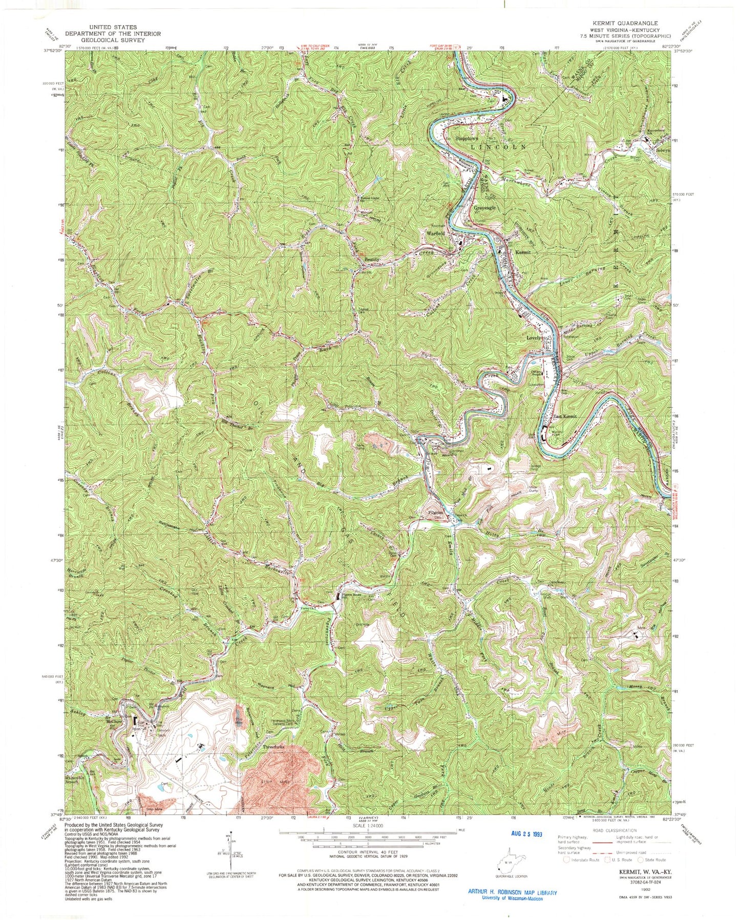
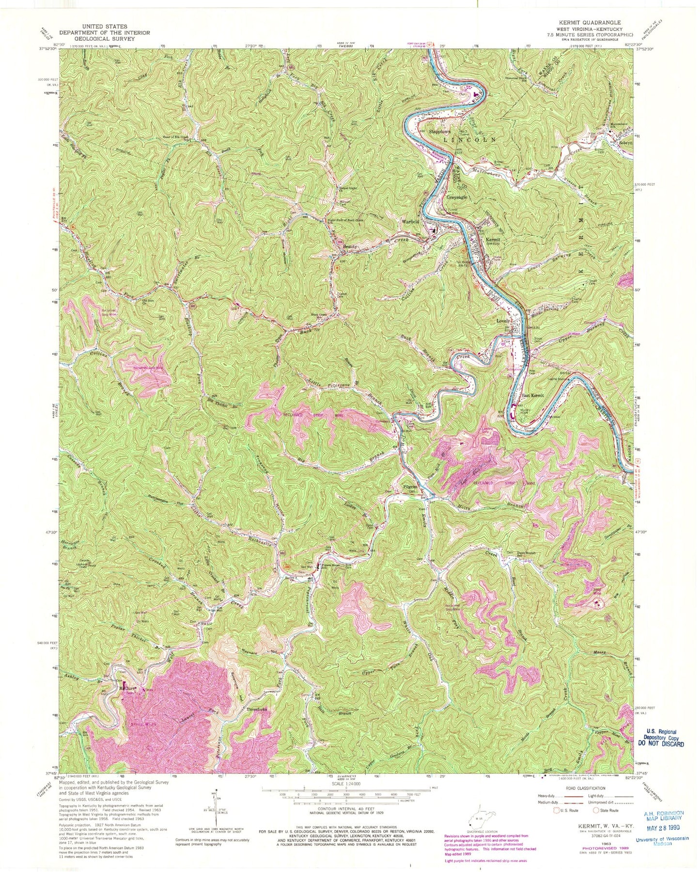
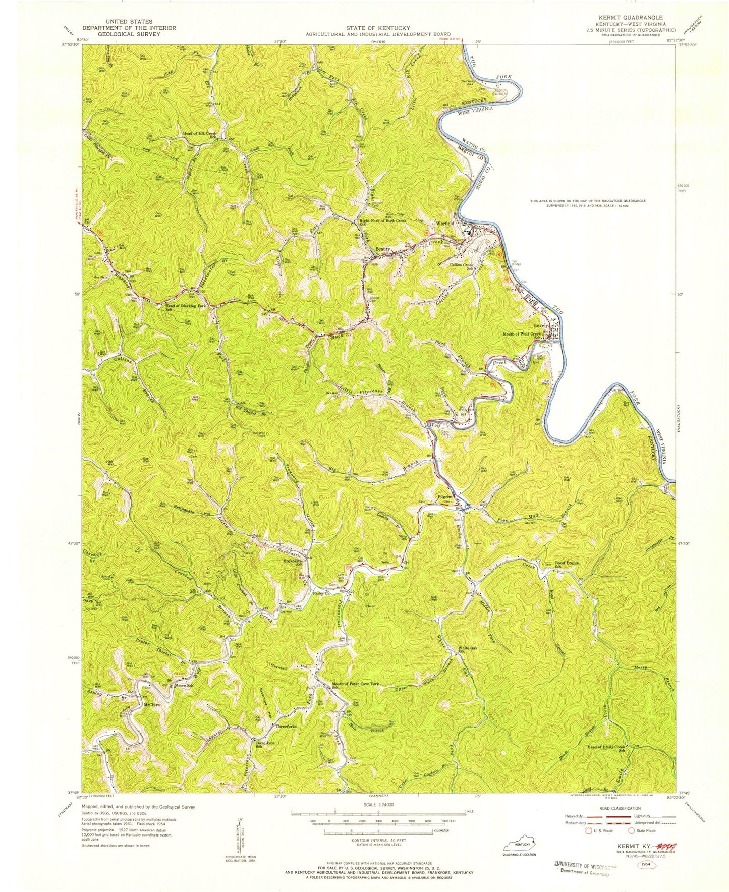
Historical USGS topographic quad map of Kermit in the states of West Virginia, Kentucky. Map scale may vary for some years, but is generally around 1:24,000. Print size is approximately 24" x 27"
This quadrangle is in the following counties: Martin, Mingo, Wayne.
The map contains contour lines, roads, rivers, towns, and lakes. Printed on high-quality waterproof paper with UV fade-resistant inks, and shipped rolled.
Contains the following named places: Aker Cemetery, Anna Church, Antioch Church, Ashlog Branch, Beauty, Beauty Post Office, Big Branch, Big Thicket Branch, Bone Hollow, Booth Fork, Bowen Branch, Brewer Cemetery, Buck Branch, Buck Creek, Calvary Temple, Cassidy Lookout Tower, Chaffin Cemetery, City of Warfield, Clay Fork, Collins Creek, Copper Mine Branch, Crooked Branch, Dave Jude School, Davis Branch, Davis Cemetery, Dryhouse Branch Emily Creek, Earley Church, East Kermit, Elk Creek, Emily Creek, Faith Church, Frogpond Hollow, Gospel Light Church, Greyeagle, Groundhog Hollow, Hale Branch, Head of Elk Creek School, Hollybush Branch, Holty Branch, Kermit, Kermit PK - 8 School, Kermit Police Department, Kermit Post Office, Kermit Volunteer Fire Department, Kermit Volunteer Fire Department Marrowbone Station, Kirk Cemetery, Lackey Branch, Laurel Fork, Left Fork Holty Branch, Left Fork Marrowbone Creek, Left Fork of Buck Creek School, Little Crooked Branch, Little Home United Baptist Church, Little Petercave Branch, Little Rockcastle Creek, Long Branch, Lovely, Lovely Post Office, Lower Burning Creek, Lower Twin Branch, Marcum Cemetery, Marrowbone Church, Marrowbone Creek, Marrowbone School, Mary Elizabeth Baptist Church, Maynard Hollow, McClure, Meade Branch, Middle Burning Creek, Middle White Oak Fork, Mossy Branch, Murphy Cemetery, Number 1 Tunnel, Number 2 Tunnel, Number 3 Tunnel, Old Zion Church, Parsley Big Branch, Petercave Fork, Petercave Memorial Cemetery, Phoebe Trace, Pigeon Roost School, Pigeon Roost Volunteer Fire Department, Pigeonroost Fork, Pilgrim, Pilgrim Post Office, Pipe Mud Branch, Poplar Fork, Poplar Thicket Branch, Rattlesnake Hollow, Right Fork Buck Creek, Right Fork of Buck Creek School, Riverview Church, Roost Branch, Roost Branch School, Saint John Neumann Church, Sartins Branch, Schoolhouse Hollow, Selwyn, Seng Branch, Small Cemetery, Stat Ambulance Service, Stepp Branch, Stepp Cemetery, Stepptown, Stonecoal Block School, Sweetwater Branch, Sycamore Hollow, Threeforks, Town of Kermit, Trinity Church, Triplett Cemetery, Union Church, Upper Burning Creek, Upper Goodwin Branch, Upper Twin Branch, Vinson Branch, Warfield, Warfield Division, Warfield Post Office, Warfield Volunteer Fire Department, West Lovely, White Oak Fork, Whitecabin Branch, Wolf Creek, ZIP Codes: 41203, 41231