MyTopo
Classic USGS Kessler Gap Wyoming 7.5'x7.5' Topo Map
Regular price
$16.95
Regular price
Sale price
$16.95
Unit price
per
Couldn't load pickup availability
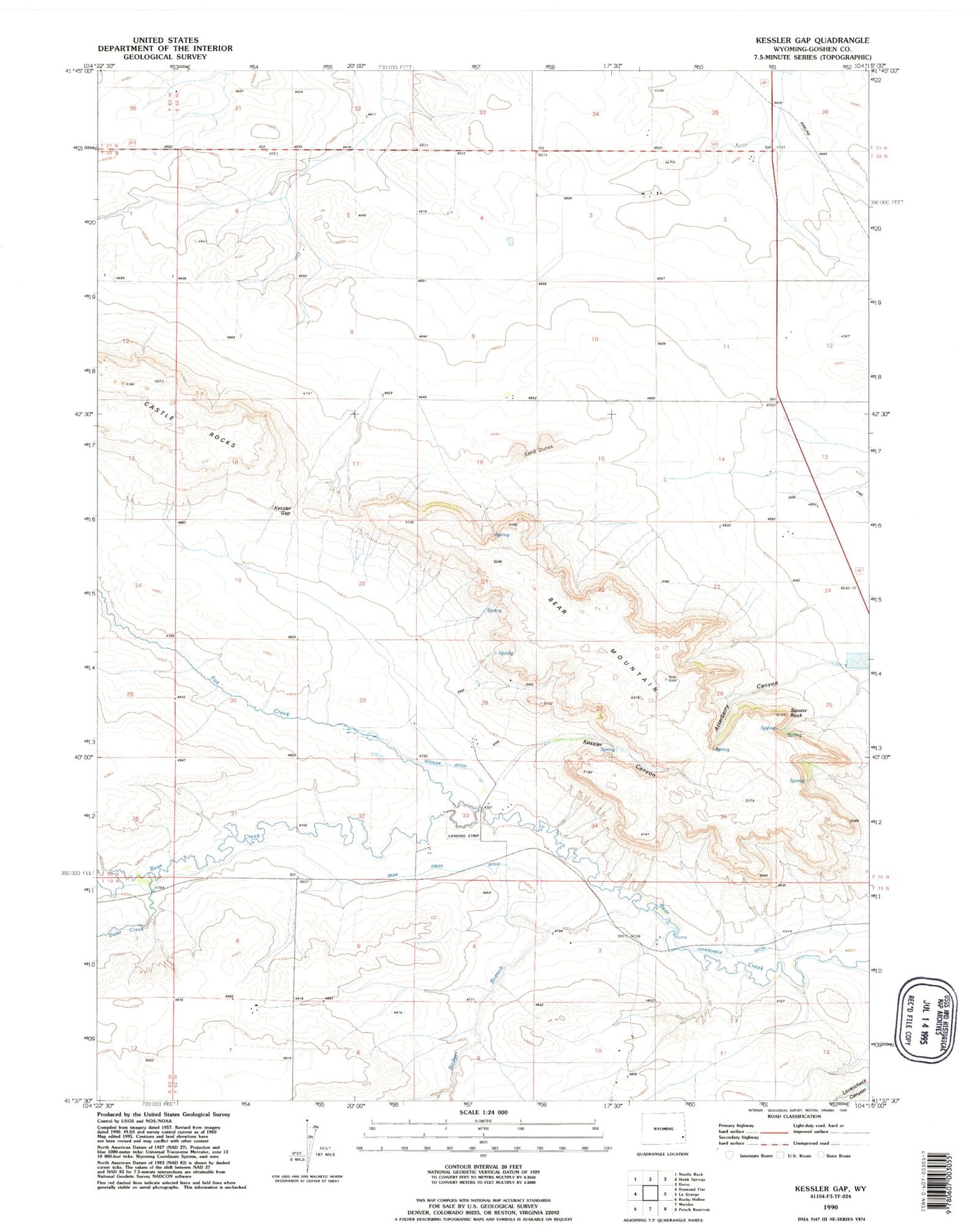
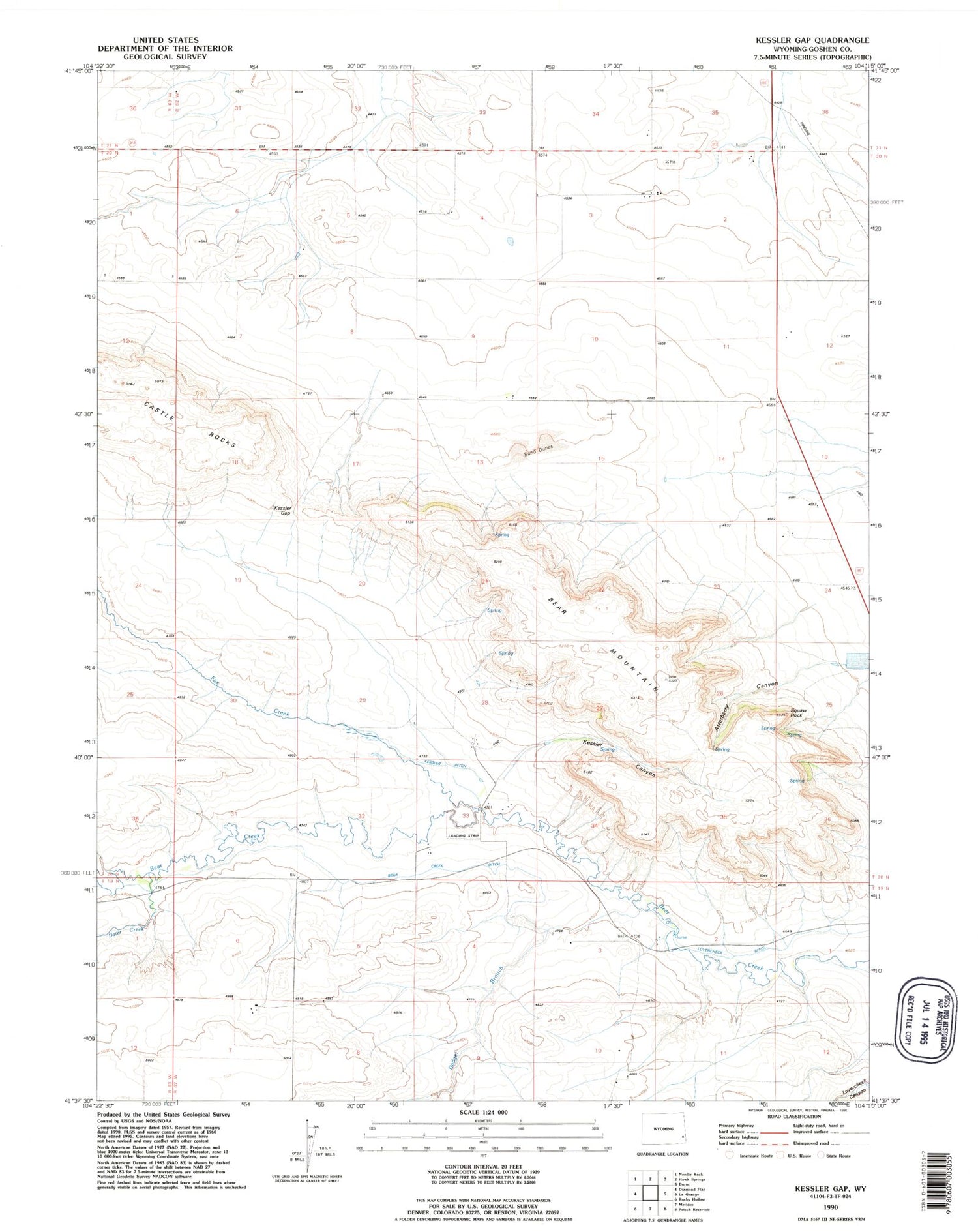
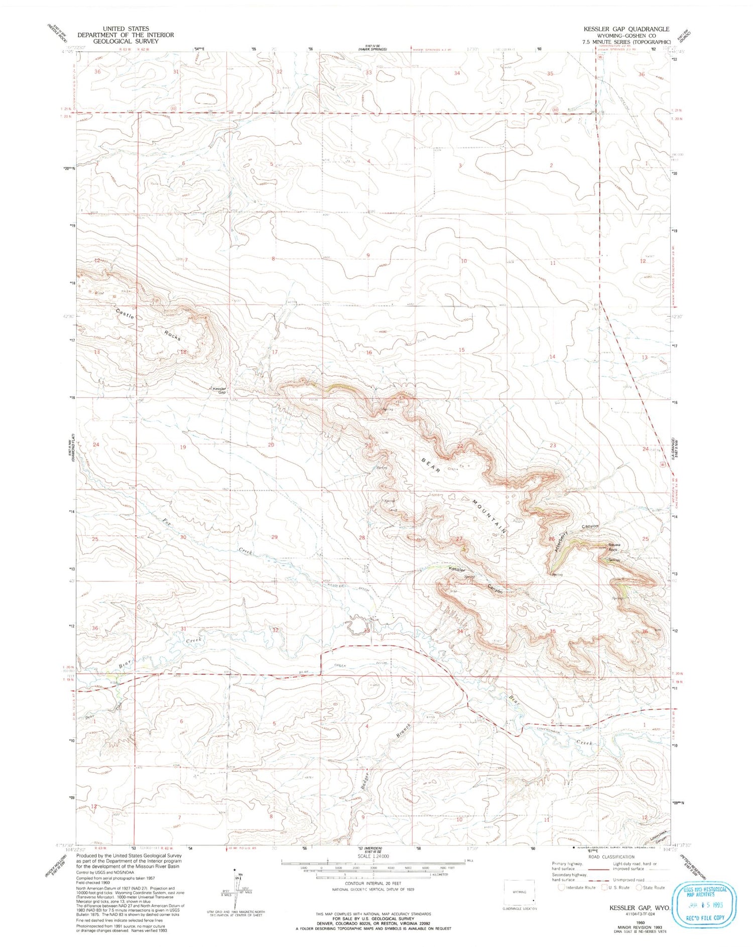
Historical USGS topographic quad map of Kessler Gap in the state of Wyoming. Map scale may vary for some years, but is generally around 1:24,000. Print size is approximately 24" x 27"
This quadrangle is in the following counties: Goshen.
The map contains contour lines, roads, rivers, towns, and lakes. Printed on high-quality waterproof paper with UV fade-resistant inks, and shipped rolled.
Contains the following named places: Atterberry Canyon, Babbitt Dam, Babbitt Reservoir, Badger Branch, Bear Creek Ditch, Bear Mountain, Dater Creek, Fox Creek, Kessler Canyon, Kessler Ditch, Kessler Gap, Lovercheck Ditch, Squaw Rock, ZIP Code: 82221