
MyTopo
Classic USGS Ketchikan B-6 SE Alaska 7.5'x7.5' Topo Map
Couldn't load pickup availability
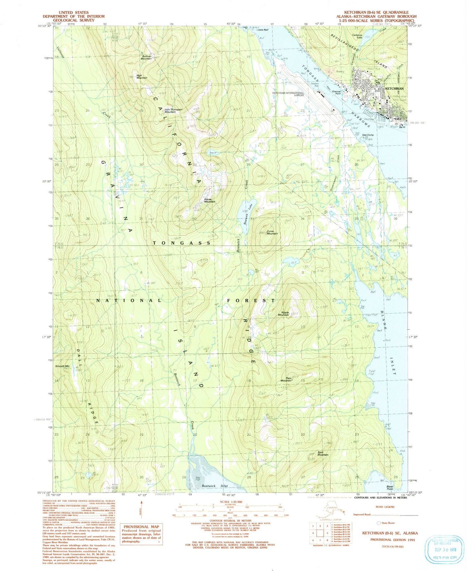
Historical USGS topographic quad map of Ketchikan B-6 SE in the state of Alaska. Map scale may vary for some years, but is generally around 1:24,000. Print size is approximately 24" x 27"
This quadrangle is in the following counties: Ketchikan Gateway.
The map contains contour lines, roads, rivers, towns, and lakes. Printed on high-quality waterproof paper with UV fade-resistant inks, and shipped rolled.
Contains the following named places: Bar Point, Blank Inlet, Blank Point, Bostwick Creek, Bostwick Lake, California Ridge, Carlanna, Carlanna Creek, Carlanna Lake, Carlanna Lake Dam, Charcoal Point, City of Ketchikan, Curve Mountain, East Clump, Government Creek, Gravina Island, Guardian Flight Medical Services, High Mountain, Hoadley Creek, House Mountain, Irvin Thompson Mountain, Ketchikan Airport Police Department, Ketchikan Fire Department Station 2, Ketchikan Indian Community Tribal Health Clinic, Ketchikan International Airport, Ketchikan International Airport Fire Department, Ketchikan Post Office, Ketchikan Public Health Center - Southeast Region, Ketchikan Regional Youth Facility, Ketchikan Women Infants and Children Clinic, Lewis Point, Nipple Mountain, PeaceHealth Ketchikan Clinic, PeaceHealth Ketchikan Medical Center, Plain Mountain, Smooth Mountain, Spot Mountain, Sullivan Mountain, United States Forest Service Misty Fiords National Monument Ranger Station, Upper Nickeyville


