
MyTopo
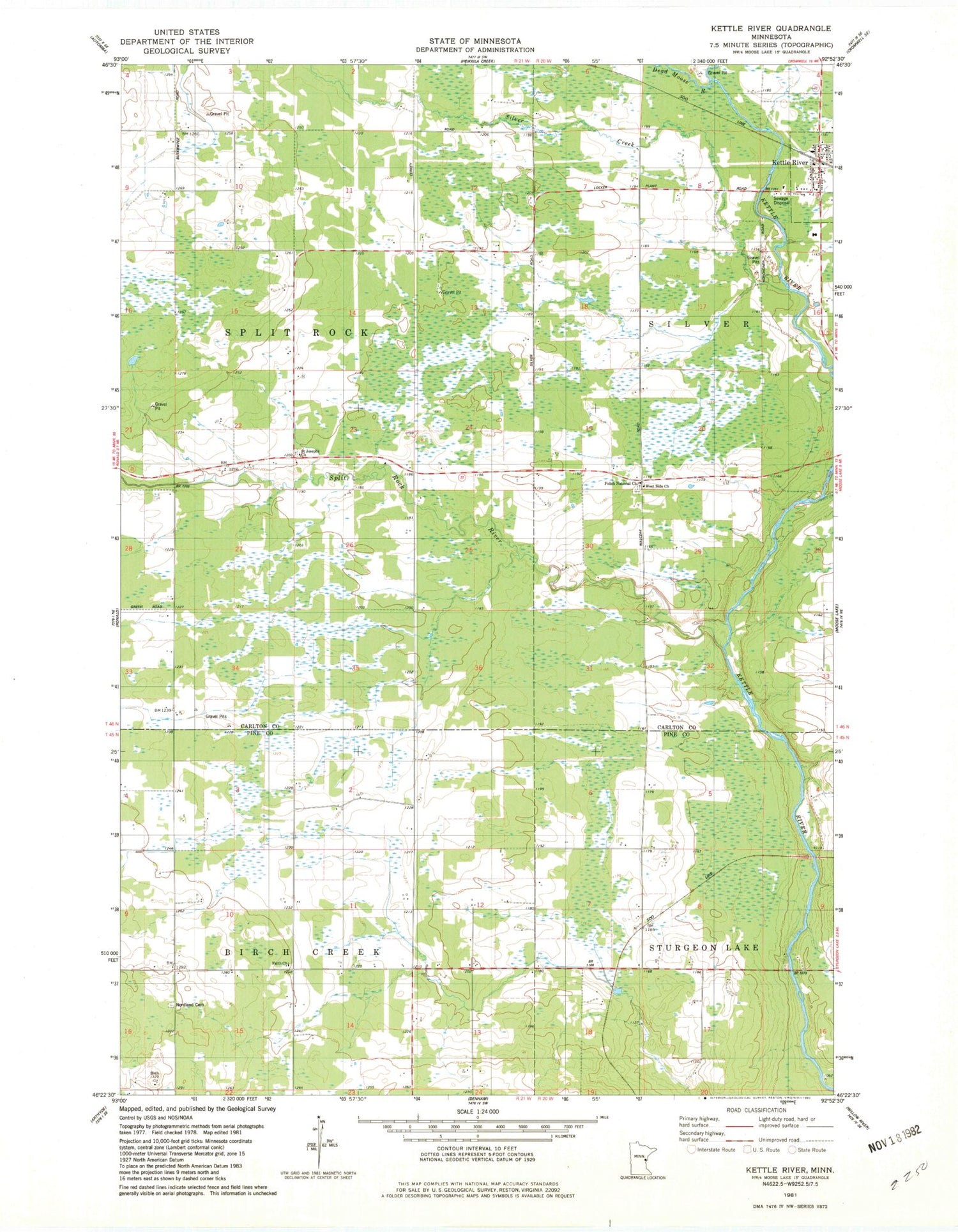
Classic USGS Kettle River Minnesota 7.5'x7.5' Topo Map
Couldn't load pickup availability
Historical USGS topographic quad map of Kettle River in the state of Minnesota. Map scale may vary for some years, but is generally around 1:24,000. Print size is approximately 24" x 27"
This quadrangle is in the following counties: Carlton, Pine.
The map contains contour lines, roads, rivers, towns, and lakes. Printed on high-quality waterproof paper with UV fade-resistant inks, and shipped rolled.
Contains the following named places: City of Kettle River, Dead Moose River, Faith Church, Gillespie Brook, Holy Trinity Lutheran Church, Kettle River, Kettle River City Hall, Kettle River Fire Department, Kettle River Post Office, Nordland Cemetery, Polish National Church, Saint Joseph's Cemetery, Saint Josephs Church, Silver Creek, Split Rock River, Township of Birch Creek, Township of Split Rock, West Side Church, ZIP Code: 55783


