MyTopo
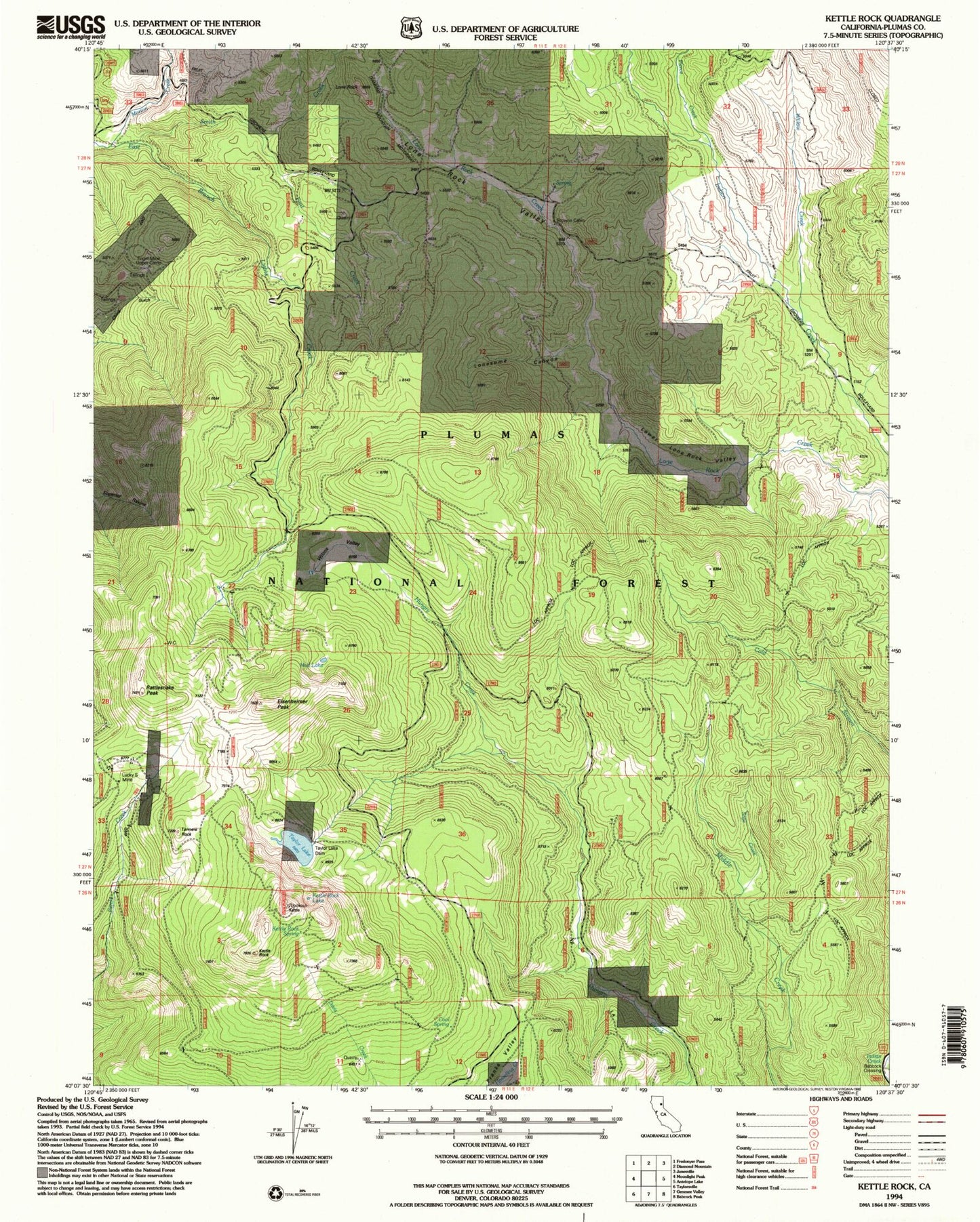
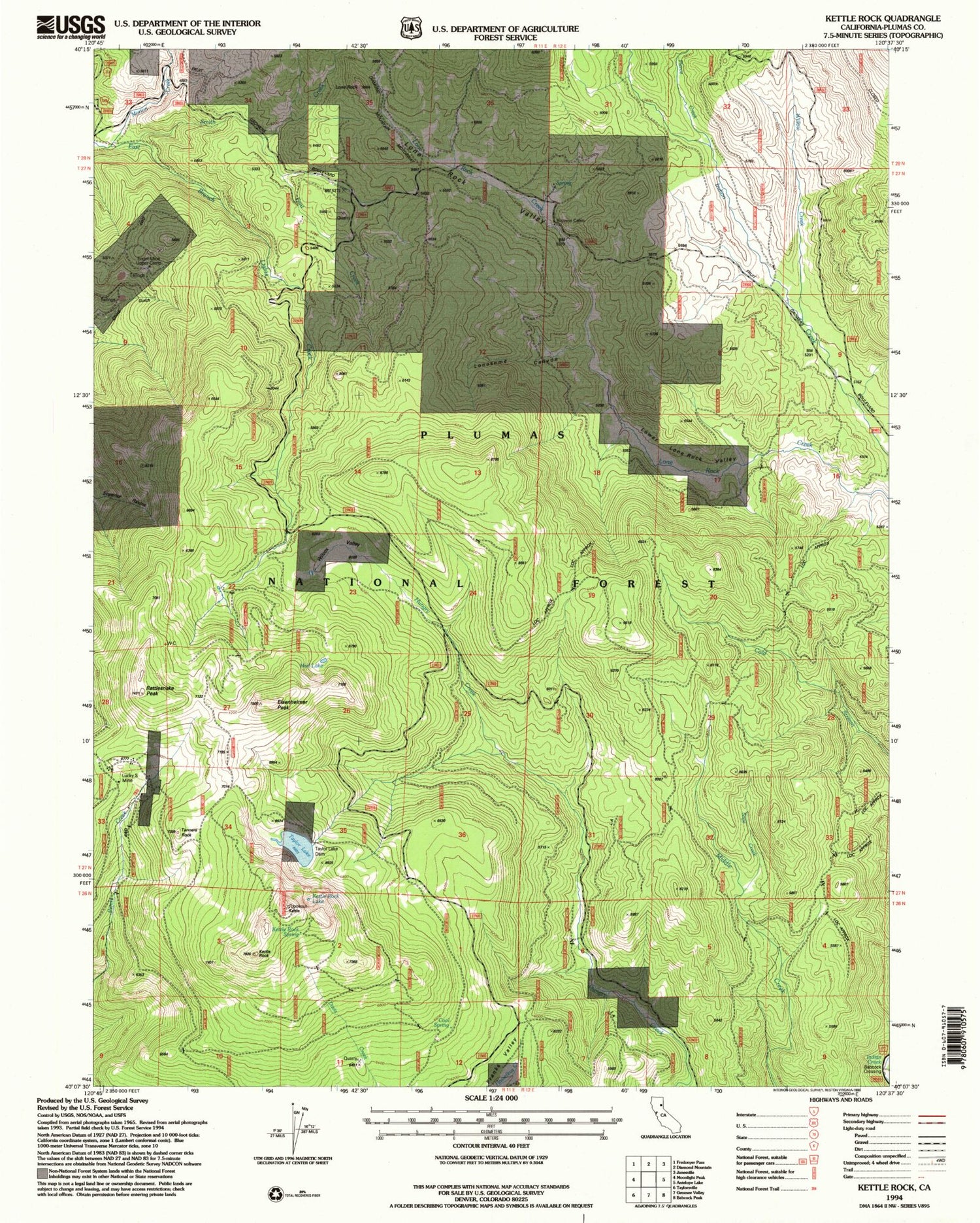
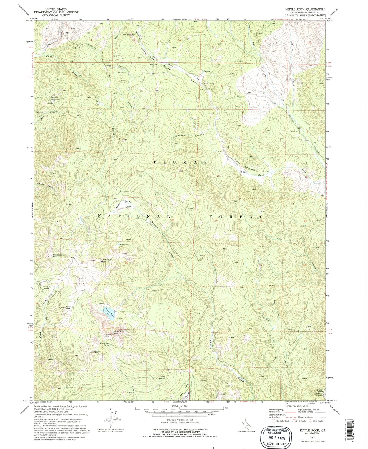
Classic USGS Kettle Rock California 7.5'x7.5' Topo Map
Couldn't load pickup availability
Historical USGS topographic quad map of Kettle Rock in the state of California. Map scale may vary for some years, but is generally around 1:24,000. Print size is approximately 24" x 27"
This quadrangle is in the following counties: Plumas.
The map contains contour lines, roads, rivers, towns, and lakes. Printed on high-quality waterproof paper with UV fade-resistant inks, and shipped rolled.
Contains the following named places: Babcock Crossing, Browns Cabin, Cool Spring, Eisenheimer Peak, Engel Mine Upper Camp, Fant Creek, Fant Gathering Corral, Greenville Division, Kettle Rock, Kettle Rock Lake, Kettle Rock Spring, Lights Creek Guard Station, Lone Pine Mine Number 1, Lone Rock, Lone Rock Valley, Lonesome Canyon, Lower Lone Rock Valley, Lucky S Mine, Morton Creek, Mud Lake, Pierce Creek, Rattlesnake Peak, Sage Creek, Smith Creek, Tanners Rock, Taylor Lake, Taylor Lake 288 Dam, Wilcox Valley, Willow Creek