MyTopo
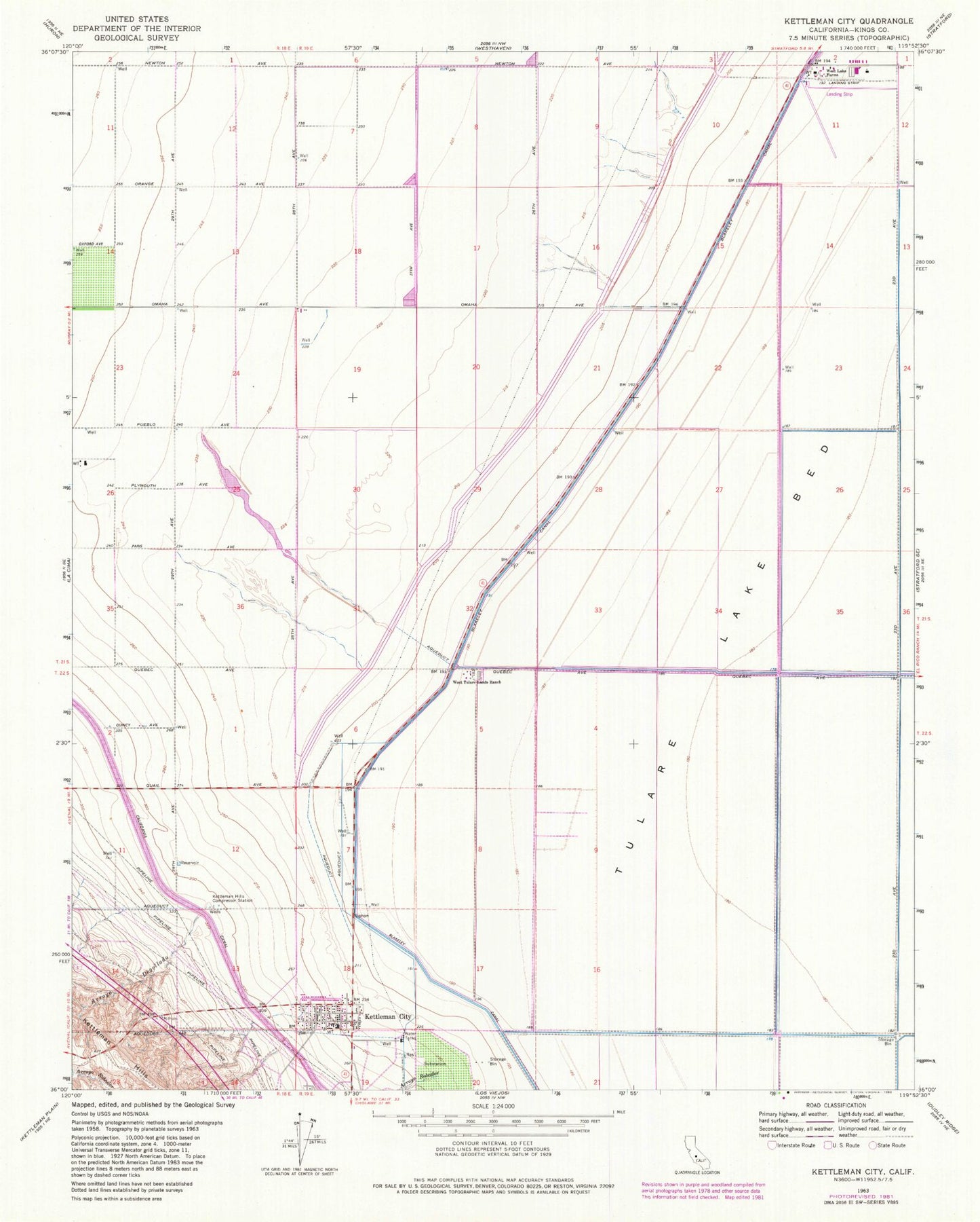
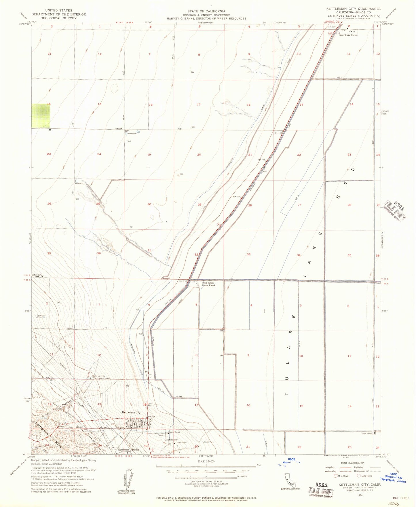
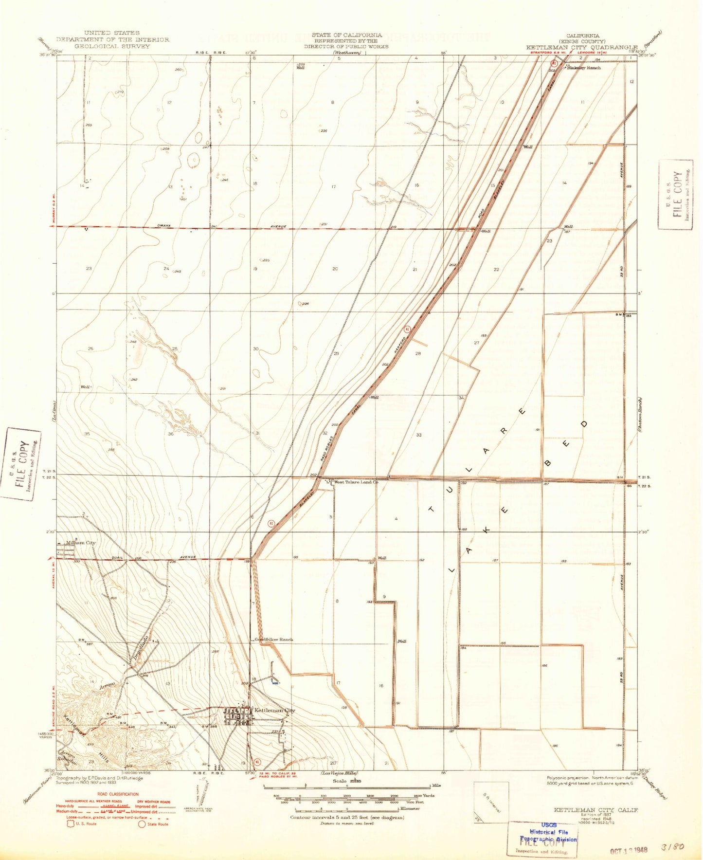
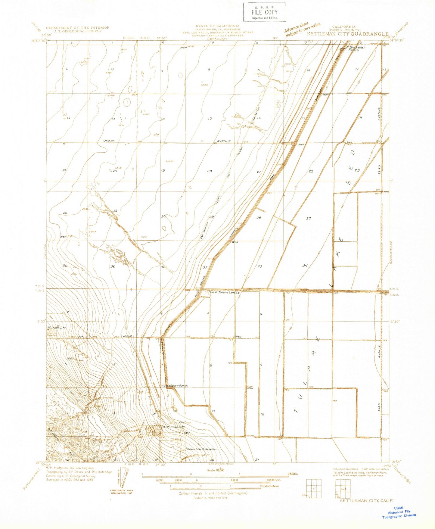
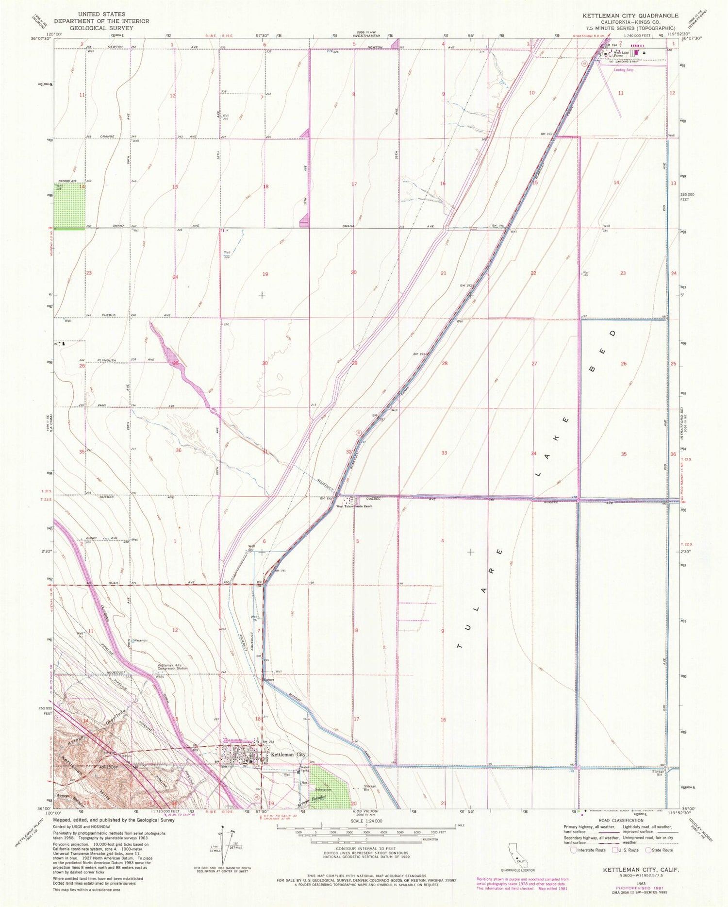
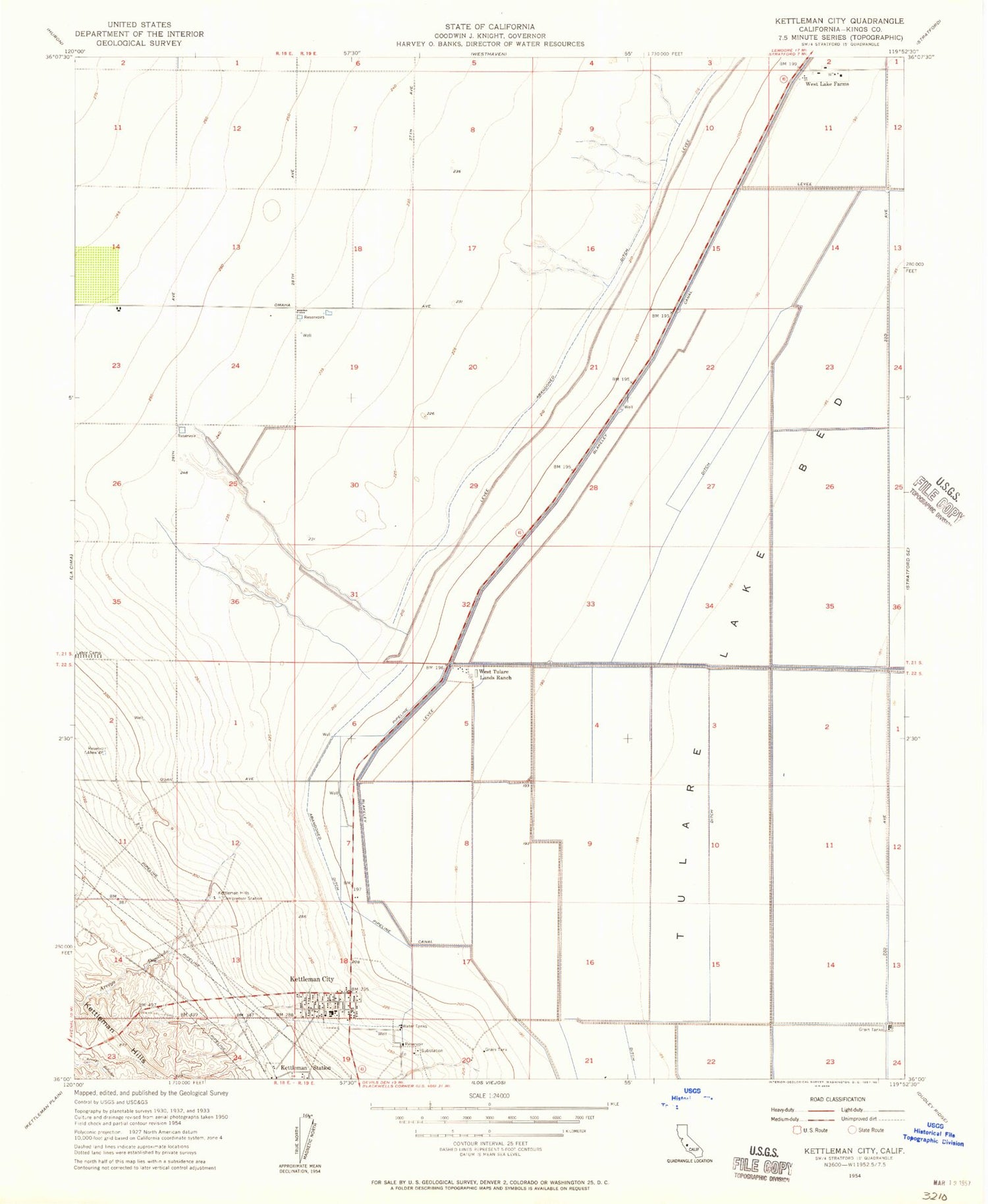
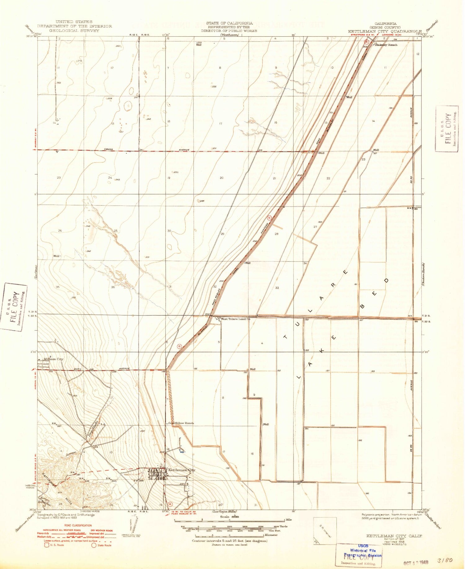
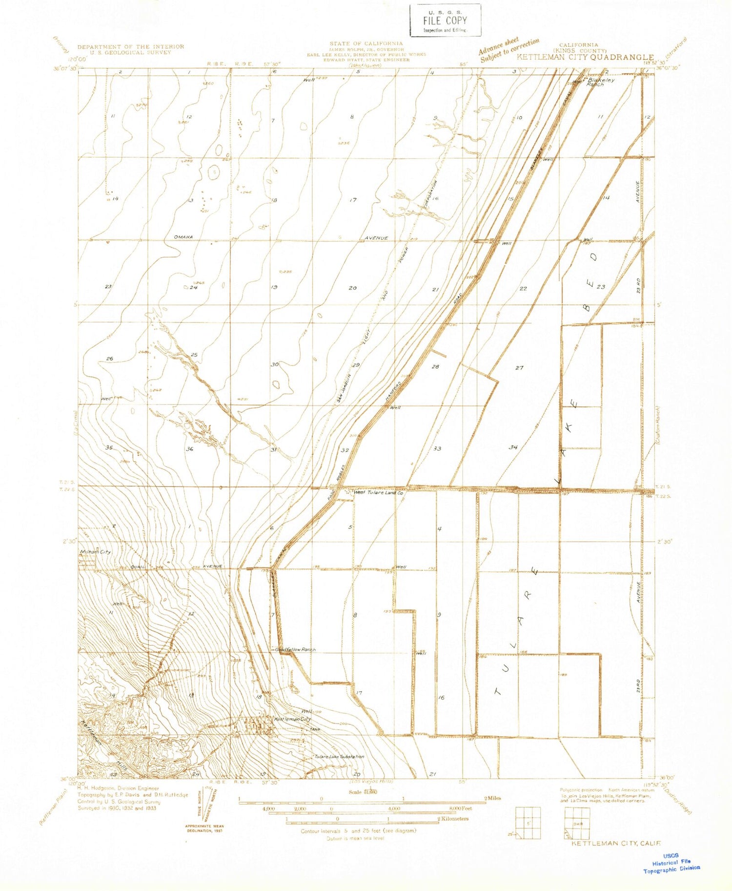
Classic USGS Kettleman City California 7.5'x7.5' Topo Map
Couldn't load pickup availability
Historical USGS topographic quad map of Kettleman City in the state of California. Map scale may vary for some years, but is generally around 1:24,000. Print size is approximately 24" x 27"
This quadrangle is in the following counties: Kings.
The map contains contour lines, roads, rivers, towns, and lakes. Printed on high-quality waterproof paper with UV fade-resistant inks, and shipped rolled.
Contains the following named places: Arroyo Degollado, Arroyo Robador, Blakeley Canal, Goodfellow Ranch, Kettleman City, Kettleman City Branch Kings County Library, Kettleman City Census Designated Place, Kettleman City Elementary School, Kettleman City Post Office, Kettleman Hills Compressor Station, Kings County Fire Department Station 9 Kettleman City, Millham City, Saint Cecilias Catholic Church, West Lake Farms, West Tulare Lands Ranch, Westlake Farms Airport, ZIP Code: 93239