
MyTopo
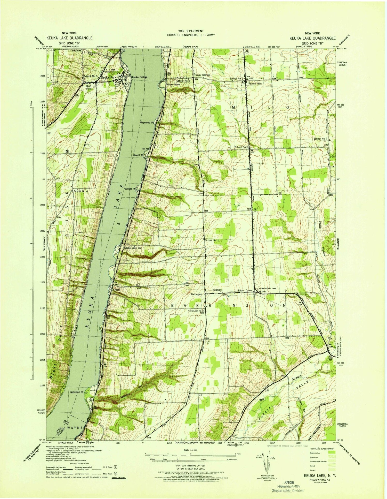
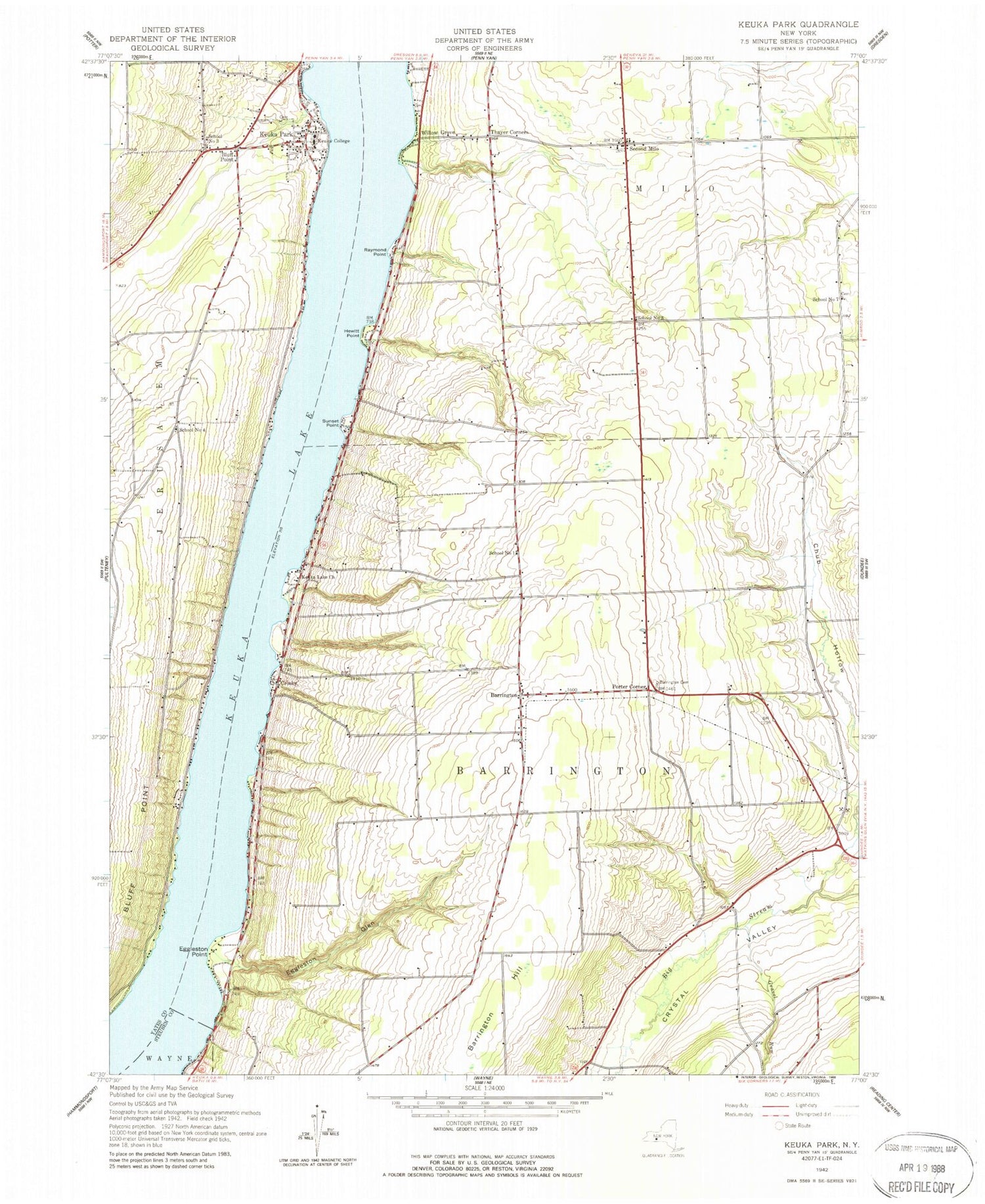
Classic USGS Keuka Park New York 7.5'x7.5' Topo Map
Couldn't load pickup availability
Historical USGS topographic quad map of Keuka Park in the state of New York. Typical map scale is 1:24,000, but may vary for certain years, if available. Print size: 24" x 27"
This quadrangle is in the following counties: Steuben, Yates.
The map contains contour lines, roads, rivers, towns, and lakes. Printed on high-quality waterproof paper with UV fade-resistant inks, and shipped rolled.
Contains the following named places: Barrington, Porters Corners Cemetery, Bluff Point, Chub Hollow, Crosby, Eggleston Glen, Eggleston Point, Gravel Run, Hewitt Point, Keuka College, Keuka Lake Church, Keuka Park, Raymond Point, Second Milo, Sunset Point, Thayer Corners, Willow Grove, Porter Corner, School Number 1 (historical), School Number 3 (historical), School Number 4 (historical), School Number 7 (historical), School Number 8 (historical), Town of Barrington, Town of Milo, School Number 3 (historical), School Number 9 (historical), Keuka Park Cemetery, Second Milo Cemetery, Barrington Community Church, Simmons Vineyard, Buzzard Crest Vineyards, Bluff Point United Methodist Church, Penn Yan Assembly of God, Keuka Park Post Office, Keuka Park Census Designated Place, Creekside Mennonite School, Gravel Run Mennonite School, Scenic Valley Mennonite School, Branchport - Keuka Park Fire Department - Keuka Park Fire Station, A and L Farm, Barrington Community Church Cemetery


