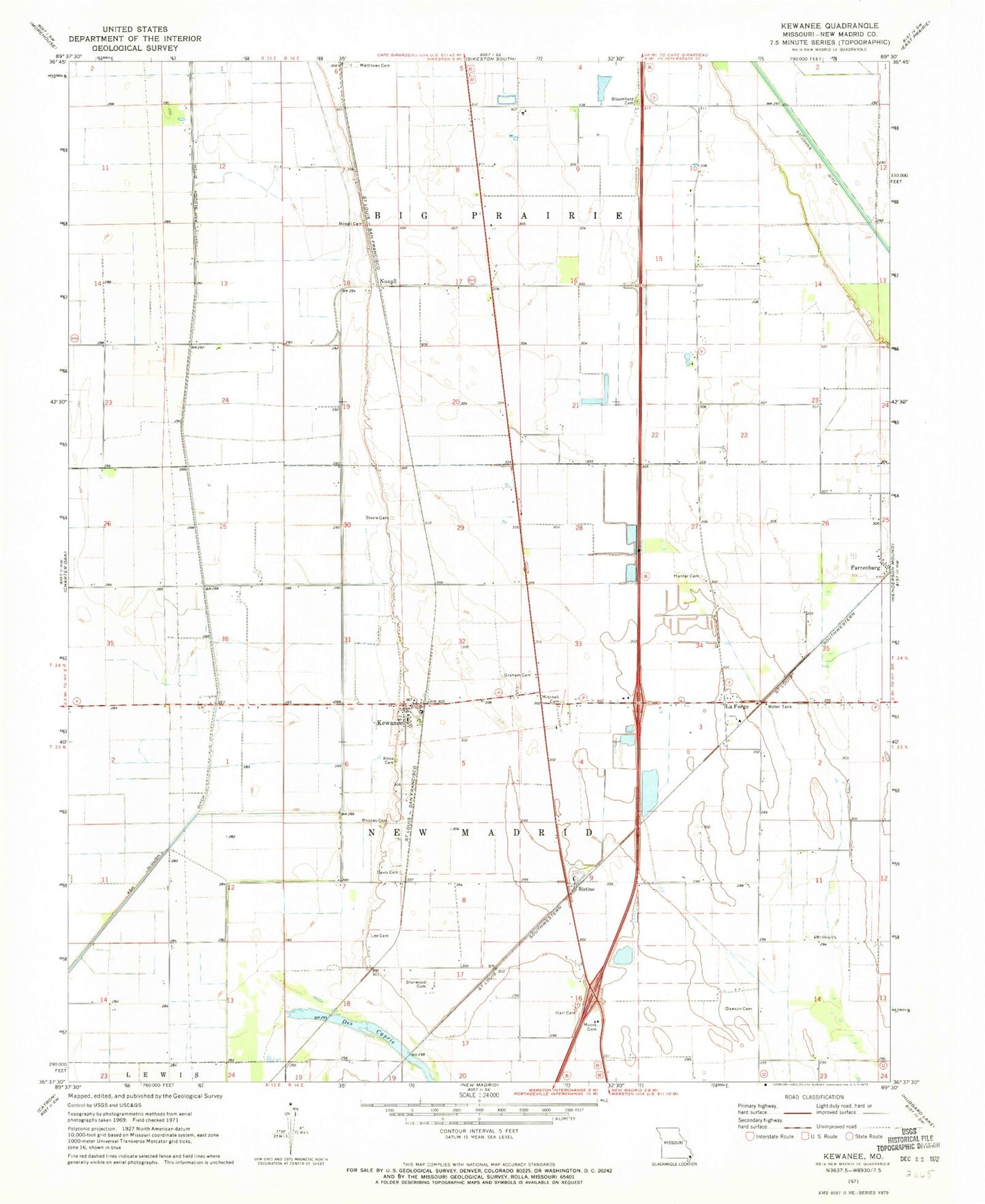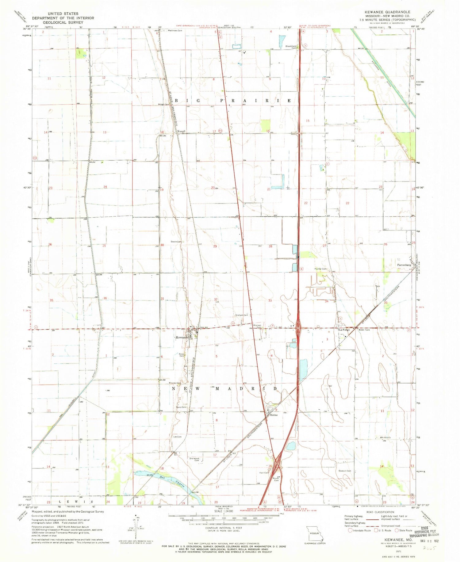
MyTopo
Classic USGS Kewanee Missouri 7.5'x7.5' Topo Map
Couldn't load pickup availability
Historical USGS topographic quad map of Kewanee in the state of Missouri. Map scale may vary for some years, but is generally around 1:24,000. Print size is approximately 24" x 27"
This quadrangle is in the following counties: New Madrid.
The map contains contour lines, roads, rivers, towns, and lakes. Printed on high-quality waterproof paper with UV fade-resistant inks, and shipped rolled.
Contains the following named places: Ash Slough Ditch, Bloomfield Cemetery, Crow Church, Davis Cemetery, Dawson Cemetery, Dawson LaForge School, Dawson School, Farrenburg, Graham Cemetery, Hart Cemetery, Hunter Cemetery, Kewanee, Kewanee and Laforge Rural Volunteer Fire Department, Kewanee Post Office, Knox Cemetery, La Forge, Lake Saint Mary, Lee Cemetery, Malone Airfield, Matthews Cemetery, Mitchell Cemetery, Moore Cemetery, Mount Olive Church, Noxall, Noxall Cemetery, Ogden, Ogden School, Rhodes Cemetery, Ristine, Roberson Church, Rosenwald School, Sherwood Cemetery, Sikeston Ridge, Steele Cemetery, Township of New Madrid, White Oak School, ZIP Codes: 63860, 63867