MyTopo
Classic USGS Kewaunee Wisconsin 7.5'x7.5' Topo Map
Couldn't load pickup availability
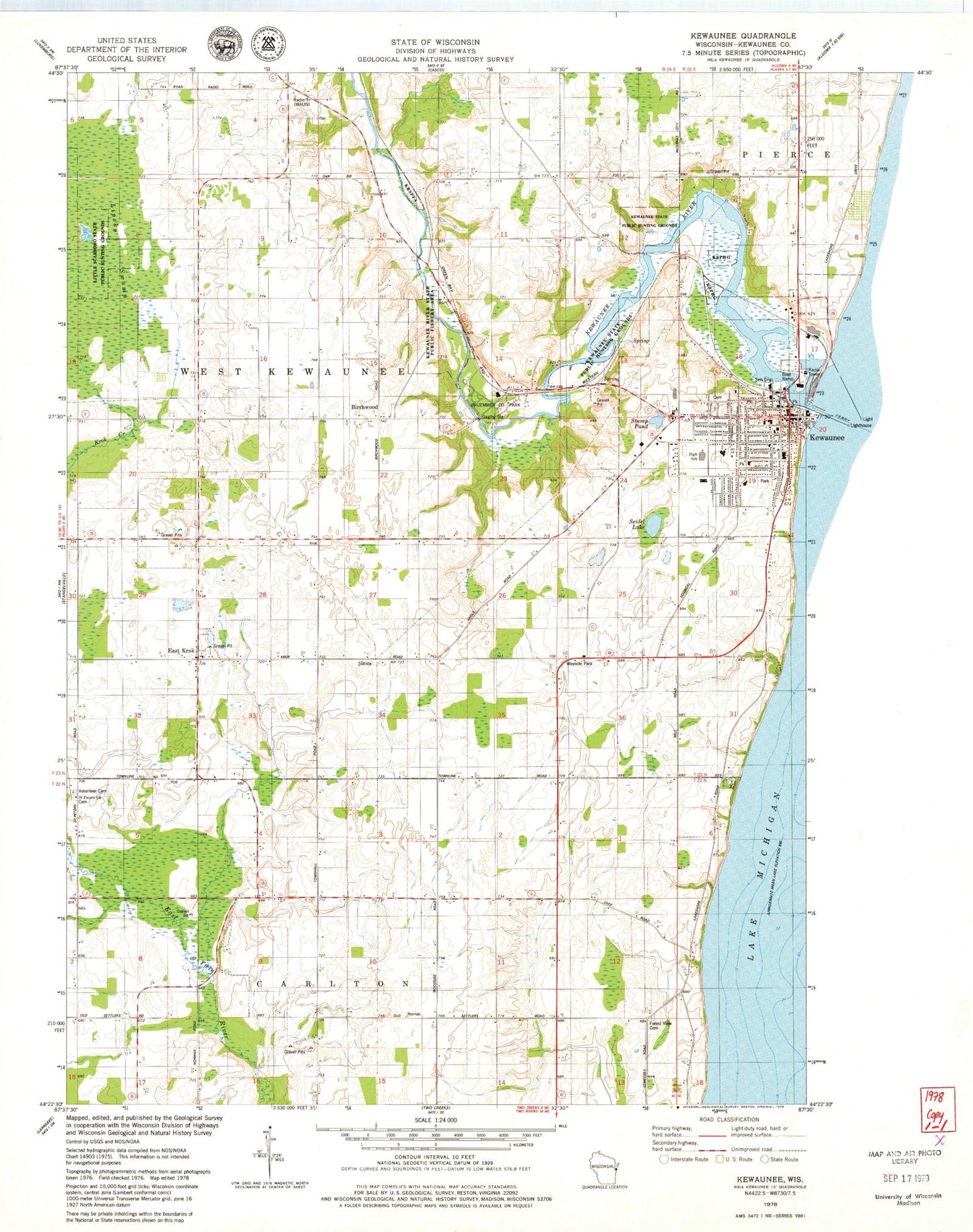
Historical USGS topographic quad map of Kewaunee in the state of Wisconsin. Map scale may vary for some years, but is generally around 1:24,000. Print size is approximately 24" x 27"
This quadrangle is in the following counties: Kewaunee.
The map contains contour lines, roads, rivers, towns, and lakes. Printed on high-quality waterproof paper with UV fade-resistant inks, and shipped rolled.
Contains the following named places: Birchwood, Bruemmer County Park, Carlton School, City of Kewaunee, Community Congregational Church, Dikeman School, East Krok, Elm Grove Dairy Farm, Footbridge School, Forest Hill Cemetery, Halls Calf Ranch, Hardtke Farms, Holy Rosary Catholic Church, Holy Rosary Cemetery, Holy Rosary School, Immanuel Evangelical Lutheran Church, Immanuel Lutheran School, Kewaunee, Kewaunee Ambulance, Kewaunee County Jail, Kewaunee County Sheriff's Office, Kewaunee Elementary School, Kewaunee Fire Department, Kewaunee High School, Kewaunee Intermediate School, Kewaunee Middle School, Kewaunee Police Department, Kewaunee Post Office, Kewaunee River State Public Fishery Area, Kewaunee State Public Hunting Grounds, Kewaunee Wastewater Treatment Plant, Lakeshore Alternative School, Lakeshore Christian Church, Little Scarboro State Public Hunting Grounds, Marquette Middle School, Norman Cemetery, Paplham Dairy, Saint Hedwig Catholic Church, Saint Hedwigs Catholic Cemetery, Saint Marys Kewaunee Area Memorial Hospital Heliport, Saint Peters Cemetery, Saint Peters Church, Sano Farms, Seidel Lake, Siegmund Farm, Stangel Farms, Stump Pond, Tess Farm, Thorn Apple Creek, Town of West Kewaunee, Volunteer Cemetery, WAUN-FM (Kewaunee), West Kewaunee Township Cemetery, ZIP Code: 54216