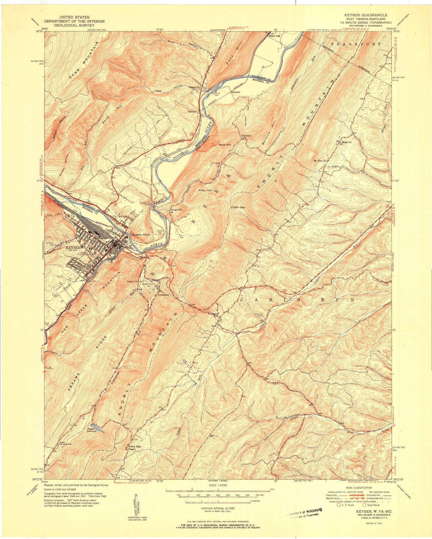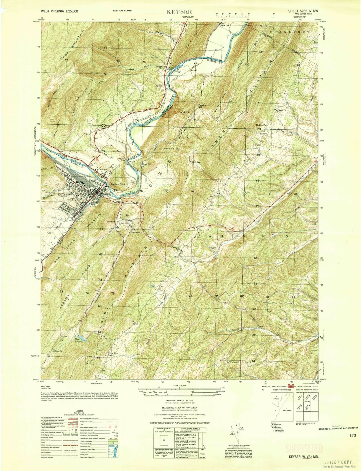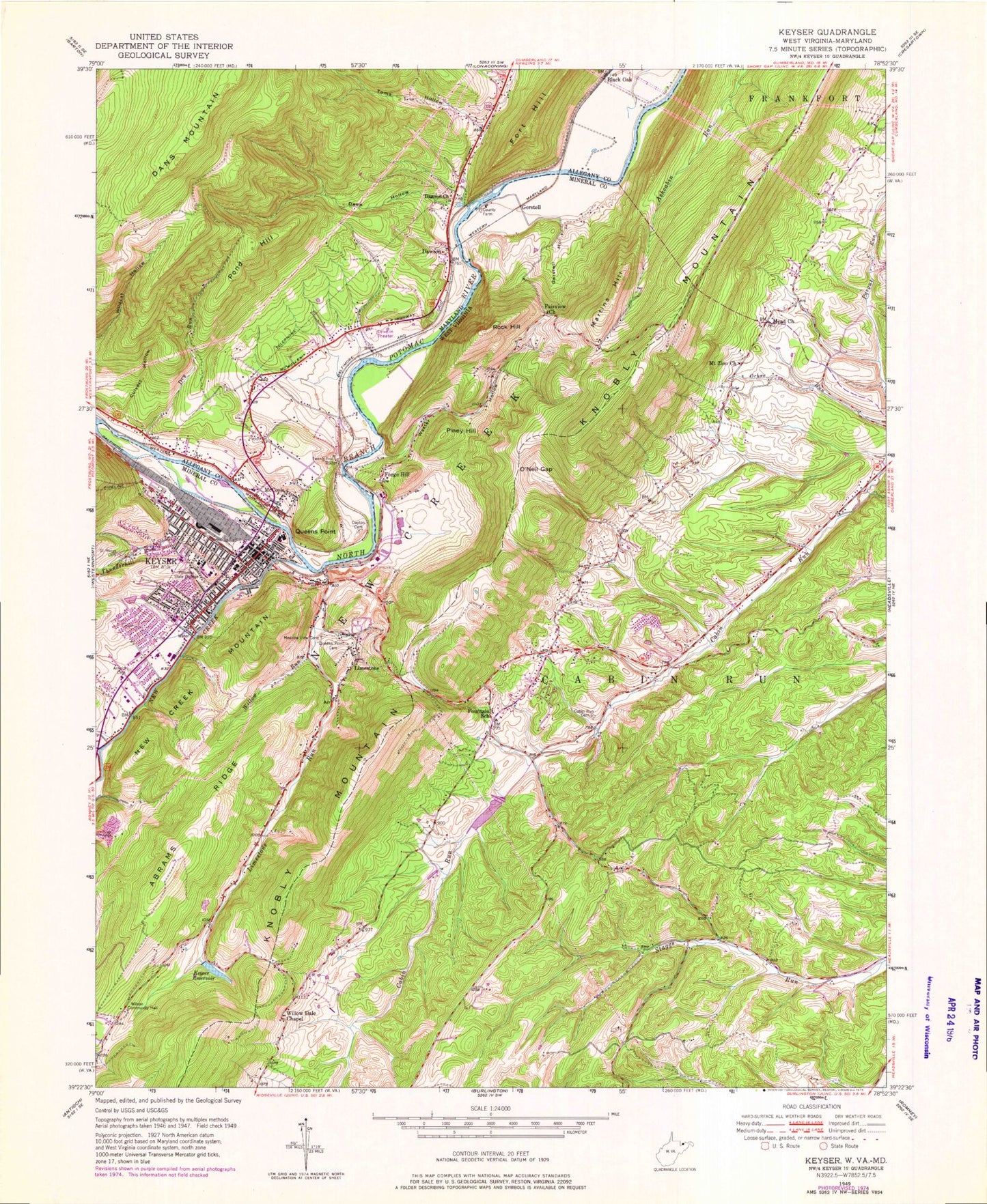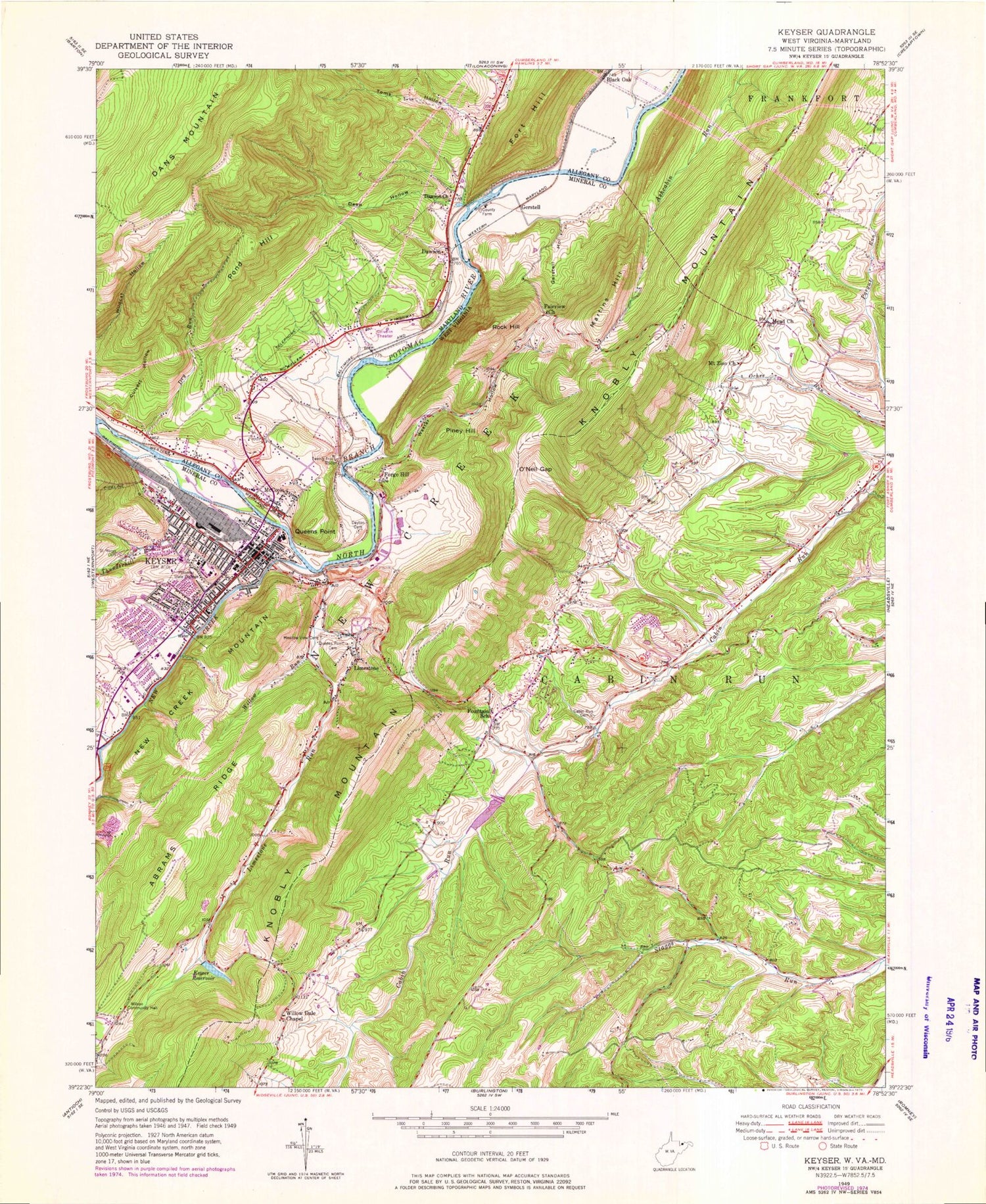
MyTopo
Classic USGS Keyser West Virginia 7.5'x7.5' Topo Map
Couldn't load pickup availability
Historical USGS topographic quad map of Keyser in the states of West Virginia, Maryland. Map scale may vary for some years, but is generally around 1:24,000. Print size is approximately 24" x 27"
This quadrangle is in the following counties: Allegany, Mineral.
The map contains contour lines, roads, rivers, towns, and lakes. Printed on high-quality waterproof paper with UV fade-resistant inks, and shipped rolled.
Contains the following named places: Abrams Ridge, Arnold Cemetery, Baker Cemetery, Biser Cemetery, Black Oak, Bruce Middle School, Cabin Run Cemetery, Calvary United Methodist Church, Church of God, Church of the Assumption, City of Keyser, Clary Street Learning Center, Culvert Hollow, Dawson, Dawson Census Designated Place, Dawson United Methodist Church, Dayton Cemetery, Deep Hollow, District 2, Dry Run, Emmanuel Episcopal Church, Eureka School, Fairview Church, First Baptist Church, First United Methodist Church, Forge Hill, Fort Fuller, Fort Hill, Fountain Primary School, Fountain Volunteer Fire Department, Gates School, Gerstell, Gerstell Family Cemetery, Gerstell Farms Airport, Gerstell Hollow, Grace United Methodist Church, Green Cemetery, Grove School, Keyser, Keyser Church of the Brethren, Keyser Emergency Medical Services 1, Keyser Headstart, Keyser McCoole Bridge, Keyser Police Department, Keyser Post Office, Keyser Presbyterian Church, Keyser Primary / Middle School, Keyser Reservoir, Keyser Volunteer Fire Department Station 1, Keyser Volunteer Fire Department Station 2, Keyser-Mineral County Public Library, Knobly School, Limestone, Limestone Run, Ludwick Cemetery, Martins Hill, McCoole, McCoole Census Designated Place, McCoole Fire and Rescue Department, Mead Church, Meadow View Cemetery, Milldale School, Mineral County, Mineral County Alternative School, Mineral County Bailiffs Office, Mineral County Courthouse, Mineral County Sheriff's Office, Mineral County Technical Center, Mineral School, Mount Zion Cemetery, Mount Zion Church, New Creek, New Creek Structure Number One Dam, Noswad, Old Keyser Dam, O'Neil Gap, Patterson Creek Structure Number 28 Dam, Piney Hill, Pond Hill, Poor Farm Cemetery, Potomac Memorial Gardens, Potomac State College of West Virginia University, Potomac State College of West Virginia University Police, Queens Point, Queens Point Cemetery, Rock Hill, Rodgers School, Saint Francis School, Saint Marys Cemetery, SSGT J E Kelly Memorial Bridge, Staggs Cemetery, Stony Run, Sulter Cemetery, Thrush Cemetery, Thunderhill Run, Toms Hollow, Trinity Lutheran Church, Twenty-First Bridge, Umstot Cemetery, Urice and Kerns Cemetery, Valley Medical Transport, Waxter Hollow, West Virginia Division of Forestry Mineral County Field Office, Willow Dale Chapel, Willow Run, Willowvale Farm Spring, Wilson Community Hall, Wilson School, WKLP-AM (Keyser), WQZK-FM (Keyser), ZIP Code: 26726