MyTopo
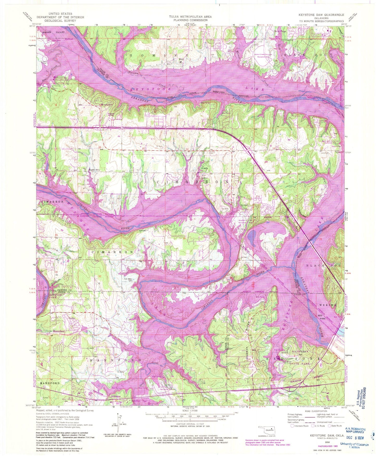
Classic USGS Keystone Dam Oklahoma 7.5'x7.5' Topo Map
Couldn't load pickup availability
Historical USGS topographic quad map of Keystone Dam in the state of Oklahoma. Typical map scale is 1:24,000, but may vary for certain years, if available. Print size: 24" x 27"
This quadrangle is in the following counties: Creek, Osage, Pawnee, Tulsa.
The map contains contour lines, roads, rivers, towns, and lakes. Printed on high-quality waterproof paper with UV fade-resistant inks, and shipped rolled.
Contains the following named places: Appalachia Bay Recreation Area, Bear Creek, Bears Glen, Cimarron River, Cowskin Bay Recreation Area, Dawson Ridge, Dixie Cemetery, East Basin Cemetery, Keystone Dam, Keystone State Park, Leroy Cemetery, Little Waresha Creek, Mud Creek, Prairie View Cemetery, Prue, Rigsby School, Rock Creek, Salt Creek, Salt Creek Cove Recreation Area, Sinnett Cemetery, Walnut Creek, Walnut Creek Peninsula Recreation Area, Waresha Creek, Washington Irving Cove Recreation Area, Mannford, Keystone Lake, Westport Airport, Rabornville, Rigsby, Sha-To-She, Timberlane, Wes, Westport, Baugh, Calida, Cedar Ridge, Curchece, Empy, Jubys, Leander, Leroy, Mule Barn, Oak Grove, Peterman Ridge, Shady Grove, Keystone Dam, Keystone Wildlife Managment Area, Keystone Elementary School, Mannford Post Office, Township of Cimarron, Town of Prue, Town of Mannford, Town of Mule Barn (historical), Town of Oak Grove, Town of Shady Grove (historical), Town of Westport, Mannford Fire Department, Westport Fire Department, Peninsula Fire Department Shaeffer Station, Peninsula Fire Department Wilson Station, Basin Fire Department, Keystone Fire Department Station 2, Mannford Ambulance, Pawnee County Sheriff's Office Substation, Mannford Police Department