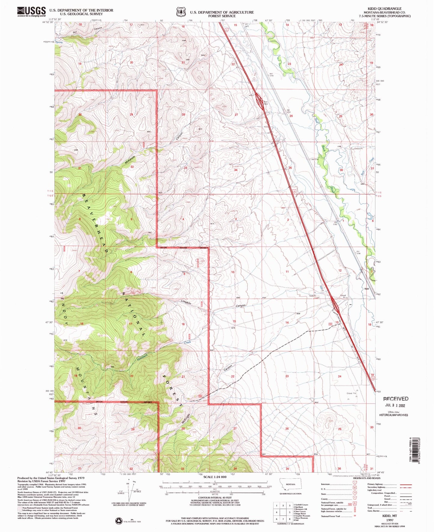
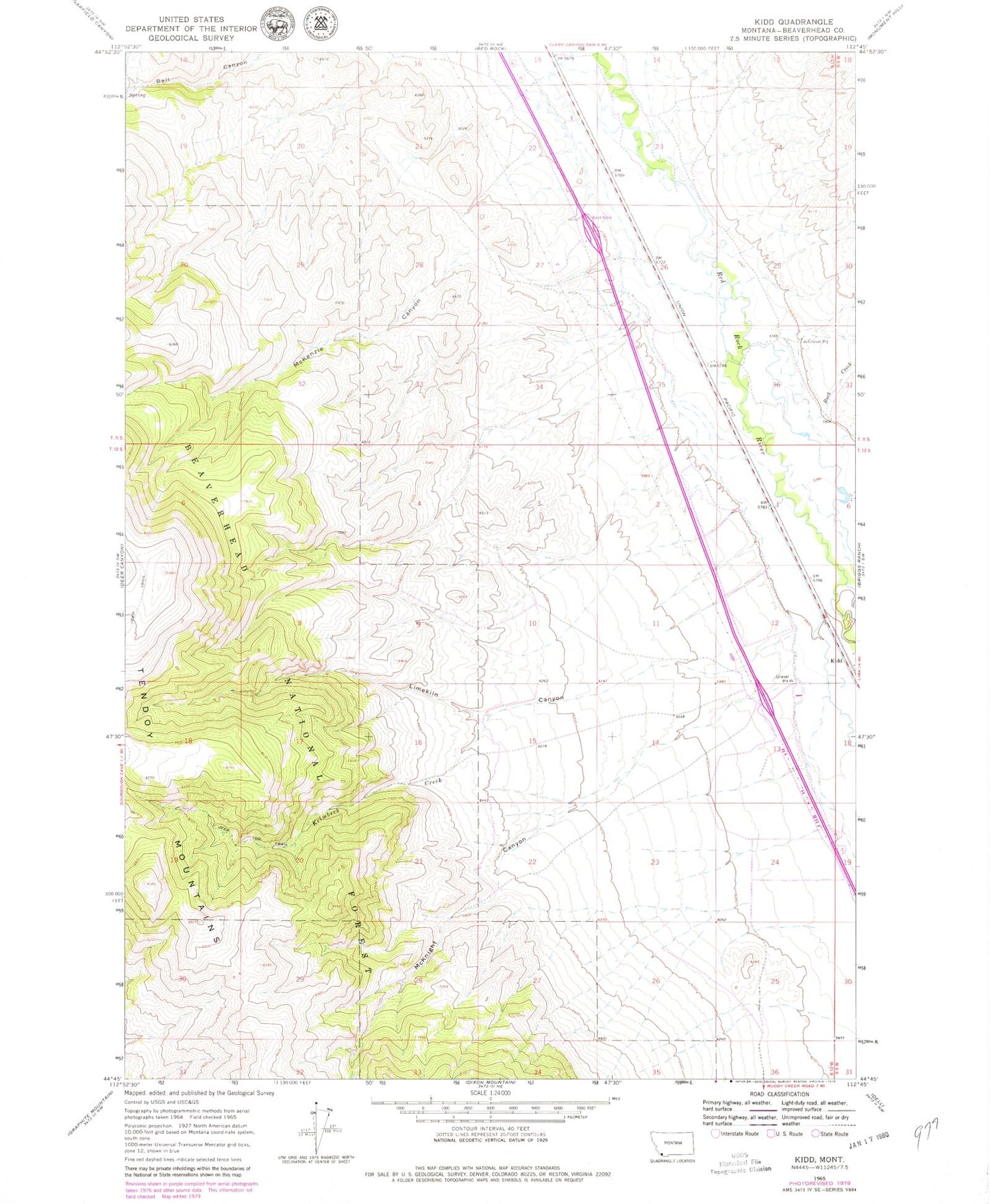
MyTopo
Classic USGS Kidd Montana 7.5'x7.5' Topo Map
Couldn't load pickup availability
Historical USGS topographic quad map of Kidd in the state of Montana. Map scale may vary for some years, but is generally around 1:24,000. Print size is approximately 24" x 27"
This quadrangle is in the following counties: Beaverhead.
The map contains contour lines, roads, rivers, towns, and lakes. Printed on high-quality waterproof paper with UV fade-resistant inks, and shipped rolled.
Contains the following named places: 11S10W26BBCC01 Well, 11S10W27ADAC01 Well, 11S10W34CCAC01 Well, 12S10W22CADA01 Well, Buck Creek, Dell - Red Rock Rest Area, Kelmbeck Creek, Kidd, Kidd Pit Mine, Kidd School, Limekiln Canyon, Limekiln Canyon Creek Mine, McKenzie Canyon, McKnight Canyon, Old Trail to the Gold Diggins Historical Marker, Willow Spring