MyTopo
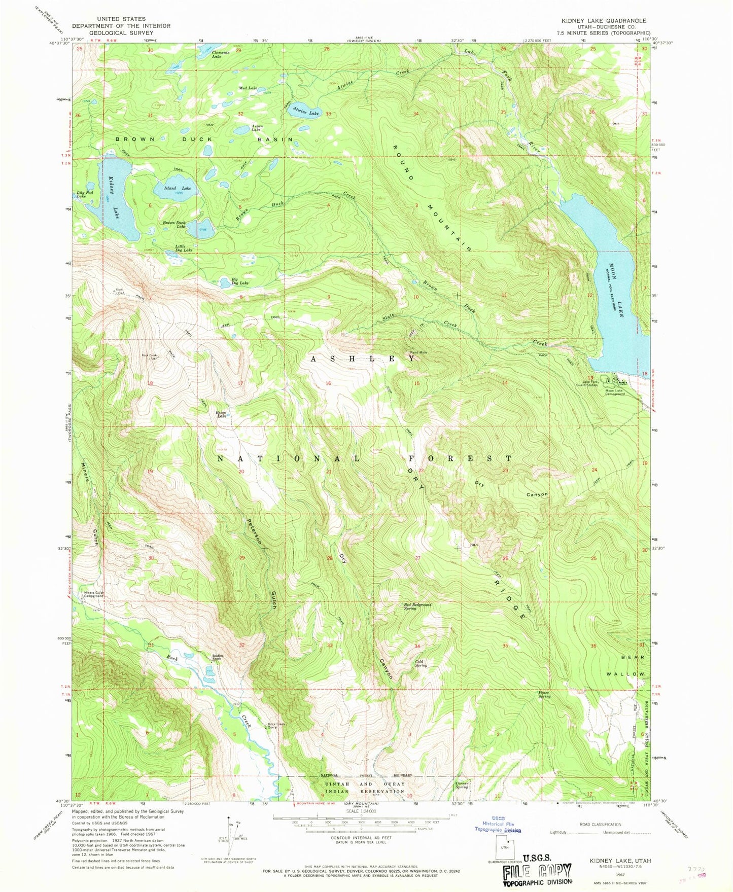
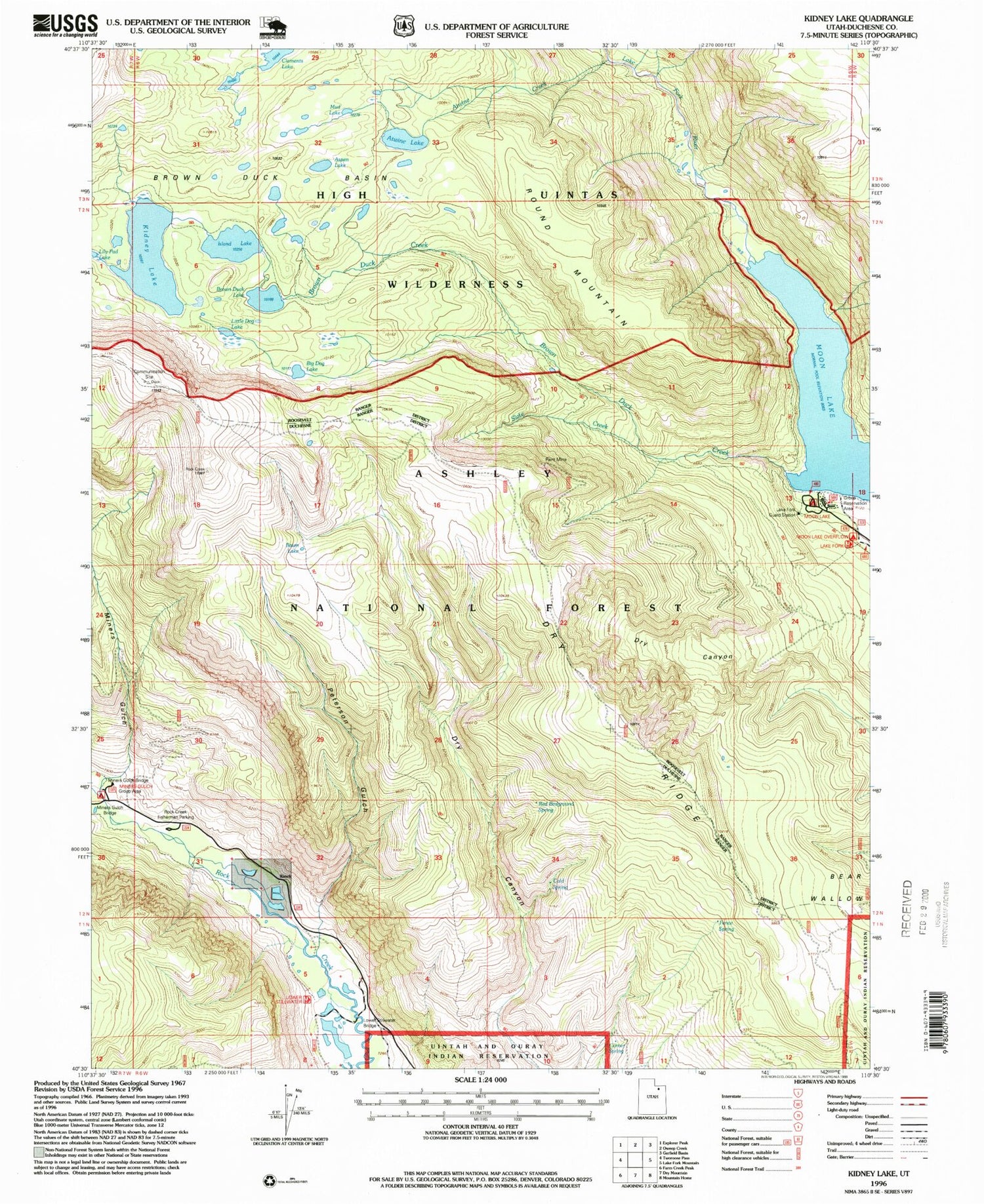
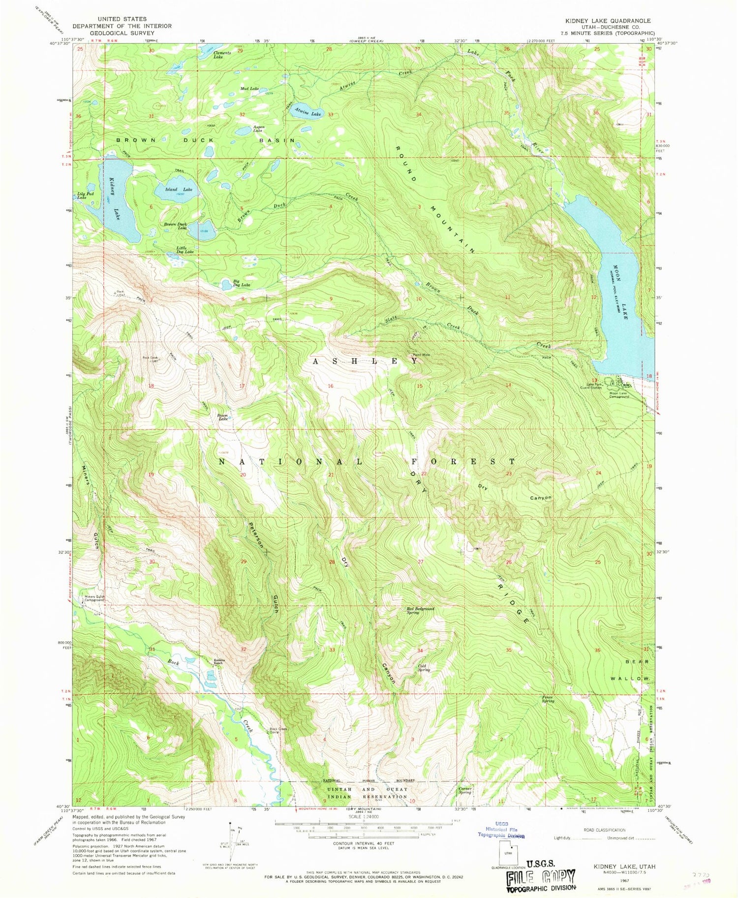
Classic USGS Kidney Lake Utah 7.5'x7.5' Topo Map
Couldn't load pickup availability
Historical USGS topographic quad map of Kidney Lake in the state of Utah. Typical map scale is 1:24,000, but may vary for certain years, if available. Print size: 24" x 27"
This quadrangle is in the following counties: Duchesne.
The map contains contour lines, roads, rivers, towns, and lakes. Printed on high-quality waterproof paper with UV fade-resistant inks, and shipped rolled.
Contains the following named places: Aspen Lake, Atwine Creek, Atwine Lake, Baum Lake, Big Dog Lake, Brown Duck Basin, Brown Duck Creek, Brown Duck Lake, Cold Spring, Corner Spring, Dry Canyon, Dry Ridge, Fence Spring, Island Lake, Kidney Lake, Lake Fork Guard Station, Little Dog Lake, Miners Gulch, Miners Gulch Campground, Moon Lake, Moon Lake Campground, Mud Lake, Paint Mine, Peterson Gulch, Red Bedground Spring, Robbins Ranch, Rock Creek Corral, Round Mountain, Slate Creek, Brown Duck Dam, Island Lake Dam, Kidney Lake Dam, Miners Gulch Campground Bridge, Miners Gulch Bridge, Moon Lake Lodge