MyTopo
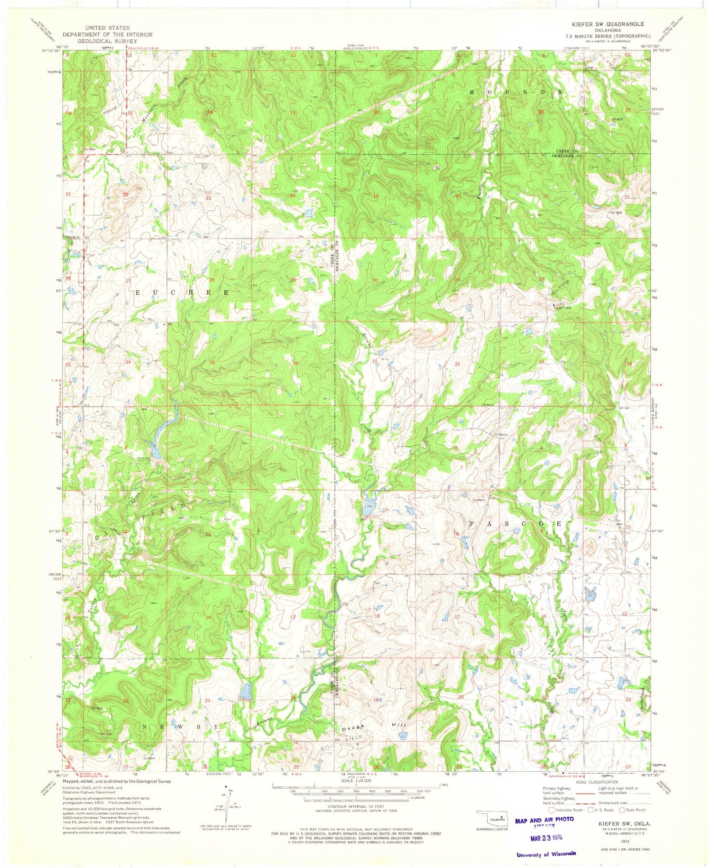
Classic USGS Kiefer SW Oklahoma 7.5'x7.5' Topo Map
Couldn't load pickup availability
Historical USGS topographic quad map of Kiefer SW in the state of Oklahoma. Map scale may vary for some years, but is generally around 1:24,000. Print size is approximately 24" x 27"
This quadrangle is in the following counties: Creek, Okmulgee.
The map contains contour lines, roads, rivers, towns, and lakes. Printed on high-quality waterproof paper with UV fade-resistant inks, and shipped rolled.
Contains the following named places: Flying H Ranch, Kellyville-Slick Division, Little Deep Fork Creek Site 51r Dam, Little Deep Fork Creek Site 51r Reservoir, Little Deep Fork Creek Site 52 Dam, Little Deep Fork Creek Site 52 Reservoir, Little Deep Fork Creek Site 54 Dam, Little Deep Fork Creek Site 54 Reservoir, Oknoname 111003 Dam, Oknoname 111003 Reservoir, Oknoname 111004 Dam, Oknoname 111004 Reservoir, Oknoname 111005 Dam, Oknoname 111005 Reservoir, Oknoname 111010 Dam, Oknoname 111010 Reservoir, Oknoname 111011 Dam, Oknoname 111011 Reservoir, Oknoname 111013 Dam, Oknoname 111013 Reservoir, Oknoname 111014 Dam, Oknoname 111014 Reservoir, Oknoname 111022 Dam, Oknoname 111022 Reservoir, Oknoname 111023 Dam, Oknoname 111023 Reservoir, Osage Hill, Sewell Family Cemetery, Upper Muddy Boggy Site Number 22 Dam, Upper Muddy Boggy Site Number 22 Reservoir